Dinosaur trackways, endless hiking opportunities and dozens of cascades – that’s what exploring Tumbler Ridge is all about! Put it in your pocket and start planning your next adventure to northeastern British Columbia.
Disclosure: This post contains Affiliate links.
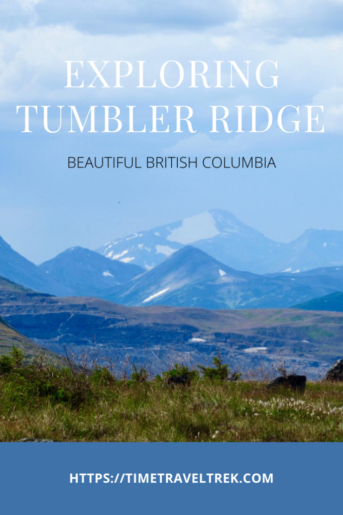
Table of Contents
Discovering Tumbler Ridge
Never heard of Tumbler Ridge? No worries, it’s a little off the radar for most travellers. Archaeological evidence shows that First Nations people occupied the area up to 10,000 years ago. The townsite of Tumbler Ridge was only created in the early 1980s. It was established as a hub for resource extraction – mainly coal and gas.

Coal mines shut down in Tumbler Ridge in 2000. The town saw its first exodus as people left to find work elsewhere. That same year, two young boys floated down Flatbed Creek, tipped their raft and scrambled to shore. As luck would have it, they landed next to a dinosaur trackway – previously unknown in the area. Tourism took off and the town of Tumbler Ridge hasn’t looked back.
On September 23rd, 2014, the Tumbler Ridge Geopark became a Global Geopark. Just over a year later, UNESCO made Global Geoparks – including Tumbler Ridge – official UNESCO sites.

What is a UNESCO Global Geopark?
A geopark is an area with sites and landscapes of geological significance. As of March 2024, there are 213 UNESCO Global Geoparks in 48 different countries. Five of these sites are in Canada. Tumbler Ridge is currently the only geopark in Western Canada. It is made up of 34 accessible geosites. These include everything from waterfalls to rock formations, high alpine regions to deep caves, and mountain summits to dinosaur trackways.
Check out our post on hiking in northern Portugal – it includes visits to the country’s UNESCO Global Geopark in Serra da Estrela Natural Park and the sauropod trackways in Parque Natural das Serras de Aire e Candeeiros!
The Tumbler Ridge UNESCO Global Geopark is found on the eastern slopes of the Hart Ranges. These ranges are part of the northern Rocky Mountains in British Columbia. The area includes sections of the Wapiti and Murray Rivers. It also includes portions of six provincial parks: Monkman, Wapiti Lake, Bearhole Lake, Gwillim Lake, Hole in the Wall and Sukunka Falls.
Exposed sedimentary rock formations date back to the time of the dinosaurs and beyond. There are countless palaeontological resources. The area has everything from Cretaceous dinosaur tracks to bone beds to Triassic fish fossils and marine reptile tracks.
There’s a lot to digest. A series of signs interpret the geological and palaeontological significance in the area. Signage also touches on archaeological discoveries and more recent human history.
The gymnasium of a shuttered school has a new lease on life. It showcases the diversity of the region’s natural and human history as the Dinosaur Discovery Gallery.
Can You Name All of Canada’s Geoparks?
The five Global Geoparks in Canada:
1. Tumbler Ridge, BC
2. Stonehammer, NB
3. Percé, QB
4. Cliffs of Fundy, NS
5. Discovery, NFLD.
Our Tumbler Ridge Adventure Begins
Accessing Tumbler Ridge involves a drive – no matter where you live. Tumbler is out there! It is 1186 kilometres (737 miles) northeast of Vancouver, British Columbia and 702 km (436 mi) northwest of Edmonton, Alberta. Road access from the north is via Highway 52 from Dawson Creek (117 km/72 mi). Access from the west is via Highway 29 from Chetwynd (92 km/55 mi).

We had planned to meet up with two other couples for our Tumbler Ridge adventure. Sadly, one of our friends took a tumble off her mountain bike right before the trip. Dang! She was the driving force in this adventure. Suddenly down to four, we scrambled to regroup and cobble together three days of camping, hiking and discovery.
We started by booking two campsites for four nights at the Lions Flatbed Creek Campground. Next step was the Visitor Centre on arrival. We spread a recreation map and a selection of hiking trail pamphlets out on the table. Narrowing the field, we chose an alpine hike, a waterfall hike and a geological hike. It was not an easy task with 50 designated hiking trails in the area!
Day One Adventure – Mount Spieker
It’s important to note that the main highways leading into Tumbler Ridge are paved. The roads spoking out to hiking areas are not. Expect gravel roads – at times narrow – with plenty of potholes and washboard sections. While a 4×4 is not necessary, a high clearance vehicle is a boon.
Heading up the Wolverine Forest Service road in our truck, we passed gas well and old mine sites. The route was well-signed. At the trailhead we parked next to a gas well. Climbing up an old exploration road, we stepped off to allow a side-by-side ATV pass. The friendly moose hunters from Williams Lake were scoping out the countryside.
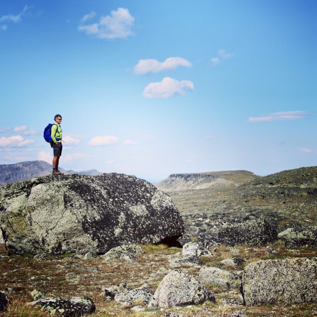
From the low pass we headed east to the summit of Mount Spieker up an easy four-kilometre rocky alpine ridge. Dozens of wind turbines moved lazily in the east. It is part of Pattern Energy’s Meikle Wind facility, the largest of its kind in British Columbia.
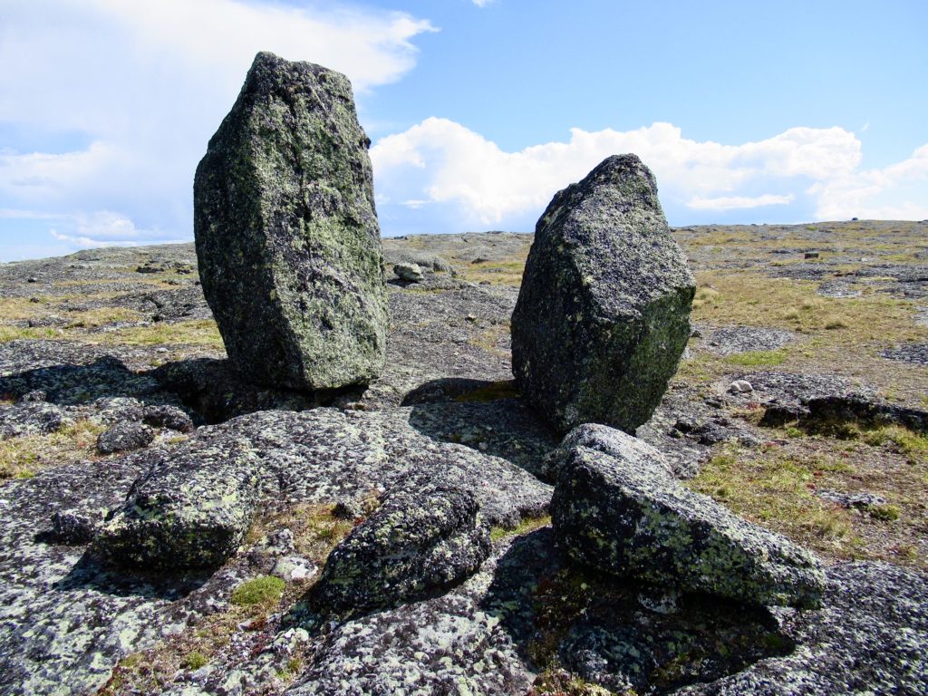
Hazy, snow-capped peaks soared off to the west. Zipping up wind coats, we hunkered down for a quick snack. After the break, we headed out on a northern spur. The route took us past the cracked bedrock of the “Neck” to an overview with a natural “Stonehenge”.
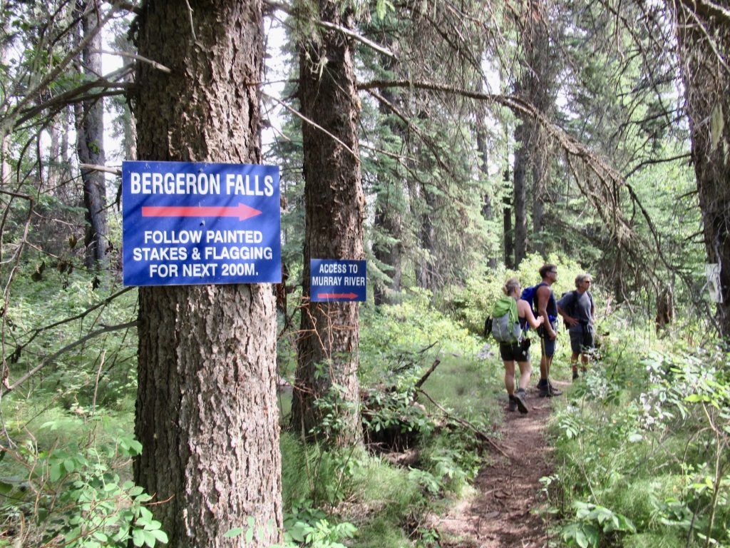
Day Two Fun – Bergeron Falls
Reportedly one of the highest waterfalls in northern British Columbia, we were expecting to be impressed by Bergeron. It didn’t let us down. Taking the well-signed, 11.5 km, circular route, we walked through aspen and spruce forests.
The trail leads down to the Murray River and up Bergeron Creek to the base of the falls. Trail crews have kindly put in rope railings to help scramble up and down steeper sections of the trail.
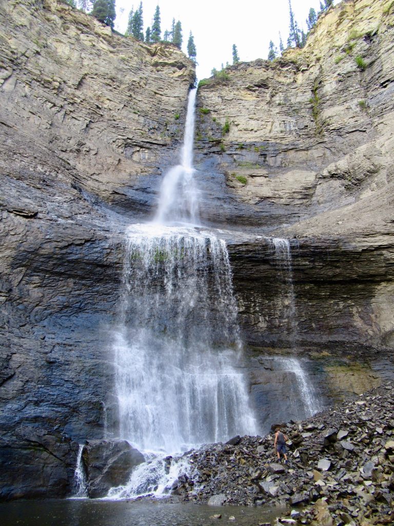
Standing beneath the mist of the majestic falls pouring down towering cliffs, we were reminded of the power of nature. Ma Nature kept up the lessons as thunder boomed and wind whipped pine trees. We scurried down the trail and off the summit in haste.
Shop quality hiking gear at Bass Pro Shops!
Day Three Triple Header – The Shipyard (and More!)
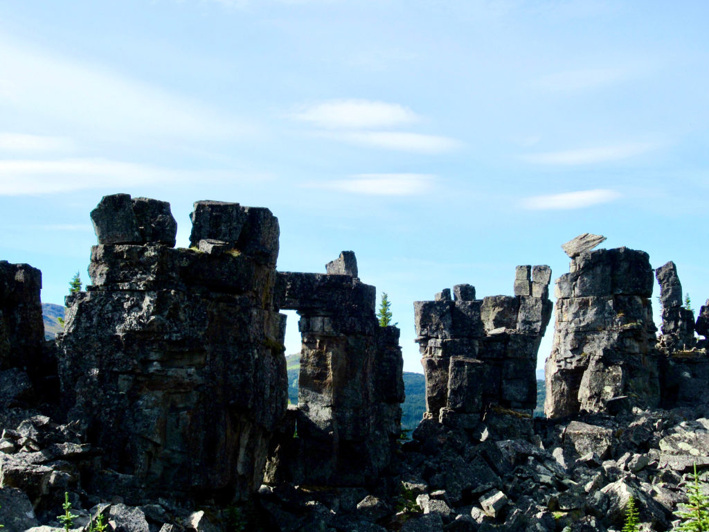
Day three was the shortest of all of our hikes at only three kilometres return. The walk is a flowered filled climb up to a series of bizarre rock formations with names such as Titanic, Armada Ridge and the Shipyard.
It was by far the busiest trail – six other people on the path! This route was also the easiest with superb views. We overlooked the headwaters of Babcock Creek and the distant Rocky Mountains in the west. The closed Anglo-American Trend mine lay to the east.
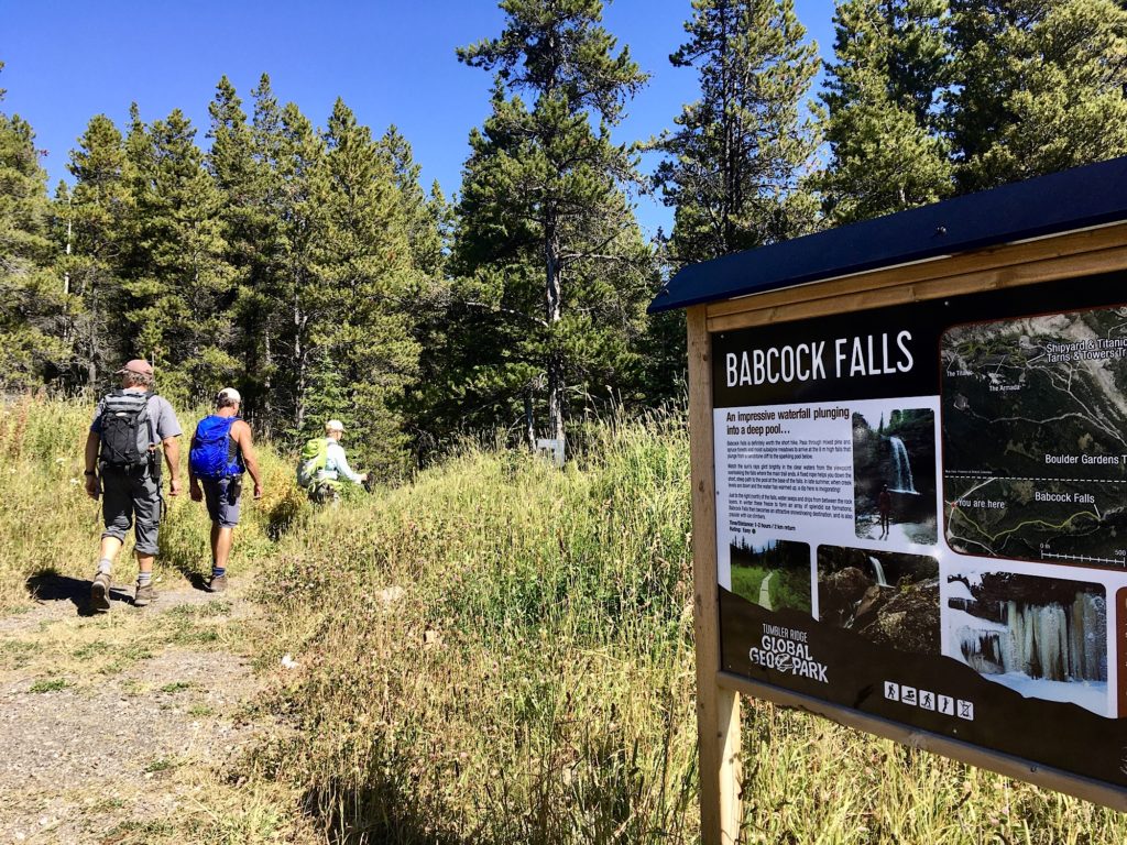
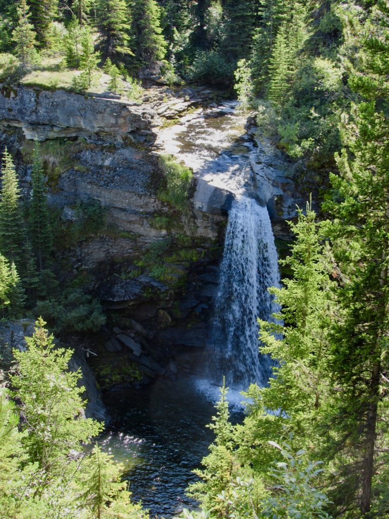
A short drive took us down to the nearby trailhead for Babcock Falls. It’s a pretty walk through a wet, subalpine forest. Interpretive signs talk of native encampments nearby. A sandstone ledge takes us to the falls viewpoint. We laid on rocks in the sun and enjoyed the peaceful flow of cool water. On the way back out we spotted several fossilized logs in rocks near the trail.
Heading back towards town, we pulled out at the Flatbed Cabin Pool Dinosaur Trackway parking lot. There were several other groups on the short trek down to the creek. We photographed Theropod tracks at the edge of the creek. Brad crossed the creek downstream in search of the original trackway discovered by the two boys in 2000. Little remains of these exposed tracks.
One Final Stop for Dinosaurs!
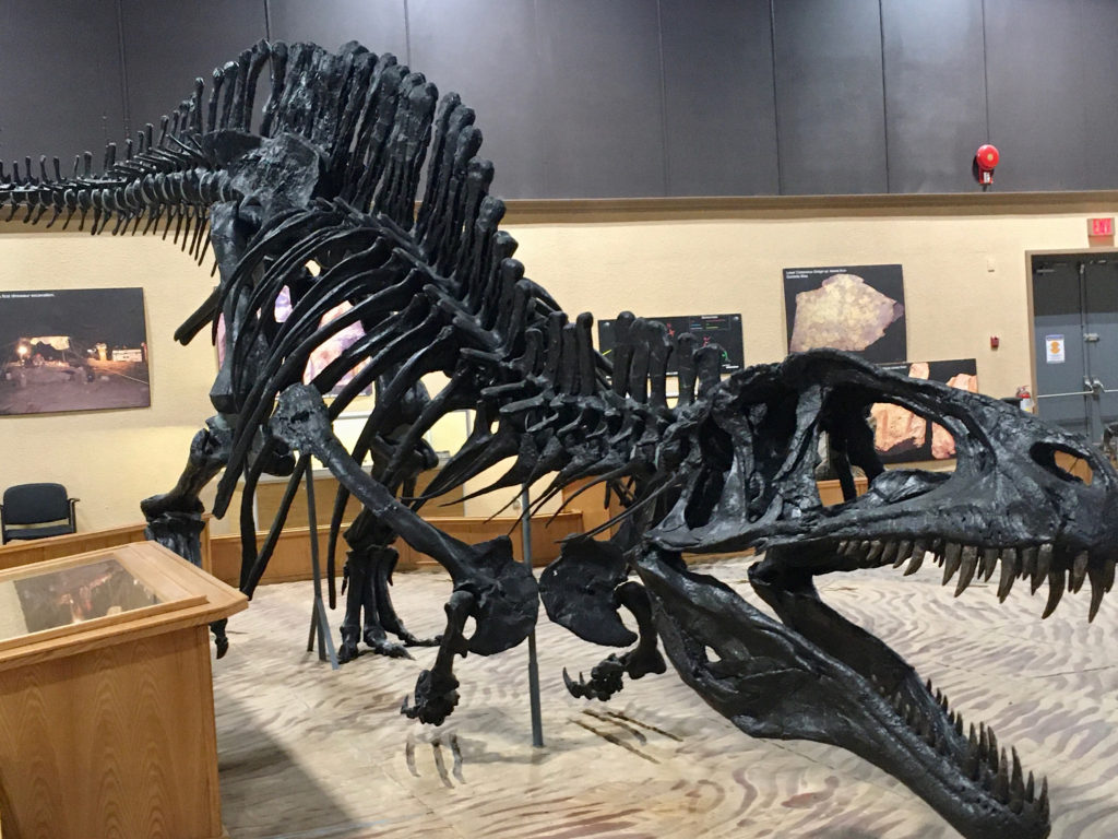
Before heading out of town the next day, we stopped in at the Dinosaur Discovery Gallery ($8 adult admission). There is a massive central display of a replica Acrocanthosaurus – think T.Rex stature – stalking two plant-eating Anklylosaurs. Two smaller Theropods waiting in the wings for leftover tidbits. The display also includes footprints and bones and casts of prehistoric crocodile tracks. Historical information about the discoveries and the area rounds out the display.
We didn’t have time to take in the Wolverine River tracks on this trip. Next time we’ll book a guided Wolverine Lantern Tour. It is led by the Tumbler Ridge Museum Foundation. Visitors see the tracks by the glow of the lantern. We’ll go along and let our imaginations soar to another time in this special place.
When You Go
- Pick up a copy of the Tumbler Ridge Global Geopark Recreation Map. Choose a selection of print copies of selected trail brochures of interest from the town Visitor Centre. Trail brochures can also be found online on the Wolverine Nordic and Mountain Society website.
- We camped at the Lions Flatbed Creek Campground ($20/night). Sites can be reserved by calling (250) 242-1197.
Planning Future Adventures?
Looking to put some more travel ideas to put in your pocket for another time? Check out these adventures!
Put This in Your Pocket: Nevada’s Mount Irish Archaeological Site
Alberta’s Kananaskis Country: Hiking and Camping in the Highwood
Ok that lantern tour sounds very cool and those falls are incredible! Looks like I need to make a trip to Tumbler Ridge
So many cool things to see and do – never enough time!
That is a beautiful place. I need to look into going there.
I hope you have the opportunity to get there one day soon, Chuck!