Tombstone Territorial Park, Yukon Canada. If you like active travel adventures half as much as we do, you’re going to love exploring Tombstone. We drove up from Whitehorse and spent over a week camping, hiking and checking out this northern pocket of paradise.
Disclosure: This post contains affiliate links. If you buy something from one of our affiliates, we receive a small commission at no extra charge to you. Thanks for helping to keep our blog up and running!
Table of Contents
Adventures in the Yukon: All About Tombstone Territorial Park
The Yukon has three national parks (Kluane, Ivvavik, and Vuntut) and eight territorial parks (Agay Mene, Asi Keyi, Coal River Springs, Herschel Island-Qikqtaruk, Kusawa, Ni’iinlii Njik, Dàadzàii Vàn and Tombstone. Many of these are difficult to access. You can drive to Tombstone.
Tombstone is a massive 2,200 square kilometre (849 sq mi) park in the north-central part of Yukon Territory. It’s a landscape filled with permafrost landforms, arctic and subarctic wildlife and jagged peaks reminiscent of Patagonia in South America.
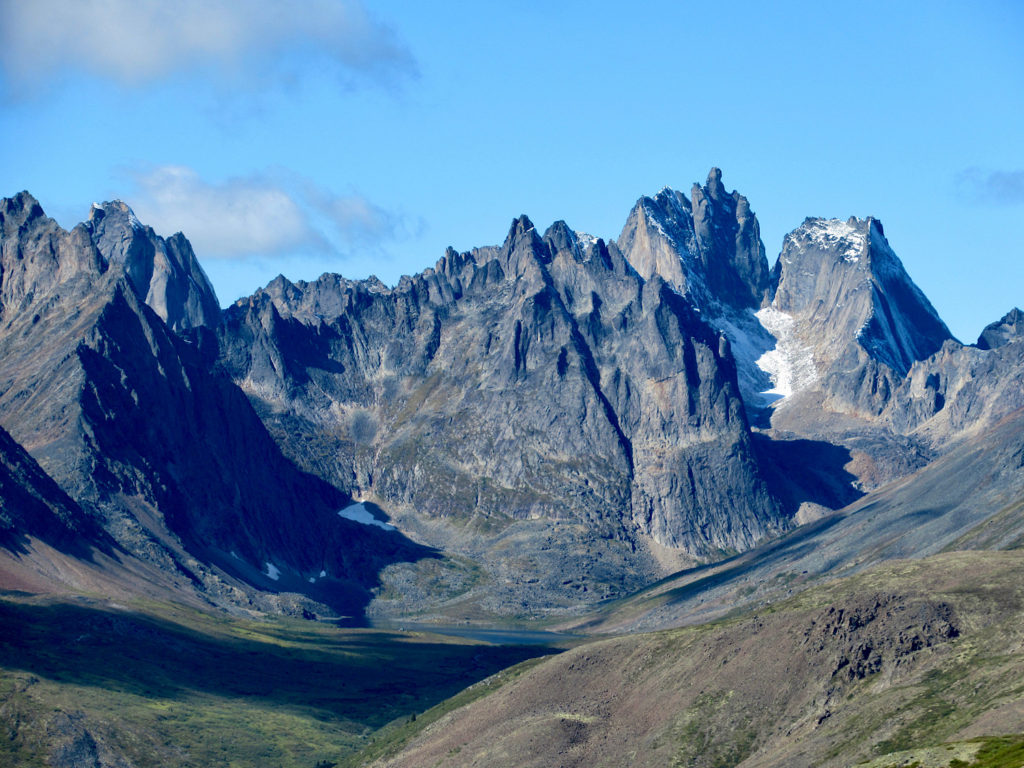
Tombstone Territorial Park lies on the traditional territory of the Tr’ondëk Hwëch’in. The area’s Hän name Ddhäl Ch’è Cha Nän means “ragged mountain land.”
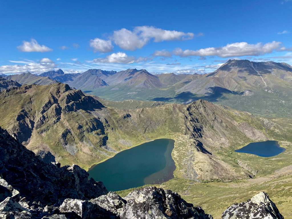
It is ragged mountain land, for sure! But Tombstone Territorial Park is more than mountains. It’s boreal forest and alpine and arctic tundra – landscapes guaranteed to enthrall active travellers.
The Dempster Highway traverses the park south to north, providing road access to this unique slice of the mosaic that makes up Canada.
Why Is it Called Tombstone Territorial Park?
The park includes sections of the Blackstone Uplands and the Ogilvie Mountains. One of these mountains is a shaft of black rock that rises high above a surrounding ridge. The Klondikers who came through these valleys in search of gold in 1897-98 called it Tombstone because of its resemblance to a grave marker.
But did you know that a year earlier it was named after Robert Campbell (Chief Factor for the HBC; European discoverer of the Pelly, Lewes and upper Yukon River; and builder of the Frances, Pelly Banks and Selkirk Forts)?
Yup – it’s a mountain with multiple names! In 1968, it was acknowledged that Mount Campbell and Tombstone Mountain were the same peak. The Geographical Board of Canada opted for the miners’ more fanciful name!
Natural History of Tombstone
Tombstone is Arctic tundra and mountains and boreal forests and alpine lakes. The diversity of landscapes provides habitats for everything from herbivores such as caribou, moose and Dall sheep to carnivores such as wolves to omnivores such as grizzly and black bears to songbirds such as yellow warblers.
Yes, birds have almost as much draw in this area as the megafauna. Nearly 150 bird species can be found in the park, including rare species like the gyrfalcons, long-tailed jaegers, golden plovers, surfbirds, northern wheatear, and smith’s longspur.
Anglers appreciate the clear streams and rivers with healthy populations of Dolly Varden and grayling. Salmon spawn in the North Klondike River.
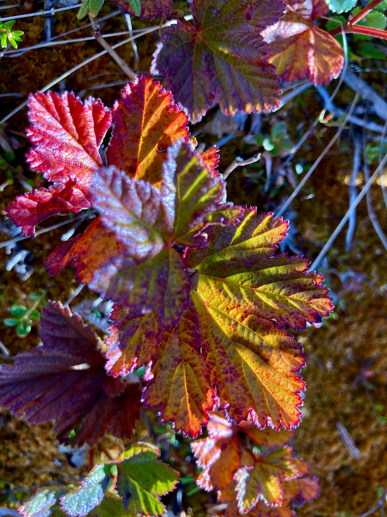
The park is home to dozens of Beringian plants and insects that are found nowhere else on earth. In August, cool nights bring on the reds and golds of autumn while the last of summer’s wildflowers still bloom in protected pockets.
Human History in and Around the Park
Humans were drawn to this region long before the Dempster Highway was built. Archaeologists have identified close to 80 prehistoric sites within the park. The Tr’ondëk Hwëch’in have used the area for over 8,000 years.
It provided everything they needed for survival from raw materials for tools to food (caribou, moose, fish, berries) to furs for clothing. This ancient land is still used by the Tr’ondëk Hwëch’in and Tr’ondëk Huch’in today.
European travelers did not come to the region until the late 1800s. They initially came to the area to establish fur trading outposts, but they started to arrive in greater numbers following the discovery of massive gold deposits.
In the early 1900s, water was another natural resource of interest in Tombstone. The Yukon Gold Company constructed the Yukon Ditch. By 1909, the Yukon Ditch was delivering 250,000 litres (66,043 gallons) of water per minute from the Little Twelve Mile and Tombstone rivers to hydraulic mining operations in the Klondike Goldfields – which were almost 160 kilometres (100 mi) away! The ditch shut down in 1933.
The Dempster Highway began as a winter road in the 1950s. All-season road construction began in the late 1950s, but it wasn’t completed until 1979. It opened the doors to today’s tourism.
Driving the Dempster Highway
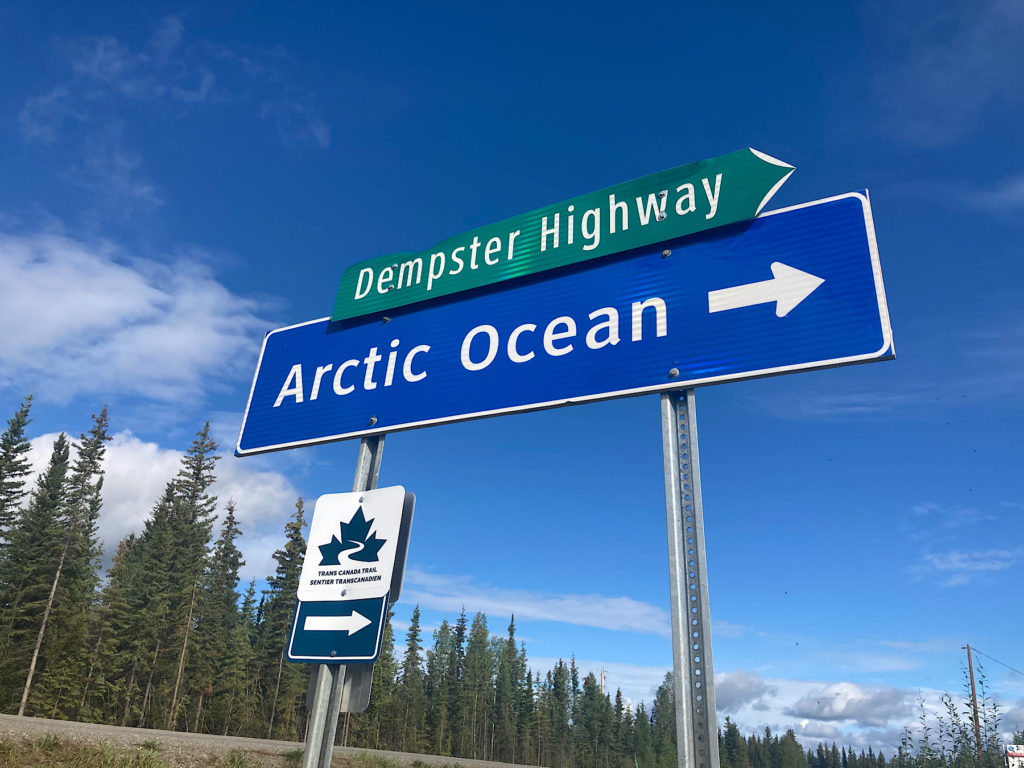
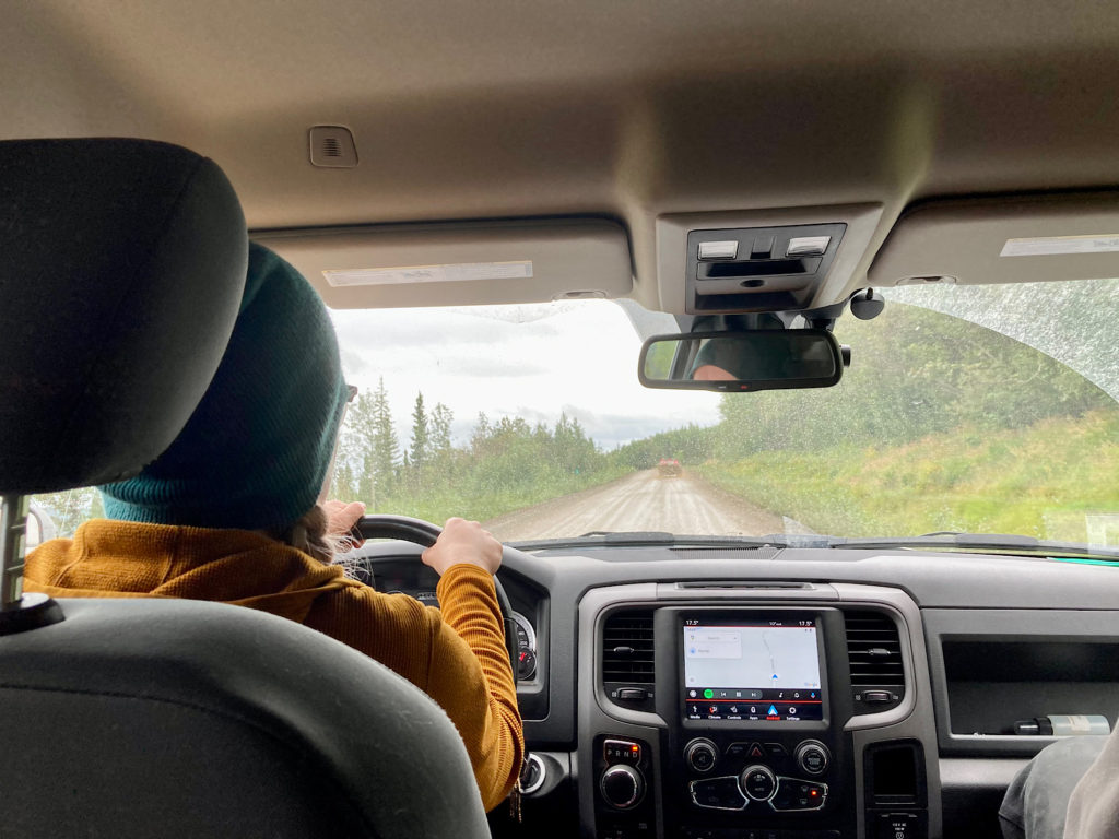
Active travel adventures in Tombstone start with getting there! The Dempster Highway is an unpaved gravel road. It has extremely limited food and gas stations and barely any cell reception. There are few pullouts. The road is relatively narrow. Large semis hauling supplies to northern communities also use the highway.
The highway can be dry and dusty or wet and muddy. It’s almost always full of potholes. Yes, driving this road is an adventure!
The Dempster Highway starts 40 km (25 mi) south of Dawson City on the Klondike Highway goes through Inuvik (my hometown for a short stint when I was a teen) and ends in Tuktoyaktuk, Northwest Territories. But if you’re only going to Tombstone Territorial Park, the Interpretive Centre is at km 71.5 and the campground is at km marker 72.0 along the road.
Who was Dempster?
William John Duncan “Jack” Dempster served with the Northwest Mounted Police – which became Royal NWMP in 1904 and Royal Canadian Mounted Police in 1920 – from 1897 to 1934.
From 1914 to 1919, he single-handedly operated a post at Rampart House near the Yukon/Alaska boundary on the Porcupine River. Dempster pioneered routes from Rampart House directly north to Herschel Island and south to Dawson.
He was also involved in the search for the “Lost Patrol” in 1911 – where four Mounties travelling from Fort McPherson in the Northwest Territories to Dawson City, Yukon lost their lives. Dempster’s ability to travel enormous distances under harsh conditions made him a legend in the north.
Jack Dempster retired in 1934 with the rank of inspector. He passed away in 1964, the year after the highway was named for him.
More Active Adventures in the Yukon: Camping in Tombstone Territorial Park
The park has one frontcountry campground, three small backcountry campgrounds (registration required), a visitor centre and only five established trails. There are no food, gas, phone, or Wi-Fi services in Tombstone. The nearest services are located in Dawson City – 110 km (68 mi) to the south – and Eagle Plains – close to 370 km (229 mi) to the north.
Camping is the only lodging option close by. Like all Yukon campgrounds, it has mix of walk-in, pull-in and group use sites. It’s good to know that Tombstone Mountain Campground has only one pull-through site out of the 34 drive-in campsites.
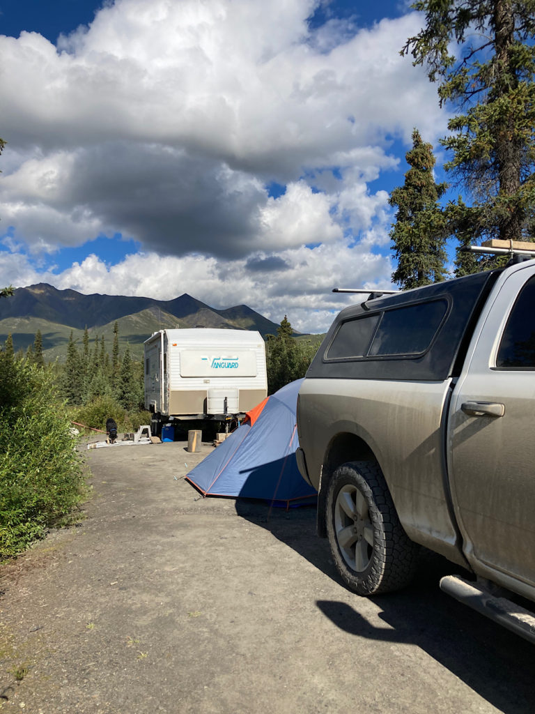
We saw larger units camped in overflow areas at the campground entrance and interpretive centre parking lot. Sites are available on a first-come, first-serve basis. They filled up every day we were there – with more campers driving through later in the evening.
Sites come in a variety of lengths – the one we ended up with had plenty of room for the trailer, a tent and two vehicles. Some were only big enough for a small vehicle and tent. The campground has pit toilets, garbage and recycling bins, non-potable creek water (boil before using) and bear-proof lockers, a hanging food cache and picnic shelter for tenters.
Hiking trails lead from the campground over to the Tombstone Interpretive Centre (less than 400 m/440 yards) and along the North Fork of the Klondike River (including a short interpretive trail loop).
Exploring Tombstone Interpretive Centre
The Tombstone Interpretive Centre is open daily June to mid‐September. We toured the main floor displays highlighting the human and natural history of the park – as well as the upstairs exhibits discussing the evolution of interpretation in the park.
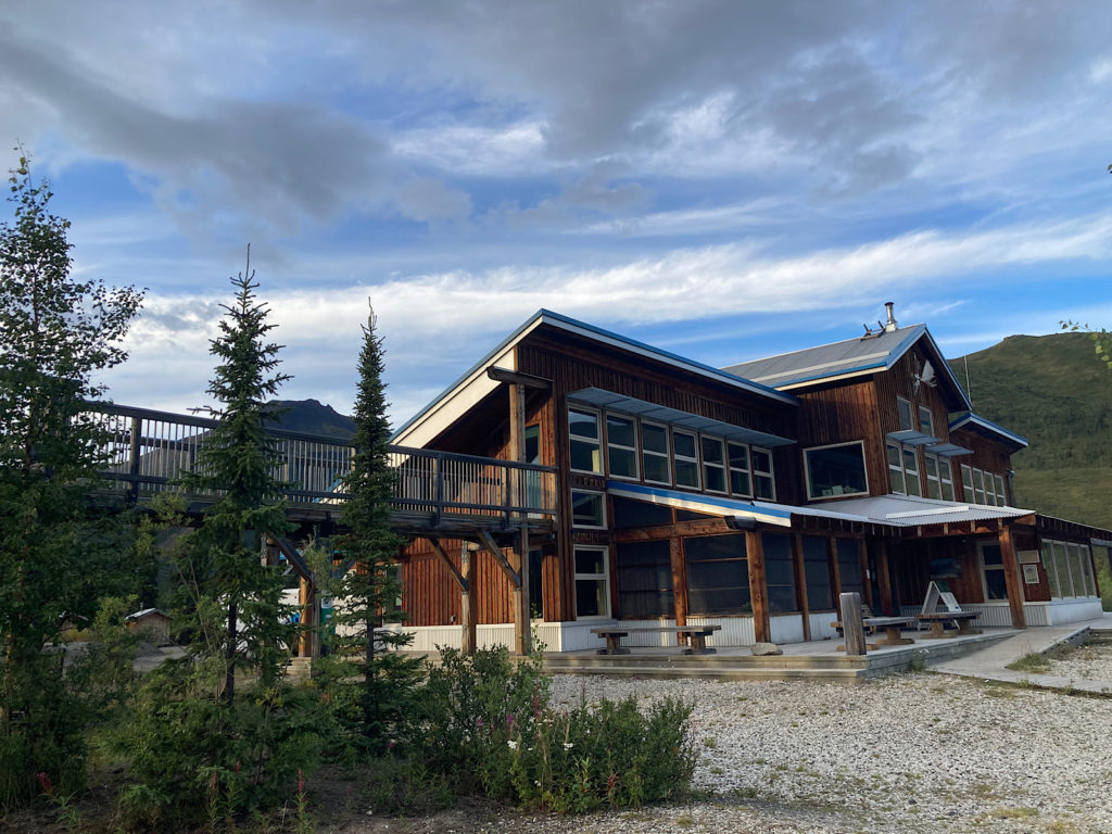
There’s a cosy fireplace complete with a kettle of tea made from native plants next to a sitting area and library of books. It’s a great place to spend an hour on a rainy morning! Interpreters are happy to answer questions about “where to hike?” and “what is this wildflower?”
Artist-in-Residence Program at Tombstone Territorial Park
I stopped in at white wall tent next to the amphitheater in the Tombstone Mountain Campground one afternoon to see what was going on. Every year a new artist is selected to come the park and share their work through displays, workshops and other events.
In 2022, clay artist-in-residence Harreson Tanner was busy staining a bust of Leonard Cohen when I visited. It was one of 12 busts representing Canadian writers. He had another sculpture of Henry Henry sitting on the table. Henry was one of Joe and Annie Henry’s sons. The family resemblance is notable.
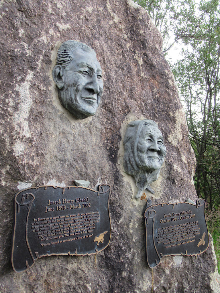
Annie Mitchell was born in 1904 in area then known as Black City, along what would become the Dempster Highway. She married Joe Henry in 1921. They hunted and trapped together on the Blackstone Uplands and eventually had 13 children.
Joe was instrumental in the construction of the Dempster Highway – picking the best route for the Cat train to follow from the Klondike Highway (Mile 0) to Olgivie Ridge. Annie and Joe were married for 81 years.
Harreson sculpted Joe and Annie’s faces and had them cast in bronze for a memorial stone that marks the site of Black City at km 112 on the Dempster Highway.
When You Go to Tombstone Territorial Park
Tombstone Territorial Park is located 585 km (363 mi) north of Whitehorse, Yukon, Canada on the Dempster Highway. The Tombstone Territorial Park Interpretive Centre and campground are located approximately an hour and a half drive from Dawson City or a seven hour drive – depending on road conditions – from Whitehorse.
You can find current information on Tombstone Territorial park and events here. For highway conditions, visit the Government of Yukon highways page.
For an overview of air and road travel, visit Travel Yukon. We flew Air North again and highly recommend this Yukon-based airline.
While we were lucky enough to join Whitehorse family and use their truck and trailer for this adventure, you can find vehicle rental information here (if you’re not driving up to Yukon in your own RV).
Pick up a copy of “Along the Dempster: An Outdoor Guide to Canada’s Northernmost Highway” by Walter Lanz here.
If you love the Yukon, you might also enjoy these posts: Yukon Wildlife Preserve, Yukon Adventures: Finding Stories Tall & True, Taking Time in Teslin and Exploring Carcross.
What are you waiting for? Get packing and set out on your own adventure to explore Tombstone Territorial Park near Dawson City, Yukon Terrritory, Canada today!
Thank you for this article. I grew up in north Idaho, Priest Lake. The selkirk mountains were my education, playground, camping area, hunting grounds. I always wanted to go to Alaska, and the Yukon. But I had family and children in Idaho, so I chose not to go. Because I knew if I went I wouldn’t come back. I’m 62 now I have 5 daughters, 7 grandchildren. I have had a hard but blessed life. I know I will never see Alaska, or the Yukon. But you just showed and told me about a piece of it. Thank you. I wish I could have done it myself.
I’m glad you enjoyed the post, Carl!