When it pops up your Facebook feed as a memory, it’s a great reminder to share a perfect adventure. June is a prime month to be paddling the San Juan River, as are the months of May and September. This river trip has everything – from ancient ruins, rock art, and historic trails to splashy rapid fun. It might not happen this year, but you need to put these planning tips in your pocket for a future active travel adventure in the American Southwest!
Disclosure: This post contains Affiliate links.
Table of Contents
Overview
The San Juan River runs along the southern border of Utah and the northern border of Arizona in the heart of the American Southwest. This tributary of the Colorado River drains the Four Corners region – the place where Arizona, Utah, Colorado and New Mexico meet. It meanders and drops through rugged red rock canyons.
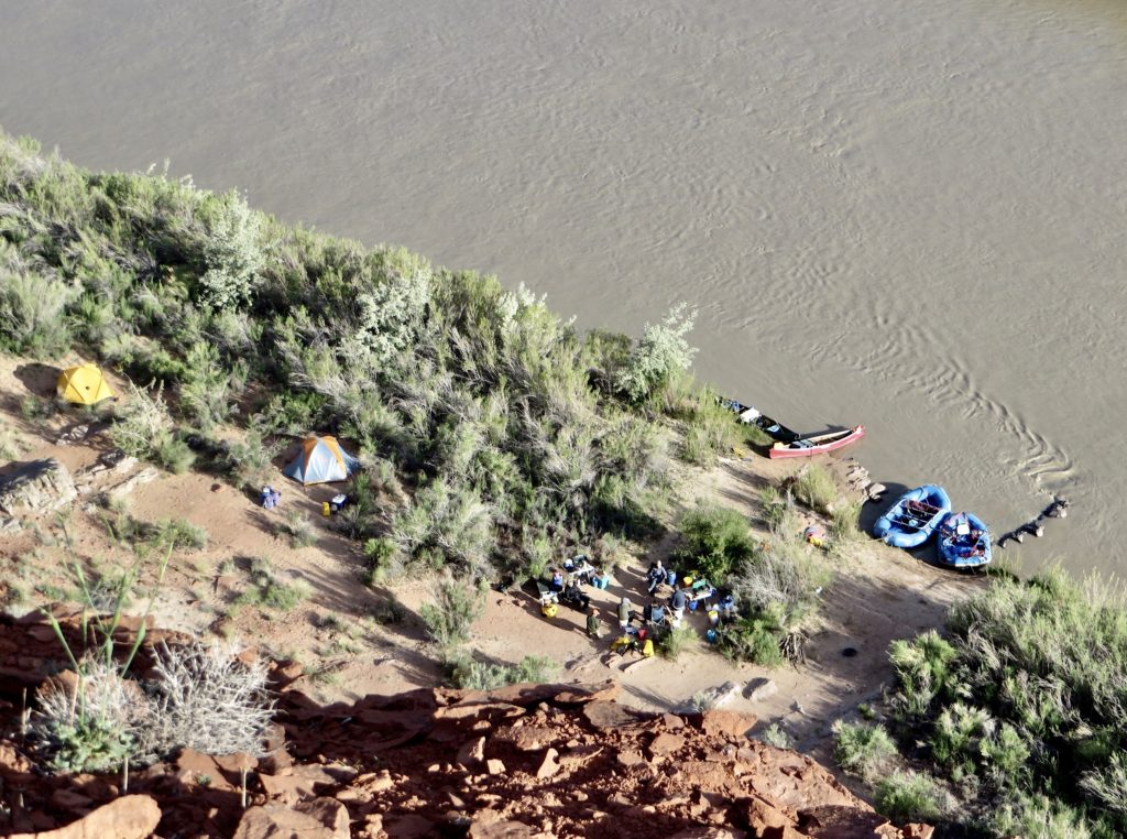
Boaters have the opportunity to explore countless prehistoric and historic sites on shore and practice their skills in Class II to III rapids on the river. Most trips run from Sand Island – near Bluff, Utah – down to Mexican Hat or Clay Hills. Sand Island to Mexican Hat is about 27 miles (43 km) and usually takes two to three days. Mexican Hat to Clay Hills is another 57 miles (92 km), upwards five days or longer. Paddling the San Juan River requires a permit which is available by a lottery system for prime months because they are so popular. You can find more details here.
Cool Fact
The San Juan River is one of the muddiest rivers in North America. One of our friends dubbed it the Sand River. Sand waves are a unique phenomenon where the movement of the water against the silted river bottom builds up waves in the middle of a normally flat section of water. These waves can disappear as quickly as they arise.
Prepping to Paddle the San Juan River
We’ve done this raft trip twice – one time taking out at Mexican Hat and the other paddling the entire length to Clay Hills. While there is always the option to go with a professional rafting company, we enjoy doing it on our own. It takes more preparation, but the rewards of travelling at your own pace are worth the effort.
The put-in at Sand Island near Bluff, Utah is approximately half a mile upstream of the Highway 191 Bridge. Sand Island has drinking water, toilets and a boat ramp wide enough for several groups to get ready for the float at the same time. We shared the ramp with a group of government scientists who were on an electrofishing expedition to check for endangered Colorado squawfish and razorback suckers.
When you’re ready to head out, a Bureau of Land Management (BLM) volunteer will come by to check that you have all the mandatory gear and permits and give a safety and Leave No Trace talk.
Mandatory Gear List
- First aid kit (big enough for the group and sufficient for treating serious injuries)
- Repair kit (with everything needed for types of boats used on trip)
- Air pump (for raft re-inflation after repair)
- PFDs (life jackets) for everyone
- Portable toilet system
- Firepan
- Extra oar or paddle for each boat
- Bailing bucket or bilge pump for each raft or canoe
- Rescue throw bag
What About Those Rapids?
Rapids are rated on a scale of Class I to Class VI. A Class I rapid is easy with smooth water, light riffles and a clear path. On the other end of the scale, a Class VI rapid is extraordinarily difficult and expert kayakers and rafters can only navigate when water levels and conditions are favourable. But don’t worry, the rapids on the San Juan are on the low end of the scale.
Rapids on the San Juan River
While the majority of the San Juan River from Sand Island to Clay Hills is an easy float, there are definitely a few sporty sections. The rapids on the San Juan River are moderate to moderately difficult. Most are rated as Class II, which means they have regular waves and open passages between rocks and ledges. Intermediate paddlers who can read the water will have little trouble.
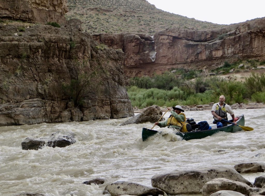
Class III rapids have high and irregular waves. The passages are clear but narrow. It’s advisable to scout ahead of time to assess the best route. Expert canoeists can run up to Class III rapids, but skill is essential. Canoeists who don’t feel that they have the skills can portage around or line their boats through the roughest sections.
We lined the boats down Government Rapids as they were a little too shallow and rocky for our liking. Before taking off downriver again, we watched another oared raft bump his way through, ping ponging off rocks before continuing on totally unconcerned – must’ve been a rental boat! San Juan River rafting is nothing if not an adventure.
Trippin’ Along Sand Island to River House
As you head out on the river from Sand Island, watch for regularly spaced steps carved in the sandstone. These are moki steps, or tiny toeholds, chipped into the rock by Ancestral Puebloans for travel up and down these canyons over a thousand years ago.
First stop is always Butler Wash – where there is an impressive set of petroglyph panels. The rock art is spread out upstream and downstream of the wash. The kachina or shaman figures are notable. It’s worthwhile taking a short jaunt up the usually dry creek bed to view some small ruin and more petroglyphs. Keep your eyes open for scattered pottery shards and pieces of chipped chert – used for points. Please leave these artifact where you find them.
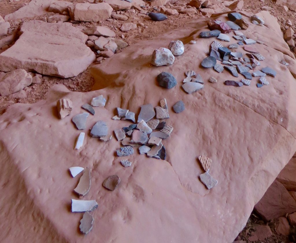
Six miles (10 km) downstream of your launchpoint is River House – an Ancestral Puebloan ruin dating back to the 13thcentury. It’s a short hike up to the 14-room ruin built into a massive sandstone cliff. There are also two kivas – circular, usually underground spaces used for ritual ceremonies. Overhead, there are a series of pictographs including handprints, a snake and wavy lines. Hundreds of petroglyphs also exist in the area, including figures of Kokopelli. Known as the trickster, Kokopelli is often depicted playing a flute and often has feathers in his headdress.
Who Were the Ancestral Puebloan People?
Formerly known as the Anasazi, Ancestral Puebloans lived in the Four Corners area (where the states of Arizona, New Mexico, Colorado, and Utah now interesect) from around AD 100 to the mid 1500s. The San Juan River and its tributaries were key to their culture which included growing crops, creating distinctive pottery, building pueblos – multi-room and often multi-story masonry buildings for living and storage, and using kivas.
River House to Mexican Hat
Less than a mile (1.6 km) downstream of River House is Barton’s Trading Post. Established in the 1880s at Rincon Crossing, Amasa Barton operated the post for his father-in-law, William Hyde. Remnants of the rock milk house and part of an old water wheel can still be seen.
As you continue downstream, the river cuts through Comb Ridge as you approach the entrance to the canyon. On river left you will pass the trail to the Mule’s Ear Diatreme – a volcanic pipe. It takes a couple hours to hike up and back, but it is easy walking on a sandstone ridge.
The next approximately 10 miles of river are through a deep canyon. A couple of easy riffles get you ready for Four Foot Rapid, the first of the class II drops. It can be scouted from river right – which means the right-hand side of the river when looking downstream. Another few miles downstream you will encounter Eight-Foot Rapid which is the most technical rapid on this section. It is easy to scout from river left.
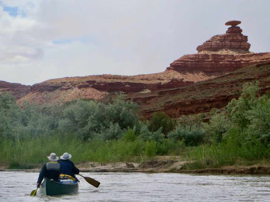
While there are two camps immediately below Eight-Foot Rapid, the next two miles of river are closed to camping as this is prime habitat for bighorn sheep. The end of this section is marked by Ledge Rapid. The rapid can be easily scouted from the top on river right. Within a few more bends the distinctive Mexican Hat Rock comes into a view on river right. The BLM River Access site of Mexican Hat is just a few miles downstream and has pit toilets and garbage bins, but no water.
Silly Goose Section from Mexican Hat to Slickhorn Canyon
A short distance downstream of the launch, you go through an class II and pass under the Highway Bridge at Mexican Hat. This is the start of your journey through the impressive canyons of the Lower San Juan. It’s a mellow float for the 10 miles down to the Goosenecks.
What is a Gooseneck?
A “gooseneck” is a geological term for winding canyons and valleys that look similar to the curved neck of a goose. Makes sense – but you can’t see it from boat level. Goosenecks State Park offers a panoramic view of the sinuous San Juan River and its goosenecks – from a plateau 1,000 feet above the river!
The walls are too high to hike a shortcut between the bends – except at Mendenhall’s cabin. If you pull out at mile 30 on the map, an easy sandstone ledge climbs up to the cabin site. Prospector Walter Mendenhall built the stone shelter in the late 1890s. Be sure to walk over for a view of the other side of the gooseneck.
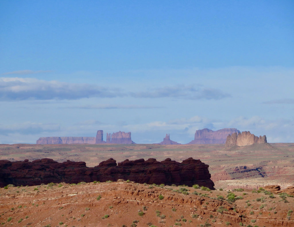
A couple miles downstream of the Goosenecks, you will reach the Honaker Trail on river right. The trail was originally constructed by gold prospectors more than a century ago. It follows a series of switchbacks along the terraced canyon walls. The route climbs 1,200-foot (365 m) in elevation from river to rim, but the rewards include a spectacular view of Monument Valley.
The Final Push
All of the camps below Government Rapids need to be booked in advance. Slickhorn is one of the most popular camps on the river and there are five sites here. The rapid of the same name is pretty much gone as a result of the water slowing down and backing up because of the Lake Powell Reservoir. Slickhorn Canyon is an excellent hike. Historical remnants from early oil explorations are still visible.
There are three more camping areas downstream of Slickhorn but you need to reserve early to get the best ones. We stayed at Grand Gulch – definitely our favourite site on the river. The canyon is quite narrow in this stretch, yet we still had the thrill of watching two F-28 jets fly down the canyon over our campsite at the mouth of Grand Gulch – here then gone in one big roar.
The final 5 miles of river down to Clay Hills are slow – especially if you have strong afternoon winds. Prepare for a little work before you reach the take-out. After unloading, sorting and packing everything into shuttle vehicles, it’s about a two-hour drive back to Blanding and another half hour back down to Bluff.
Enjoying San Juan River Flora and Fauna
Taking a spring trip, you’re likely to see Mormon tea, narrow-leaved yucca, prickly pear and Sacred Datura in bloom. If you’re lucky, you might also spot sego lily, scorpionweed, morning glory and desert trumpet. Willows and cottonwoods still grow, but invasive tamarisk – also known as salt cedar – and Russian olive trees are replacing native species in many areas. Ravens and vultures, blue herons, Canada geese, wild turkeys and hummingbirds are common. Keep your eyes open for rattlesnakes and scorpions – we’ve seen both in springtime.
Get the Gear
This is a remote trip. There is no cell phone coverage on the river and limited take out points. Our safety drybag always includes a two-way satellite messenger device. Luckily, we didn’t need to use it but there was moment of consternation on one our journeys.
We woke up just before 6 a.m. by one of our river mates calling outside our tent: “Brad, Brad?”
“Yeah…” Brad replied sleepily.
“Got any Benadryl?”
Coming out of the haze of deep sleep, I start to explain where the first aid kit was and then asked, “Who is it for?”
“Me! Brad, can you come out and help?”
Our buddy woke up with a seriously swollen half of his tongue and a thick feeling in his throat.
Bug bite? Spider? Allergic reaction? We still have no idea. Benadryl worked to bring down the swelling, but we decided as a group to pack up and head off river a day early… just in case. The moral of this story – and for all travel adventures – is prepare for the unexpected.
Making a List and Checking it Twice!
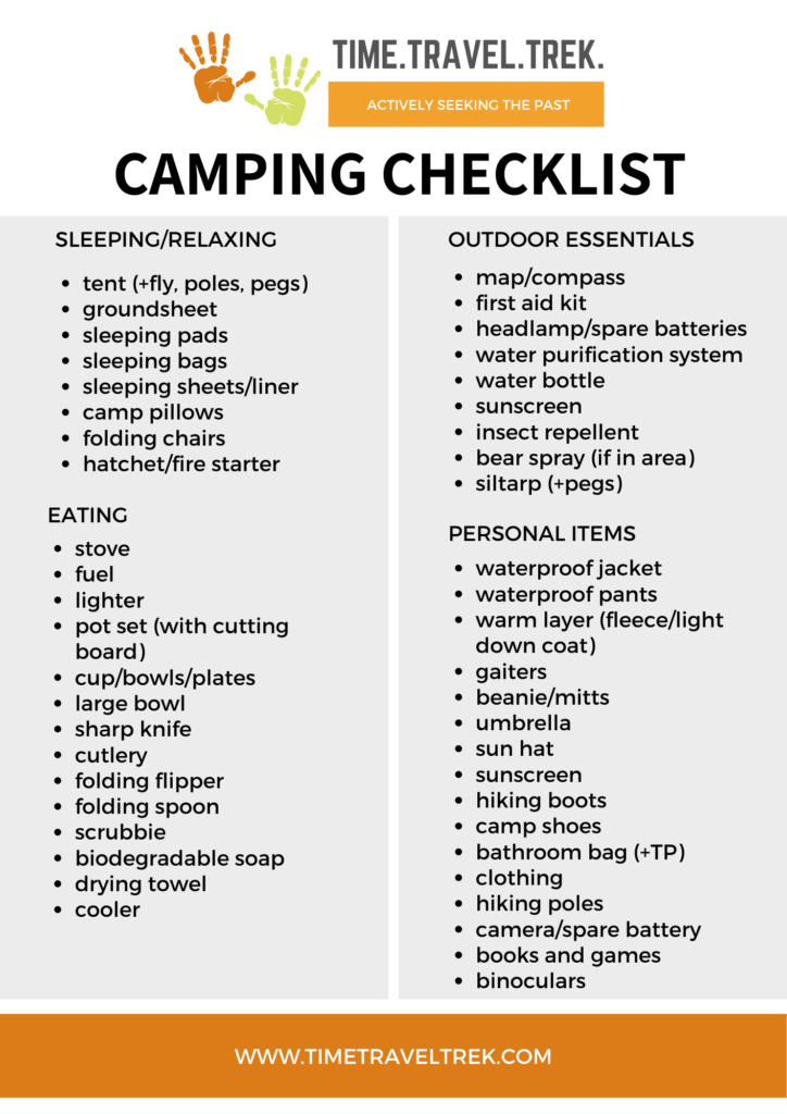
Add to this this water. Note that water along the river is too silty to filter for drinking. We carried 32 gallons of water for four people for a five-day trip and had about four gallons left at the end. This will vary depending on your use but be sure to carry enough for your needs.
Additional Resources for Paddling the San Juan River
The Navajo Nation requires additional permits to camp, hike, or visit archaeological sites on river left. For more information on how to obtain a Navajo permit, call the Navajo Parks and Recreation Office at (928) 871-6647.
You can find more trip planning information from BLM here.
Don’t forget the map!

CONTINUE YOUR JOURNEY IN THE AMERICAN SOUTHWEST!
Canoeing the Green River, Utah


Great photos and details – looks amazing!
Thanks! Like so much of the American Southwest, it is a fascinating area to explore!
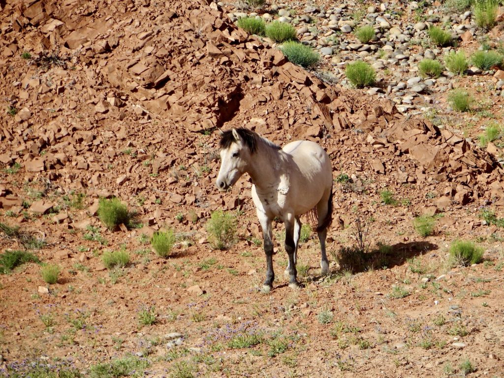
This sounds like a really fun adventure for 5 days of river fun. It’s not an area I’m familiar with, but I love all the geological features and the chance to see wild horses!
The geology is as multi-layered as the human history in this amazing area!
The camping checklist is really helpful, thank you!
Glad to hear the checklist is helpful, Amy. We’re big on lists on our end – saves a lot of “wish I’d remembered the …!”
Saving this post for a future trip! Sounds exciting! Thank you for sharing all of your details.
Love to hear how your trip goes when you finally get on the river – it’ll be worth the wait!
It must have been an exciting adventure for you paddling, camping, hiking and sightseing along the San Juan River! It’s very interesting to see ancestral pueblos and ancient ruins from the river. It makes your trip unique. We took a half day Rio Grande whitewater rafting tour with an experinced guide, who navigated the boat and it was thrilling.
Knowledge is key to appreciation and understanding, IMHO! A good guide makes a trip, for sure.
I am new to this type of trek, and I found your post very informative and easy to navigate. I am very spontaneous, so this guide reminded me that preparation is the key to adventures . Will definitely refer back here when I visit this part of USA!
Let me know if you end up doing it; I love to hear of other travellers using our tips and tricks to get outside!
I have always wanted to try something like this, but fear is holding me back. The scenery is so beautiful.
A guided trip might take away some of your anxiety – and the scenery will take care of the rest!
Wow! Looks like the adventure of a lifetime! I love this part of the US. Does it take a long time to get permits approved for this trip?
We applied a couple of years in a row and then got in, but it really varies depending on how many people are in your group, dates you want to be on the river and how many others are applying – which is not something you have much control over! It’s a popular float for a reason; worth the effort.
Great post about an amazing trip! I loved all the photos and the detailed info you provided about the flora and fauna. I’m always amazed by wild horses. I would like to see this area sometime.
Thanks Debbie! If you ever get the chance to float the San Juan, take it! I’d do this trip again in a heartbeat.