It glowed in the setting evening sun. Shadows danced. Nevada’s Spirit Wilderness was alive and waiting for us to come on in and explore. Hiking Grapevine Canyon – one of countless canyons within the wilderness – is the perfect portal for a wander-full walk into the past.
Disclosure: This post contains Affiliate links.
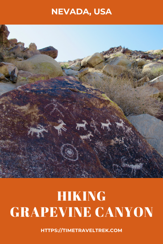
Table of Contents
Finding the Spirit
Off Highway 95 near Laughlin, Nevada, the granite peaks of the Newberry Mountains stand out for miles. The crowning jewel is Spirit Mountain, Avi Kwa Ame to the Mojave people. It is a sacred mountain to many Native American tribes in the Mojave and Sonoran Desert regions. From what I’ve read, tribal elders call the mountain “the place where shamans dream.”
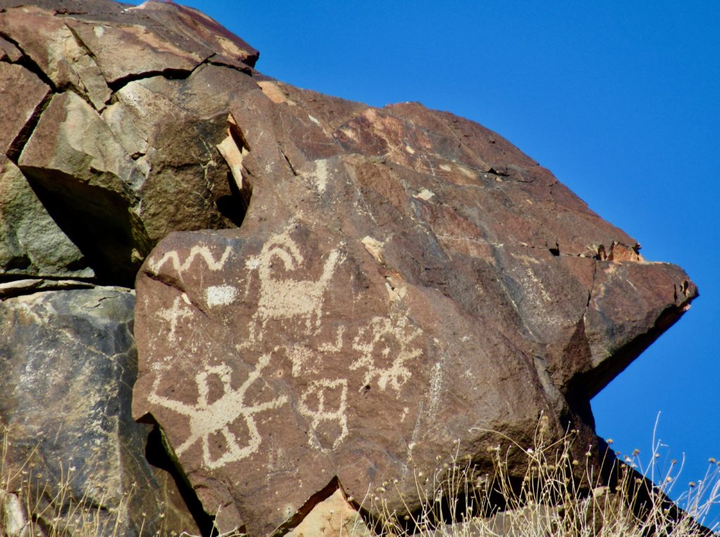
Below Spirit Mountain, another set of sparkling gems make up a gateway – a prehistoric record made up of hundreds of ancient carved symbols and shapes that leads into Grapevine Canyon. It is one of the largest collection of petroglyphs in southern Nevada – and definitely one of the most highly visited, with easy access from nearby Laughlin.
(Photo: Megan Kopp)
Exploring Grapevine’s Petroglyphs
It’s a short stroll up the wash from the parking lot to the boulders and low walls plastered with petroglyphs guarding the entrance to canyon. A family frolicked on slick rock, couples sauntered in hand in hand, and a few intrepid souls wandered down from the upper reaches of the wash. What makes this area so attractive is the ease of access to hundreds of prehistoric images.
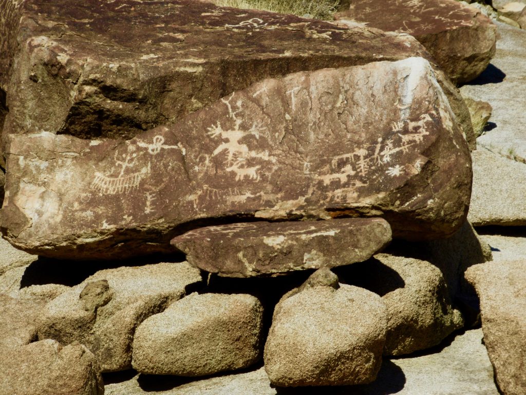
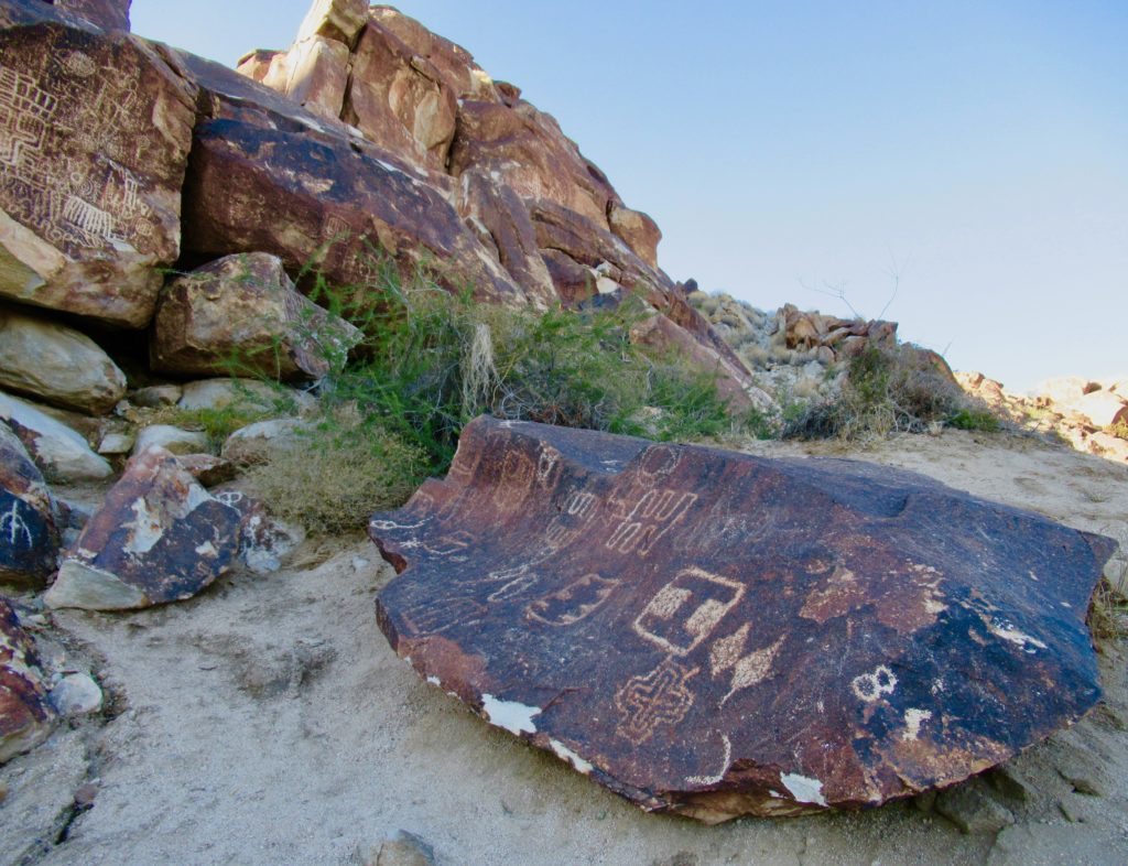
There are suns and spirals, snakes and sheep, and an endless variety of cross-hatched, geometric shapes pecked into the rock. It is believed that these petroglyphs are in the neighbourhood of 800 years old.
The display is especially heavy on the right side of the portals – or canyon entrance. Almost every boulder on the hillside bearing a mark or two or three. On the left side after the decorated entrance pillars, follow the beaten path up the slope to view the herd of sheep pecked into the low coffee-coloured boulder.
Did You Know?
The Spirit Mountain area has been designated a Traditional Cultural Property by the Bureau of Land Management (BLM) and the National Park Service. It is also listed on the National Register of Historic Places.
Rediscovery of This Ancient Site
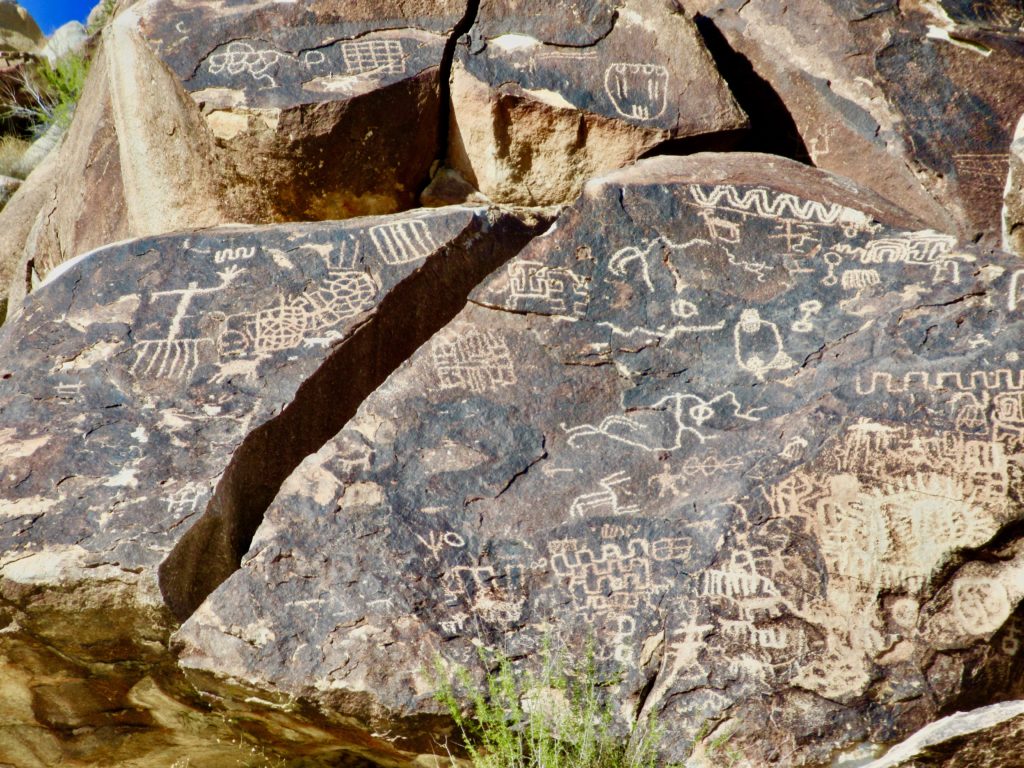
Grapevine Canyon was first recorded in archaeological literature in the 1920s when Julian Steward wrote about the site. The Grapevine Canyon style of petroglyphs is known for its geometric designs, in particular Steward noted the proliferation of the “rectilinear” petroglyph style.
I get “linear” but “rectilinear”… had to look that one up to be sure! According to the Art of Ancient Nevada website, “rectilinear style is composed of straight lines, angular designs and perpendicular forms, such as grids, rectangles, squares, triangles, lines, cross-hatching, rakes, etc.” Staring up at the countless calendar-looking grids scattered across the rock faces, I’d say Seward was right on recticlinear!
How are Petroglyphs Made?
There are four basic techniques that were used to create petroglyphs in the past. The first is pecking. A hammerstone is used to chip a series of dots in a rock surface. A sharpened stone is sometimes used to cut a groove in the rock. This is incising. When a series of fine lines are cut into the rock with smaller, sharpened stoned, the technique is called scratching. Abrading is done when a stone is rubbed back and forth to make an impression.
The images found here at Grapevine Canyon are include many of these techniques, although pecking seems to be the most common technique. These petroglyphs are large and densely inscribed, often superimposed one on top of another, on boulders and rock faces. Distinctive “H” and “I” shapes are repeated in numerous locations. Sheep motifs are also commonly found across the site.
Hiking Grapevine Canyon Beyond the Portals
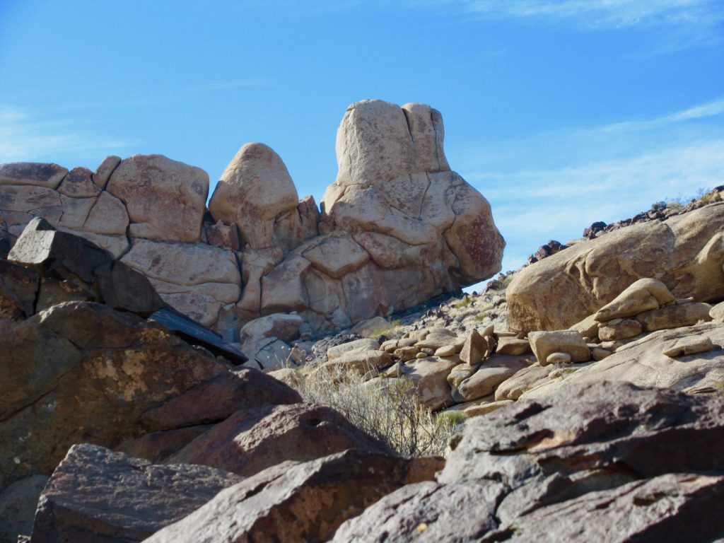
Viewing the petroglpyhs and debating what they might possibly mean can take hours, but if time permits, it’s worthwhile to scramble further up the canyon, past the namesake vines that choke the narrow passage, beyond the chockstone dryfall to where the valley opens up. Large cottonwood skeletons lay fallen on the wash. Up to the right, watch carefully on the small dark rocks for a few more petroglyphs.
(Photo: Megan Kopp)
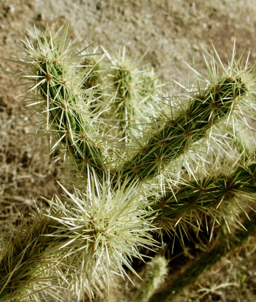
We climbed high on hill on the north side of the wash, past thick reddish fishhook barrel cactus, teddy bear cholla and mesquite to a height of land overlooking the next drainage. Not a soul in sight. One could wander for days here.
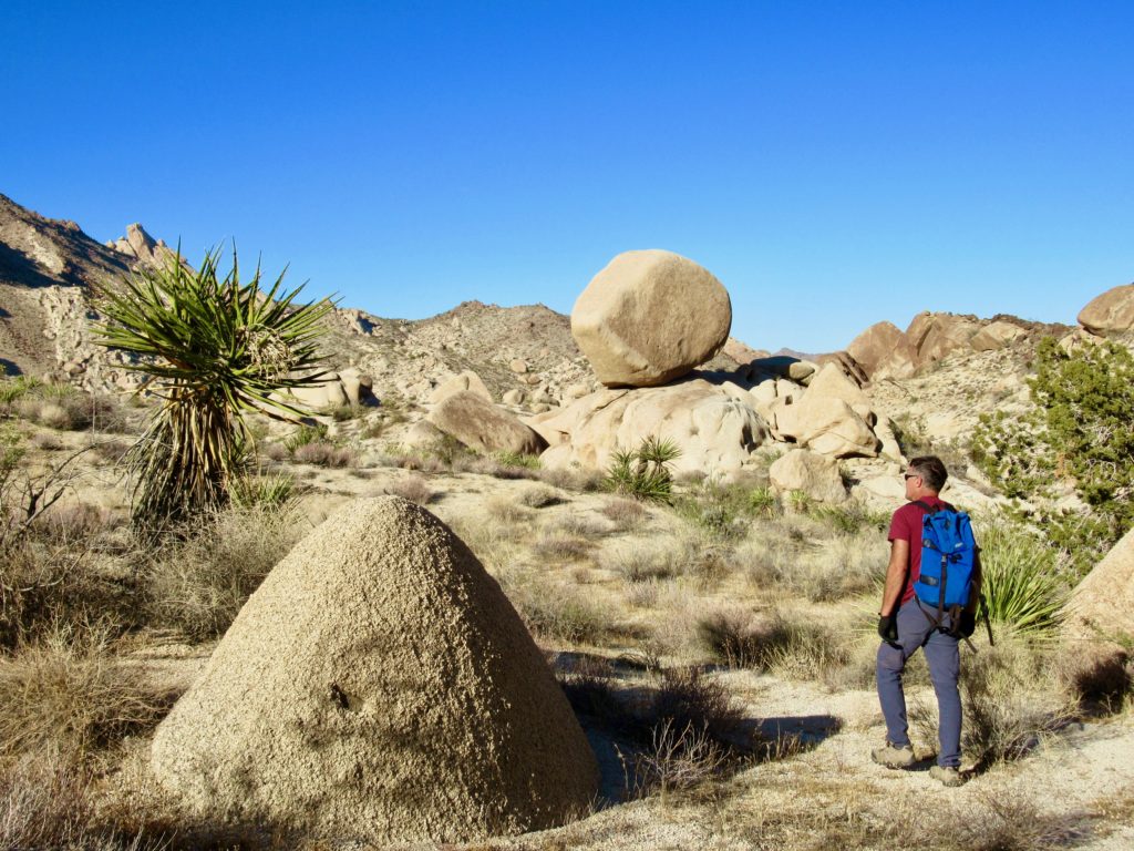
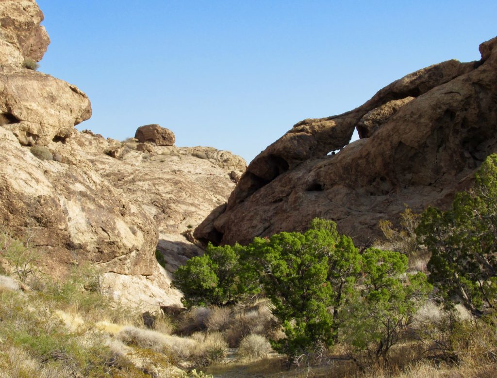
Descending back down to Grapevine Canyon, we wandered up the massive boulder-choked drainage to the south for an overlook of Laughlin. It’s not hard to eat up an entire day with random wandering while absorbing the beauty of the Mojave desert, among pinkish-white granite monoliths – just be sure to watch out for the catclaw acacia and a variety of cactus species, all of which love grabbing clothing and exposed skin!
Grapevine Access
All of these hiking areas can be accessed off the Christmas Tree Pass Road. This narrow, occasionally rough, dirt road runs east off Highway 95 (access is about five miles north of Highway 163) through the wilderness and back down to join up with Highway 163 around seven miles west of Laughlin. It is possible to access the hiking areas from either side, but the shortest route on is via the Laughlin entrance. Drive approximately two miles to the signed turnoff for Grapevine Canyon. Trailhead parking and washrooms are quickly visible.
(Photo: Megan Kopp)
A Few More Hiking Options in the Area
A little further up the road from Grapevine Canyon is Sacatone Canyon (signed in wash on left at bottom of first large hill). The route is about a five-mile roundtrip with elevation gain of less than 1,000 feet. A fair amount of scrambling is required, but the rewards of solitude and a few hidden petroglyphs is worth the effort.
Fun, slickrock exploration – with the promise of a few faded pictographs (painted images) and a rock cistern wall if you search hard enough – can be found about four miles in from Highway 163. If you reach the branch road signed for Pipe Springs, you’ve gone too far. There are no official trails in this area, but there are plenty of old roadways (now closed to all motorized traffic) to explore on foot.
More scramble than hike, the trek up Spirit Mountain is the highest peak in the Newberry Mountains. Access is from Christmas Pass at the height of the road. Summiting this lofty spire is a five-mile, roundtrip hike with an elevation gain of 2,400 feet. It is not a designated trail but is informally marked with cairns.

Further Reading
For more ideas on adventures exploring cool canyons, prehistoric sites and rock art, check out these posts:
Exploring Cathedral Gorge State Park | Nevada
Canyons of the Ancients National Monument
Additional Resources

That looks very intriguing! So awesome & exciting for you guys.
Thanks, Chris. The Mojave Desert is full of intrigue and adventure!