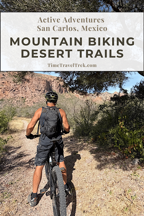
Mountain biking in San Carlos, Mexico? You bet! Join us for twisting single-track routes winding through cactus forests, narrow dirt roads, more challenging arroyos, and onto flowy – sometimes rocky – desert hills with occasional views out to the Sea of Cortez.
Disclosure: This post contains affiliate links. If you make a purchase through one of our links, we may earn a small commission at no extra cost to you. Thanks for supporting TimeTravelTrek.
Table of Contents
Adventures Mountain Biking in San Carlos
Our friends promised us three things in their quest to get us to come check out San Carlos, Mexico as an RV adventure destination: kayaking, hiking and mountain biking. They’d already delivered on the first two. Today was a trip out into the desert to check out the mountain biking trails.
To be honest, I wasn’t holding my breath.
Was I in for a surprise!
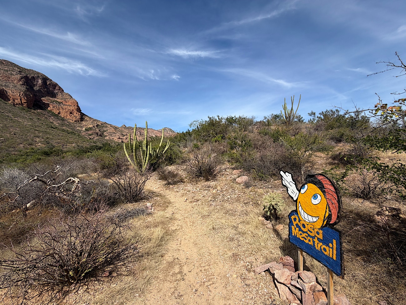
Biking the Baviso Trail
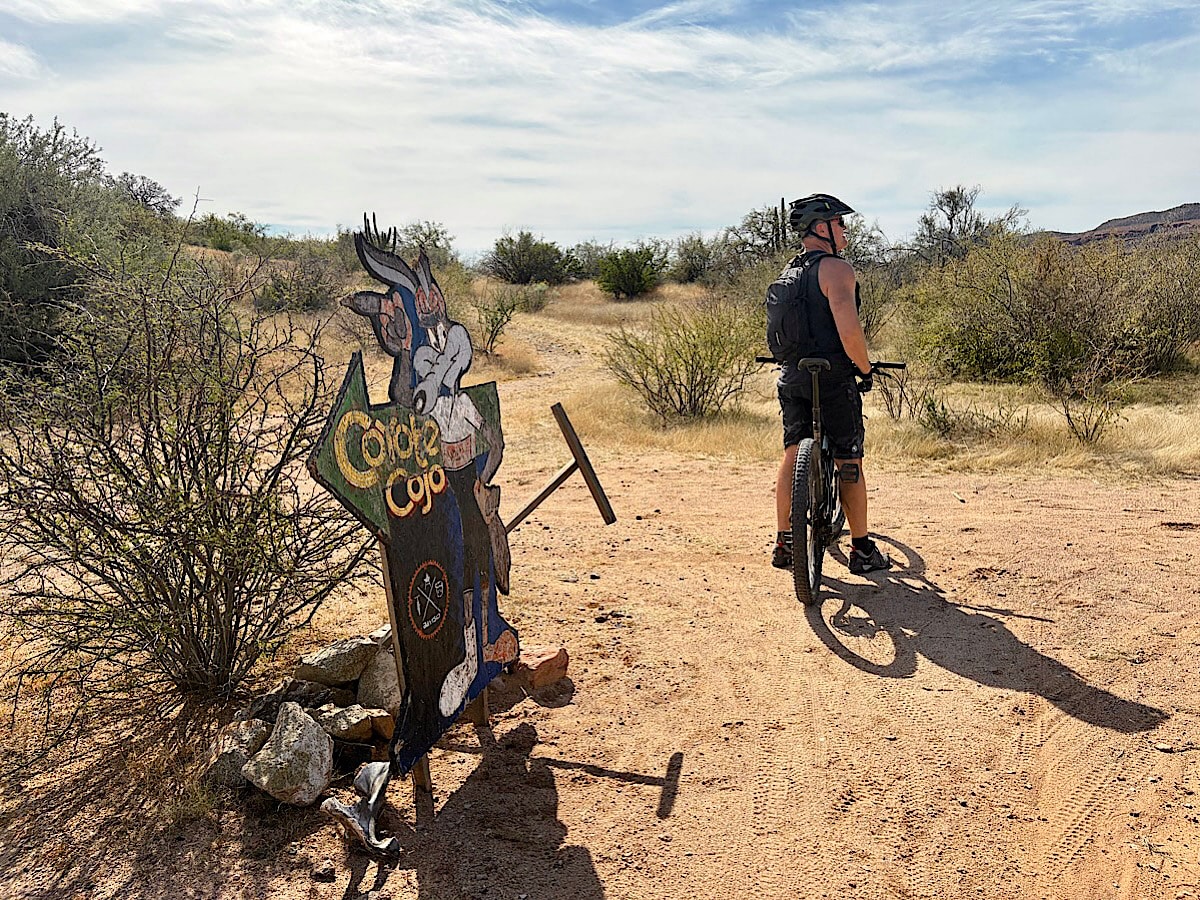
The first ride led us through the back roads of town to the “Lollipop” tree – about 3.5 km (2.2 mi) from camp. This little tree – still not sure where the “Lollipop” name comes from – is where most biking groups meet for their weekly rides. It’s at the town end of the old airport landing strip. A short ride down dirt roads skimming a row of expensive looking homes took us to the Baviso trailhead.
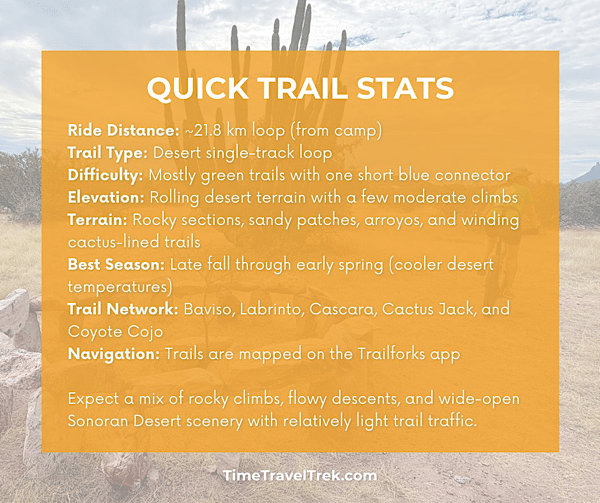
Rated green on the Trailforks app, this fun 7 km (4.3 mi) clockwise loop climbs gently up along a single-track trail before crossing the road to Nacapule Canyon. From here it flows down beside a dry arroyo. There are numerous trail junctions – mostly unsigned along the way. Using the app or having a friend who knows the lay of the land is a good idea!
The only challenging section on the ride is the dip down into and out of the arroyo to cross to the other side. It’s rocky but short and easy enough to push if you need to. I managed to ride down and partway up the other side but then misjudged a rock and lost momentum. Next time!
Heading back, the trail is fun and flowy and before you know it you are back at the Lollipop. The sweet part of the ride is over but it’s an easy pedal straight back to camp.
Total distance from start to finish: 14.5 km (9 mi)
Get a bird’s eye view of the biking trail terrain from the summit of Tom’s Peak!
Who Is This Ride Best For?
The Baviso loop is a good fit for riders who:
✔ Enjoy exploring scenic desert landscapes on two wheels
✔ Are comfortable navigating cross-country style loops
✔ Don’t mind loose rocks, sandy washes, and somewhat rugged natural trails
✔ Prefer quiet trails with very little traffic
This ride may be less ideal for:
✖ Riders looking for smooth, machine-built flow trails
✖ Beginners uncomfortable with rocky or sandy terrain
✖ Riders wanting steep downhill challenges
Extending the Baviso Loop
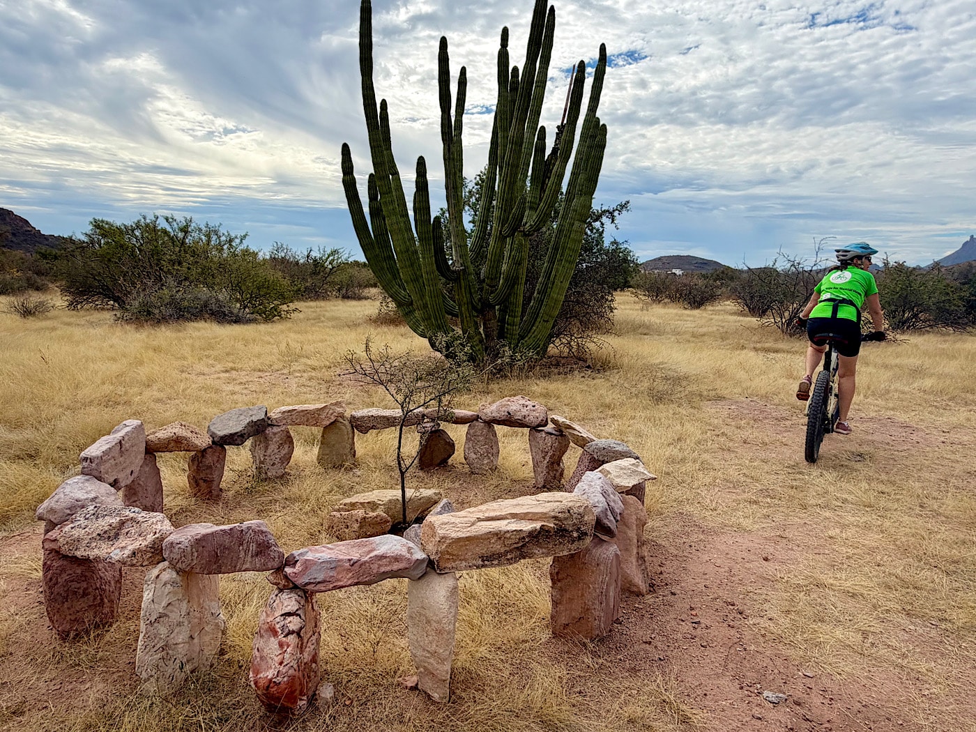
Our second ride on the San Carlos trails took us on an exploratory route starting counterclockwise on Baviso linking several other sections of trails.
Baviso → Labrinto → Cascara → Cactus Jack → Coyote Cojo → Baviso
The first few hundred metres weren’t exactly scenic. Near the start of the trail sits a small dump area with old construction materials. It’s a reminder that desert edges near town sometimes double as unofficial disposal sites. Funny we didn’t notice this the first time we were zipping down this section of trail in the opposite direction!
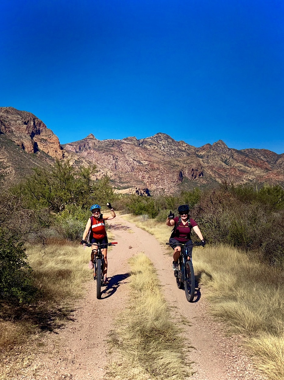
But the landscape quickly improves! The trail transitions into the familiar desert single-track weaving between towering cardón cactus, ocotillo, and thorny shrubs. Not long after starting the climb up Baviso, we encountered a group of about ten mountain bikers heading the opposite direction. It was the only real traffic we saw all day and required a bit of careful maneuvering on the narrow rocky trail.
The Cascara section was rocky – not my fave – but the upper arroyo crossing was much less of a challenge than the first one we did. And the ride down Baviso? Zippity-di-do-da fun!
In total, the loop came to about 21.8 km (13.5 mi) from camp, with mostly green-rated trails and one short blue connector.
A Third Option for Exploring the San Carlos Biking Trails
For our third ride, we headed clockwise up the Baviso trail to try another route. Instead of crossing Nacapule Road, we continued straight up the arroyo. Palm trees dotted the sandy wash as we pedaled along the desert corridor.
The arroyo eventually led us back to an upper section of Nacapule Road. From there, we rode the road uphill to the signed Descenso Jabalí trail. We continued toward the well-known Bus Stop tree along the route.
Near the tree, we took a short, fun loop to the left before returning to the road. Back on Nacapule Road, we picked up the trail running along the right side of the road. A short, zippy stretch of single-track soon connected us back to Baviso.
We didn’t track the exact distance, but the ride easily topped 20 km (12.5 miles). That’s the beauty of mountain biking in San Carlos. The trails make it easy to mix, match, and keep rolling on new desert routes.
Desert Riding Safety Tips
Mountain biking in the Sonoran Desert is a bit different from riding forested trail systems.
- Start early
Temperatures rise quickly once the sun is high. - Carry more water than usual
Shade is limited and dehydration can happen faster than expected. - Watch the trail surface
Loose rocks, sand, and dry arroyo crossings can catch riders off guard. - Mind the cactus
Stay alert along narrow single-track — brushing a cholla or prickly pear can quickly end a ride. - Download trail maps before heading out
Apps like Trailforks help with navigation when exploring unfamiliar desert trails.
Looking for a More Challenging Desert Loop?
We didn’t have time to investigate this next loop – but it did come recommended for riders looking for something more demanding. The Guaymas mountain bike association has developed an 11 km (6.8 mi) single-track loop through desert hills near the Soldado Estuary.
This trail is known for being more technical and physically demanding than the easier green routes.
The terrain is rugged and rocky, with challenging sections that require solid bike-handling skills.
But the payoff is worth it.
From higher points on the trail, riders are rewarded with beautiful views over the estuary and the Sea of Cortez, framed by the dramatic desert mountains – like Tetakawi – surrounding San Carlos.
It’s a ride best suited for confident intermediate or advanced mountain bikers.
Like keeping track of your list and wish list rides?
Pick up a copy of our printable Biking Journal on Etsy!

When You Go
San Carlos has an active mountain biking community and a growing network of trails.
For up-to-date maps and route details (and trust me, there are a lot more than the easy ones I’ve mentioned here), check the San Carlos trails on Trailforks, which includes most of the local single-track routes.
Desert Riding: What to Expect
Mountain biking in San Carlos has a different feel from riding in forested trail systems.
The Sonoran Desert landscape creates a ride that is:
- open and expansive
- sunny and exposed
- rugged and natural
Shade is limited, and temperatures can climb quickly later in the day.
Early morning rides are often the most comfortable, especially during the warmer months.
The reward is a uniquely beautiful setting — pedaling through cactus forests with desert mountains on one side and glimpses of the Sea of Cortez on the other.
With a mix of beginner-friendly loops and more challenging technical trails, San Carlos offers a surprisingly good mountain biking scene for desert adventure seekers.
PIN THIS POST FOR FUTURE REFERENCE!
Leave a Reply