Exploring Arizona’s Ironwood Forest National Monument for the first time was an adventure! This multi-use zone includes everything from livestock grazing and mining to motorized off-road travel and human-powered recreation – but tucked away within its boundaries are not one, not two, but three archaeological districts listed on the National Register of Historic Places. It may be a little off the beaten path, but this hidden gem is worth a visit.
Disclosure: This post contains affiliate links. If you buy something from one of our affiliates, we receive a small commission at no extra charge to you. Thanks for helping to keep our blog up and running!
Table of Contents
Why visit Ironwood Forest National Monument?
We’ve been exploring Arizona – from Kingman to Kofa, White Tank to Chiricahua, Organ Pipe to Buenos Aires – for a few years now.
But looking at the atlas one day, I realised we’ve never explored Ironwood Forest National Monument (IFNM) – and it is right next door to our favourite southern Arizona city of Tucson.
Time for a bit of research.
“Humans have inhabited the area for more than 5,000 years.”
Interesting.
“More than 200 sites from the prehistoric Hohokam period (600 A.D. to 1450 A.D.) have been recorded in the area.”
Incredible.
Three archaeological districts – Los Robles, the Mission of Santa Ana de Chiquiburitac, and Cocoraque Butte – all listed on the National Register of Historic Places.”
We’re hooked.
Wait a minute. How do we get there? How rough are the roads? Where exactly are these archeological districts? Researching online provided bits and pieces of information, but not a lot of specifics and only a few answers to our questions. It’s a treasure hunt with a map missing a few sections.
Exactly the kind of adventure we love – let’s get started!
Who, what, where, when and why?
The monument was created by President Bill Clinton on June 9, 2000. It covers 129,055 acres (52,227 ha) in southern Arizona in the Sonoran Desert about 25 miles (40 km) west of Tucson.
There are two large valleys (Avra and Aguirre) and eight different mountain ranges (Roskruge, Pan Quemado, Waterman, Silver Bell, West Silver Bell, Samaniego Hills, and Sawtooth) within its boundaries. It is managed by the Bureau of Land Management (BLM).
In the presential proclamation announcing the formation of the monument, federally threatened or endangered species – such as the Nichols Turk’s head cactus and the lesser long-nosed bat – are mentioned. As well, this monument is home to what might be the “last viable population of desert bighorn sheep indigenous to the Tucson basin.”
The proclamation also acknowledges the rugged mountain ranges, including Ragged Top Mountain which is a “biological and geological crown jewel.” The Silver Bell Mountains also “support the highest density of ironwood trees recorded in the Sonoran Desert.”
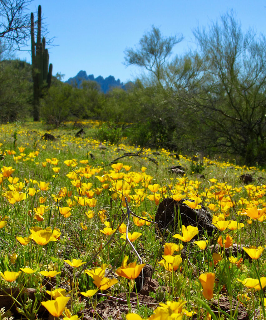
What’s so special about Ironwood trees?
- Desert ironwoods (Olneya tesota) can live 800 years or longer.
- Ironwoods are keystone species.
- They are important nurse trees for other desert trees and shrubs, providing shade and protection from harsh desert sun and cold desert nights.
- Ironwoods are roosting sites for birds.
- They provide forage for desert bighorn sheep and other animals.
- The lavender-colored blossoms provide nectar for native bees and other insects.
- Ironwood bean pods provide food for desert animals.
- A dense canopy provides safe nesting sites for white-winged doves and other birds
Human history of Ironwood Forest National Monument
The presidential proclamation states that “the area holds abundant rock art sites and other archeological objects of scientific interest. Humans have inhabited the area for more than 5,000 years. More than 200 sites from the prehistoric Hohokam period (600 A.D. to 1450 A.D.) have been recorded in the area.”
Ironwood Forest National Monument includes everything from campsites used by Archaic hunter-gathers about 6,000 B.C. to villages and corn, bean and squash fields used by Hohokam farmers between A.D. 300 and A.D. 1450. The Hohokam people also mined andesite – used for making agave knives.
In more recent times Tohono O’Odham people, believed to be descendants of the Hohokam, camped, farmed, and harvested domesticated and wild plant crops.
There was a small mission in the monument, constructed in the late 1700s by Tohono O’Odham laborers for Spanish Franciscan friars. In addition, historic remains include remnants of mining camps and cemeteries dating to the 1880s.
So much to see, so little time! Where do we start?
Finding Our Way in IFNM
With only one day for an initial exploratory trip, we decided to start with the northern section of the monument. From what we gathered in our research, the Silverbell Road area was going to be the easiest to access with the most potential for finding historic and prehistoric sites as well as getting closer to the natural history wonders surrounding Ragged Top.
There problem is that there are a few ways to access Ironwood National Monument at its northern end.
- Take Avra Valley Road on the south end of the Silverbell Mountains to Silverbell Road (by the still active mine of the same name).
- Take Silverbell Road in the middle (it leads to the base of Ragged Top Mountain).
- Take Sasco Road (from Red Rock exit off I-10) on the northern end of the monument. Note that this route crosses the river – which is often impassable without four-wheel drive.
We’ll take door number 3, please! And for a reason – we want to see if we can find Cerro Prieto along the way.
A Quest to Find Cerro Prieto in Los Robles Archaeological District
Cerro Prieto is Spanish for ‘Dark Hill’. In this case, it’s a volcanic peak that rises about 900 feet above the surrounding plain in the Ironwood Forest National Monument northwest of Tucson.
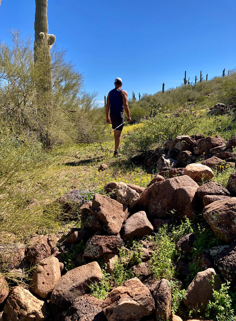
What appears at first glance to be a volcanic rubble pile holds one of the largest and most complex archaeological sites in the monument. We were fascinated by our readings on trincheras – large rock terraces built on the hillsides.
This site’s archaeological features were constructed and used by the Hohokam culture around AD 1150-1300. It apparently includes “house foundations, waffle gardens, check dams, trail systems, petroglyphs, rock walls, talus pits, and a stone source used to produce agave knives.”
All of this suggests that it was used for a variety of functions – for daily living, food production, and ceremonial rituals. In other words, an area to treat with respect.
Our Day in Ironwood Forest National Monument
We headed off I-10 onto Red Rock Road to Sasco Road, driving along south of Picacho Peak. After crossing the river – water flowing, but barely a trickle – we turned right onto La Osa Ranch Road to check out the historic Sasco cemetery. Honoring the “private” signs, we drove on further to view the photogenic stone ruins of the Sasco Hotel.
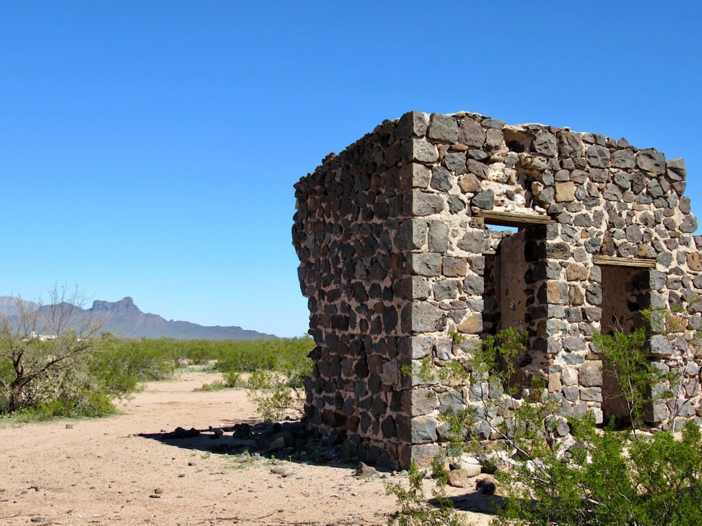
There are several historic mining and mining-related towns in and around Ironwood Forest National Monument – Sasco being one of them. It was a smelter town, refining ore from the Silver Bell Mine. The smelter was short-lived, operating only from 1907-1919. The remnants of the old stone hotel and a few concrete slabs are about all that remains of Sasco’s heydays.
Our main objective though was directly south – Cerro Prieto. Now, because this quest is all about the excitement of discovery, I’m not going to give you exact directions to the trincheras. You’ll know when you’ve found them. Note of caution: there are no obvious pathways on the hillside. Keep an eye out for rattlesnakes in and around the rock piles when temperatures heat up.
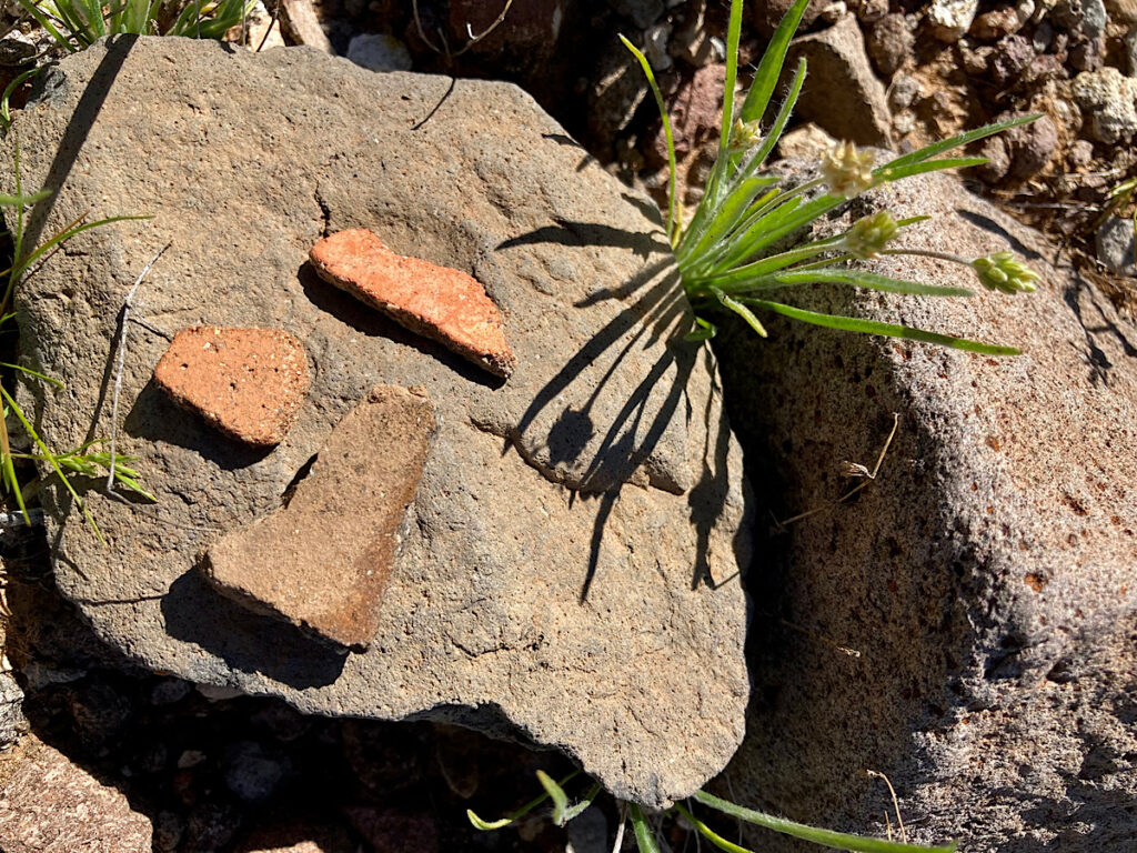
Spending a couple of hours wandering the hillside, we were in awe of the size of the complex. There were low walls and large, circular piles of stones with depressions in the center. Ancient pathways led from one section to the next. Small sherds of pottery begged to be photographed. Shallow circular depressions in rocks and metates both showed human use. Next time we’ll spend an entire day in this area to see what else we missed on this initial foray!
Driving the Silverbell Road
The rest of the trip was a bit anticlimactic after standing in the past on the slopes of Cerro Prieto. Continuing along the Sasco Road, we passed a random camping area along with fields of poppies just starting to bloom. Ragged Top stood prominently off to one side of the road. One day, we’ll have to make time to try and get to its raggedy summit.
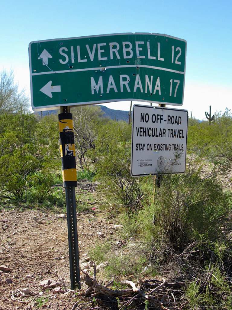
At the junction of West Silverbell Road, we kept right onto the slightly rougher Silverbell Road past a private ranch. From here on, the road was up and down though washes, hitch dragging in a few places, wheels spinning in others. And it goes on and on… like the endless views of the monstrous Silver Bell Mine tailings!
We’d had enough by the time we reached the pavement of West Avra Valley Road – and even though we’d missed the historic Silver Bell cemetery and the site of the Mission of Santa Ana de Chiquiburitac, we weren’t about to turn around and go back to check them out! You might want to start fresh and come in from this direction just for those historic sites.
Even More to See in IFNM
If time and energy permits, stop by the Titan Missile 2 Interpretive Site (road off to south or right as you head down from the junction of Silverbell and Avra) as you head back. Interpretive signage explains the decommissioning of yet another one of the Titan Missile silos that dotted southern Arizona.

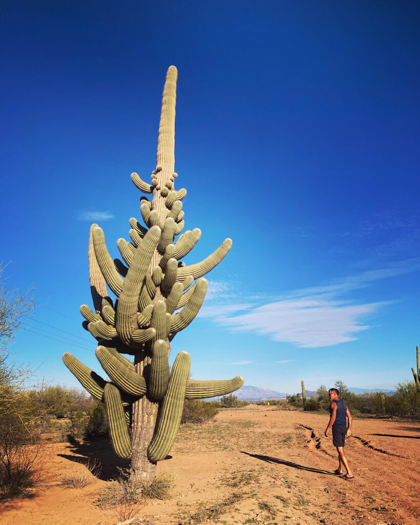
You might also want to keep an eye out for the “80-Arm Saguaro” – also called the “Shiva” saguaro cactus for its many arms. Although not signed, you’ll see it on the right not far down from the Titan Missile silo road.
Yes, there is more to see than one day can possibly do justice – but it provides a framework for future exploration. Our IFNM adventures have just begun. Feel free to share your own discoveries in the comments below.
Love off-the-beaten path adventures? Be sure to check out these places!
Fort Bowie National Historic Site
RV Adventure: Homolovi State Park | AZ
Besh-Ba-Gowah in Historic Globe, Arizona
Exploring Ironwood Forest National Monument
When You Go
Ironwood Forest National Monument is beautiful if primitive. Roads are rough and some areas require high-clearance or four-wheel drive. There are no official trails, restrooms or other visitor facilities.
Dispersed camping is allowed for up to 14 consecutive days. Remember to leave no trace. We camped in Tucson Mountain Park at Gilbert Ray Campground (about an hour’s drive away)
Be sure to check out the Bureau of Land Management (BLM) website and the Friends of Ironwood Forest National Monument website for maps and more information.
This adventure is one of 25 listed in this compilation of RV adventures in Arizona worth exploring!
Like National Monuments? You might want to check out this post highlighting all of Arizona’s National Monuments. Or, discover ones managed by the National Park Service in this book:





Hello,
Great article! We drove all around the Titan Missile Interpretive site, up and down the roads today but could not find the 80 armed saguaro. Would you be able to provide any markers or more details as to exactly where it is? We’d love to visit there again before we have to leave and head back to our home in Montana. Thank you so much!
Thanks – and so glad you got to explore up that way! The Shiva (80 armed saguaro) is on the Avra Valley road just before the Silverbell Mine on the left as you head up to the mine. Billy Mattusch posted this pic with coordinates: https://www.facebook.com/photo.php?fbid=272285571792717&set=p.272285571792717&type=3 It’s a dirt road off, nothing obvious.
This was such a great article!! We had found the old smelter a couple of weeks ago, on our first attempt of finding Shiva, and I started researching the area and stumbled across this page. I learned even more than I had found AND we found Shiva!!! Thank you for helping us find her!
She isn’t obvious but once you see her, you KNOW it’s her.
So glad you found the post useful – and happy you found the Shiva saguaro!