What and where is Homolovi State Park? Don’t worry, we’ve discovered the answers – as well as an overview of the area’s 1400-plus years of human history, what there is to see and do in the park today, and where to camp. Read on!
Disclosure: This post contains affiliate links. If you buy something from one of our affiliates, we receive a small commission at no extra charge to you. Thanks for helping to keep our blog up and running!
Table of Contents
What and Where is Homolovi State Park?
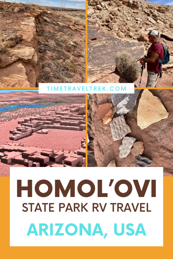
Homol’ovi – it means “Place of the Little Hills” in the Hopi language. The park protects more than 300 archaeological sites in the northeastern corner of Arizona. It encompasses 4,000 acres and sits at an elevation of just under 5,000 feet (1,524 m) sitting on a corner overlooking Winslow, Arizona.
First Impressions of Homol’ovi and its Location – Don’t Take them to Heart!
As we head out to Homolovi late in the day after driving up from McDowell Mountain Regional Park, all I can think is “OMG, we booked 3 nights here?” and “Maybe we can cancel a night or two.”
We are in the high desert. There are a few cacti, but it’s mostly grass and low shrubs. The landscape – with an admittedly tired eye – appears unimpressive. It’s flat with distant low hills to north. The majestic saguaro and cuddly looking – from a distance – cholla and even leafless palo verde are long gone. A tumbleweed blows across the road.
And as we get ready to take the exit off the highway, we can see the campground.
From. The. Busy. Highway.
This was a mistake.
Driving along the park road, we follow a large motorhome past the closed entrance kiosk and campground turn to the visitor centre. A small white observatory stands in the middle of a parking area. The low brown rock and metal visitor center building faces out over low rocky hills.
We hop out and beat out campers from the big RV into the visitor center to check in. Site 16 – as reserved – no power.
The other campers walk up to counter.
“Any electrical?”
“No,” Ranger Chad replies, “resold last cancellation earlier.”
“To them?” massive motorhome guy looks at us as he asks with a tinge of disgust.
“No,” Ranger Chad answers, “they have non-electrical.”
Not a great start – but don’t worry, things quickly turn around.
Touring the Park Visitor Centre
It’s small, some might even say tiny, but the Homolovi Visitor Center is one of the most information-packed Arizona State Park Visitor Centres that we’ve ever seen. There is more here than first meets the eye.
We start wandering, skimming the interpretive displays, and then stopping to re-read with growing interest. To be honest, I never knew too much about the Hopi culture, but I was hooked with the first interpretive panel about Hopi trails.
Foot trails in the American Southwest were not created for recreational use – they connected people to natural resources such as salt and turquoise. Other routes led to sacred places. The Homol’ovi Migration Trail is one route established by ancestors of the Hopi.
A Brief Early History of Homolovi
The Hopi call “people of long ago” Hisat’sinom. They believe that the Hisat’sinom who lived at Homol’ovi are their ancestors. Archaeologists have identified 3 major time periods for early occupation of the Homol’ovi landscape.
- The First Farmers at Homol’ovi (A.D. 620-890)
Living in large, round pit houses built into the ground, these seasonal farmers grew corn and beans near the Little Colorado River – known as Paayu in the Hopi culture.
- Late Pit House Villagers (A.D. 1000-1225)
Shifting to small, square pit houses, these villagers built large community structures. Trade to neighbouring pueblos was conducted on a regular basis.
- Ancestral Hopi (A.D. 1260-1400)
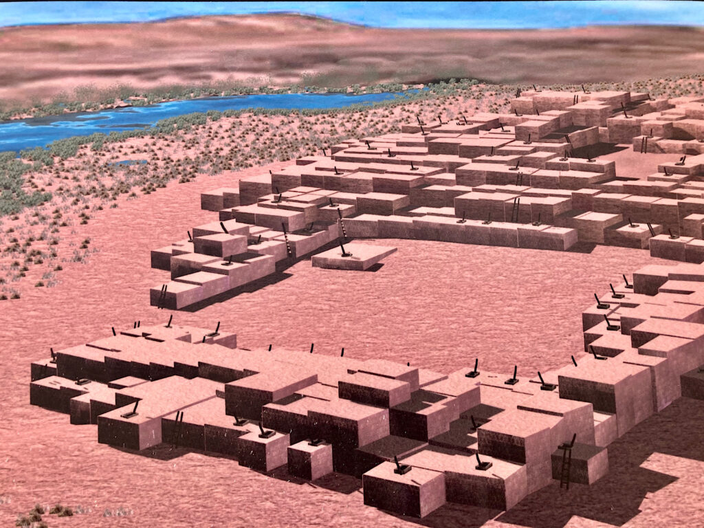
The ancestral Hopi grew crops, including cotton, along the river. They built villages with masonry and adobe walls. Villages were organized around central plazas and there were special rooms for ceremonies. The first villages had less than 50 families. During the 1300s, families numbered in the hundreds.
Hopi Clans
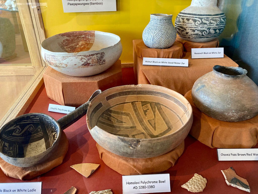
The interpretive displays also talked about the Hopi clans who lived at Homol’ovi.
“Several Hopi clans trace their history to Homolovi where they lived for a time during their migrations. At Homolovi, they replenished their food supplies and grew healthy before they moved north to their final destination Tuuwanasavi (the spiritual center) and the mesas where Hopi people live today.”
Names of the Hopi Clans who lived at what is now Homolovi State Park
- Plikvaswungwa (Corn)
- Patkiwungwa (Water)
- Pipwungwa (Tobacco)
- Tapwunga (Rabbit)
- Iswungwa (Coyote)
- Kwaawungwa (Eagle)
- Taawawungwa (Sun)
- Qalawungwa (Sun Forehead)
- Tuwawungwa (Sand)
- Kookyangwungwa (Spider)
- Paagapwunqwa (Bamboo)
Time for a Tour
Heads bursting with information, we booked the Box Canyon petroglyph tour. Although this is not part of the park per se – owned by the Archaeological Conservancy – it is managed by the park and occasionally tours are led into the area. It’s our lucky day!
We meet Ranger Jones – Steve for short – at the visitor center for a brief introduction and overview of the park, its human history, and what we can expect to see on the hike. Piling into cars, seven vehicles follow Ranger Steve’s truck to a side road, where we tuck in behind a low hill. From here, it’s a two-mile hike – stroll to be honest.
Looking west we can see the Kachina Peaks Wilderness – a nature reserve north of Flagstaff. It includes the upper reaches of the San Francisco Peaks – including Arizona’s highest point, Humphrey’s Peak at 12,643 feet (3,854 m) above sea level.
The Hopi call this area Nuvatukya’ovi and they believe these peaks are the home of the Katsina spirits. According to Hopi mythology, Katsina are supernatural beings with the power to bring rain.
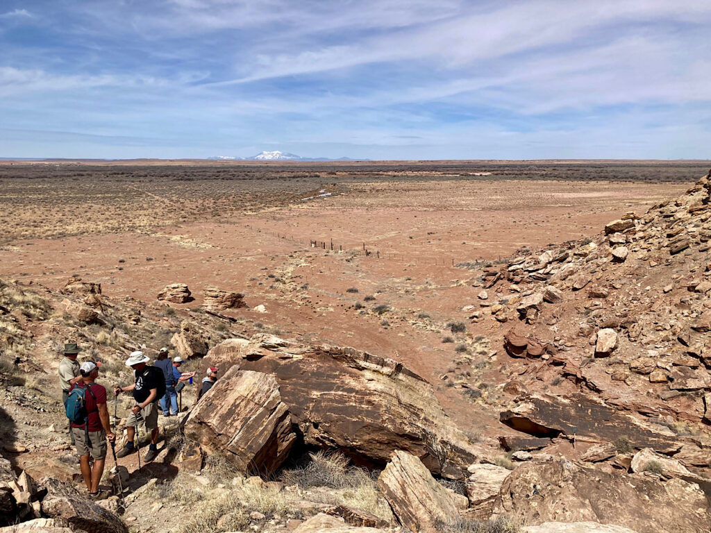
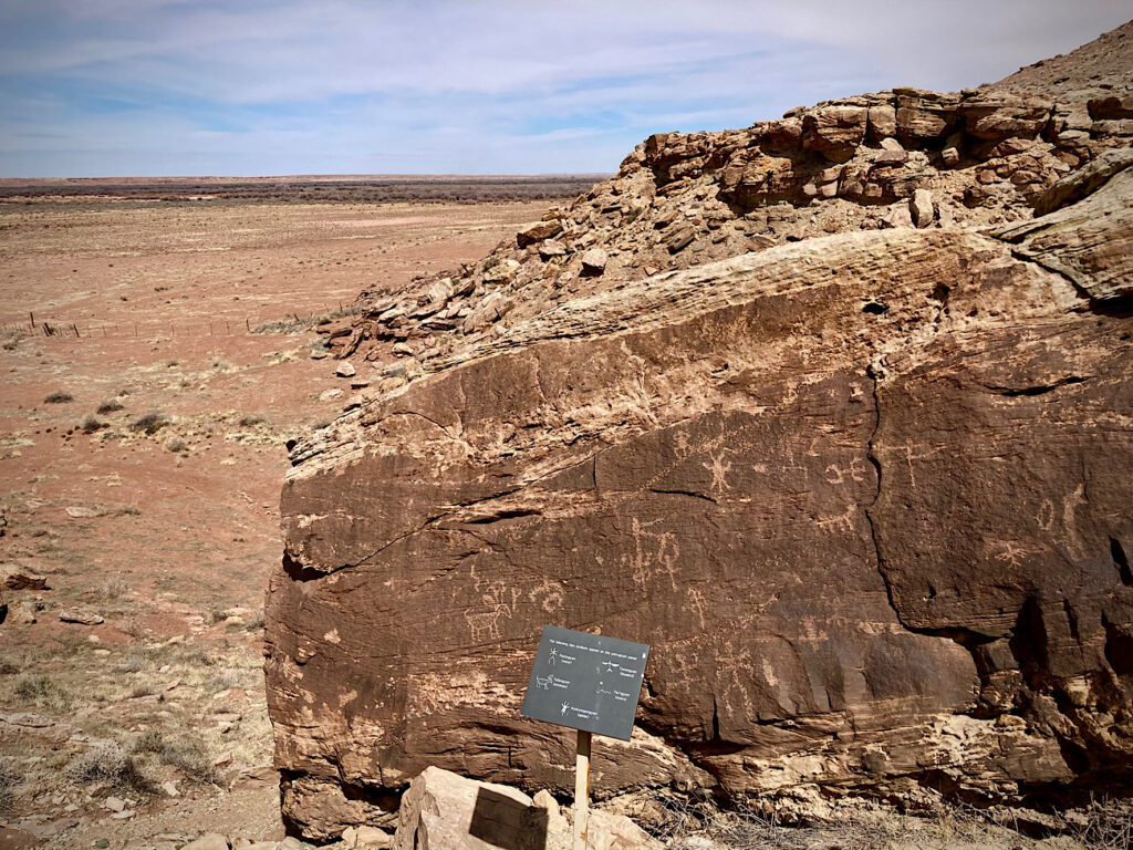
No rain on the horizon today as 14 of us, plus Ranger Steve, walk across the Little Colorado River flood plain. We spy the first set of petroglyphs on a series of random boulder below a low cliff. There were dozens of pieces of rock art to admire and photograph. But this wasn’t the end point. No, we wanted to see the clan images.
Around the corner, we climbed a short, steep rocky slope and there they were – the bluebird, antelope, snake, and water. Clan symbols carved in time. Faded but still obvious. We spent almost half an hour wandering around the rocks, trying to decipher the petroglyphs. Ranger Steve passes on highlights of what little is known about the rock art. We ponder and muse.
Past meets the present in a box canyon in the middle of the high desert.
Homol’ovi II
Heading back to the vehicles, we circled around to catch a few more words from Ranger Steve. He suggested we drive up to the end of the road and visit Homol’ovi II – and of course, we did.
A 0.5 mile (0.8 km), wheelchair accessible, paved trail leads up to the largest archaeological site in the park. Archaeologists estimate that this pueblo contained over 1,200 rooms – and possibly up to 2,000. It’s hard to imagine as we climb over low mounds of rubble that were once part of a vibrant community with several hundred families around A.D. 1360-1400.
They were drawn north by the lush flood plain of the Little Colorado River. Standing on the hill overlooking the plain, you can see the appeal for growing crops of corn, beans, squash, and cotton on the flat land below to supplement harvests of pigweed, Indian rice grass, cactus and yucca fruits, and piñon nuts.
Today we wander through excavations and partial reconstructions of the central, east, and west plazas, dozens of kivas (ritual underground gathering and ceremonial spaces), living, working, and storage areas. The central plaza was once surrounded by rooms rising as high as three stories.
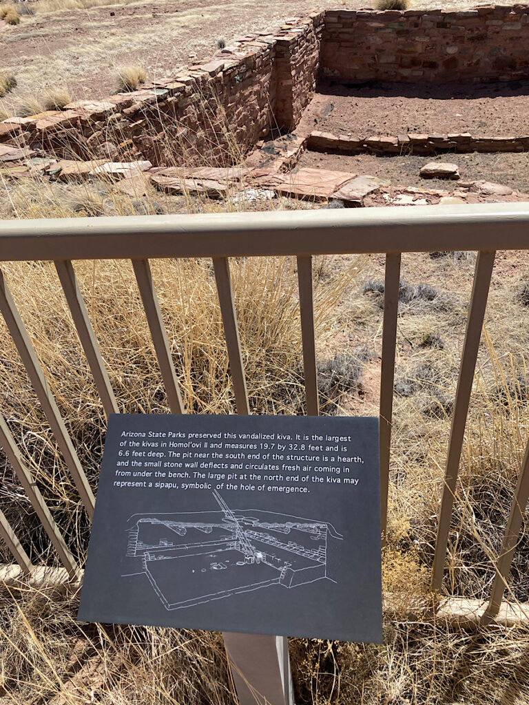
The energy that once flowed through this site is palpable – and the connection to the past comes through the stones, scattered pieces of pottery and knapped stone, and the petroglyphs carved into the rocks on cliffs below.
Tsu’vo Trail
On the way back to the visitor we stop off at the Tsu’vo Trail. Tsu’vo means path of the rattlesnake, but nothing is moving on this early spring day as we wander up this short, 0.6 mile (1 km), self-guided interpretive trail.
We pass the boulder with shallow impressions called metates, created by rocks grinding grains. The petroglyphs on nearby rocks are faded and mostly indistinct, but the elevation of this site provides good views and it’s easy to see the appeal for past inhabitants.
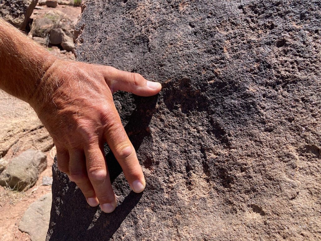
Before we turn back at the trail’s end, we look down to bleached pieces of petrified wood. Not surprising really, as Petrified Forest National Park is less than an hour east. Time drifts from present to prehistoric past within a few footsteps here.
Homol’ovi I
The next morning, we stroll down the road from our campsite for about a mile (1.6 km) to Homol’ovi I. There are four major 14-century pueblos within the park, but only two are open to the public. Homol’ovi I is situated alongside the river – flowing chocolate brown on the other side of the green fringe of shrubs and trees blocking it from view as we walk.
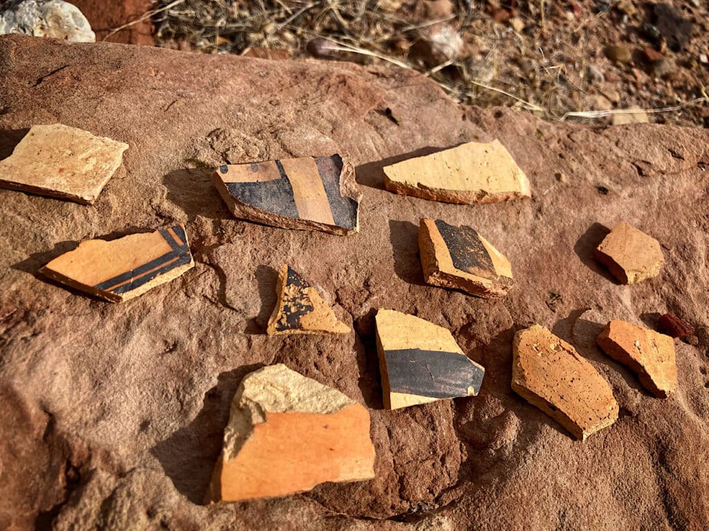
It’s a short walk beyond the gate on a dirt road at the end of the pavement to this smaller pueblo site, dating from A.D. 1290-1400. We come across dozens and dozens and dozens more pieces of pottery.
I can’t even imagine what it must have been like to be Jesse Walter Fewkes, learning about the Homol’ovi area from Hopi clan histories and then excavating – and naming – these sites in 1896. The pieces of the past he uncovered held so many stories.
Even now, as we pick up and touch a piece of pottery before returning it to the earth, we feel a connection to this amazing past. It leaves a lasting impression – and lasting impressions are what count.
We will come back to Homolovi State Park – situated in the high desert where the tumbleweeds roll and the spirits make my heart sing.
When You Go to Homolovi State Park
To get to Homolovi State Park, follow Interstate 40 east from Winslow to exit 257. Take the exit and continue 1.3 miles (2.1 km) to the park entrance. The park is open 8 a.m. – 5 p.m. daily for day use. There is a $7/vehicle entrance fee if not camping in the park. To book a campsite in advance, visit the Arizona State Park camping reservation page.
You may be interested in visiting the Sunset Cemetery down towards the river from the visitor center. It is the last known remains of the 1876 Mormon settlement called Sunset. It makes for nice evening stroll.
While staying at Homolovi, you might want to investigate nearby Winslow (“Standing on the corner in Winslow, Arizona…”) to check out the historic architecture of La Posada – the last Fred Harvey hotel – and the Lorenzo Hubbell Trading Post building.
And if you love active adventure travel and uncovering the past as much as we do, you might also want to read TimeTravelTrek. posts such as the Painted Desert Inn: A History Tour, Picacho Peak & Petroglyphs, Desert Rock Art: Geoglyphs, Sedona & the Sinagua, and Besh-Ba-Gowah.
Be sure to check out this list of 50+ Off the Beaten Path Cultural Sites in Arizona as well.

Leave a Reply