Hiking Tom’s Peak is the perfect way to get a bird’s-eye view of San Carlos, Mexico. From the summit, vistas spread down to the Sea of Cortez, across to the Soldado Estuary and over to the dramatic silhouette of Cerro Tetakawi. It’s the kind of view that makes you pause and start connecting the adventure dots. You can see almost every paddle, hike and bike location around San Carlos. Don’t miss this one!
Disclosure: This post contains affiliate links. If you make a purchase through one of our links, we may earn a small commission at no extra cost to you. Thanks for supporting TimeTravelTrek.

Table of Contents
All You Need to Know About Hiking Tom’s Peak
Before we set out, I watched a YouTube video about hiking Tom’s Peak. At the end of the video the couple said:
“We hiked it, so you don’t have to.”
Huh.
Well, we hiked Tom’s Peak overlooking San Carlos, Sonora and have all the details so you can get out there and do it yourself.
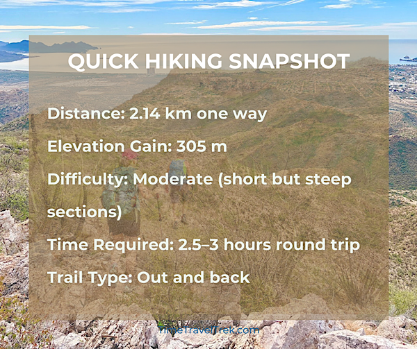
This short but rewarding hike climbs steadily to one of the best viewpoints in the region.
The trail isn’t long, but the elevation gain keeps things interesting. Add in sweeping desert scenery and ocean views, and you have one of the most satisfying half-day hikes in San Carlos.
It’s the perfect place to connect the adventure dots – you can see almost every paddle, hike, and bike location around San Carlos.
Should you hike Tom’s Peak first to get the lay of the land? Or save it for later in your trip once you’ve explored the region?
Honestly, it doesn’t matter.
Just make sure you don’t miss this gem of a hike.
How Long Does the Tom’s Peak Hike Take?
We climbed Tom’s Peak at a steady pace with plenty of photo stops.
It took us 1 hour and 20 minutes to reach the summit.
The descent was slightly quicker at 1 hour and 13 minutes, but we took our time. There’s quite a bit of loose, roll-y rock on sections of the trail.
Good footing and patience make the descent much easier.
If you enjoy photography, simply soaking in views or adding birdwatching to your day, plan for about three to four hours total.
How to Access the Tom’s Peak Trailhead
Getting to the trailhead takes a bit of navigation through the outskirts of town, but once you know the route it’s straightforward.
Follow Google Maps toward Nacapule Canyon from San Carlos.
Continue along Avenida L until you reach the fenced airport runway. The runway is closed but the chain-link that surrounds it is easy to recognize.
Drive with the fence on your left for roughly 2.5 km.
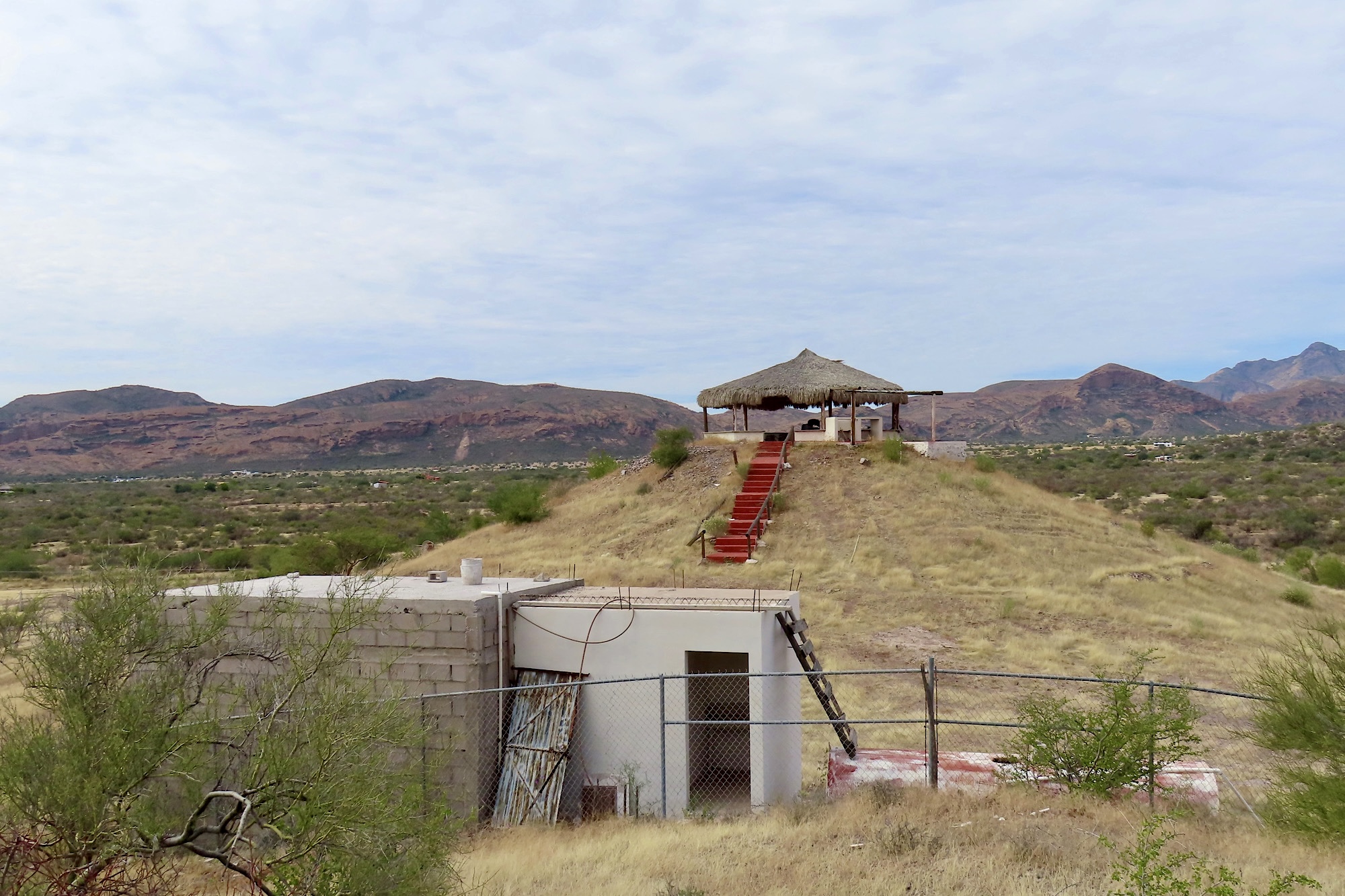
As you approach the end of the runway, look for a small thatched-roof building that resembles a “control tower” inside a fenced compound. From here, you’re less than 400 metres from the parking area.
Stay left and drive past a small garbage dump site.
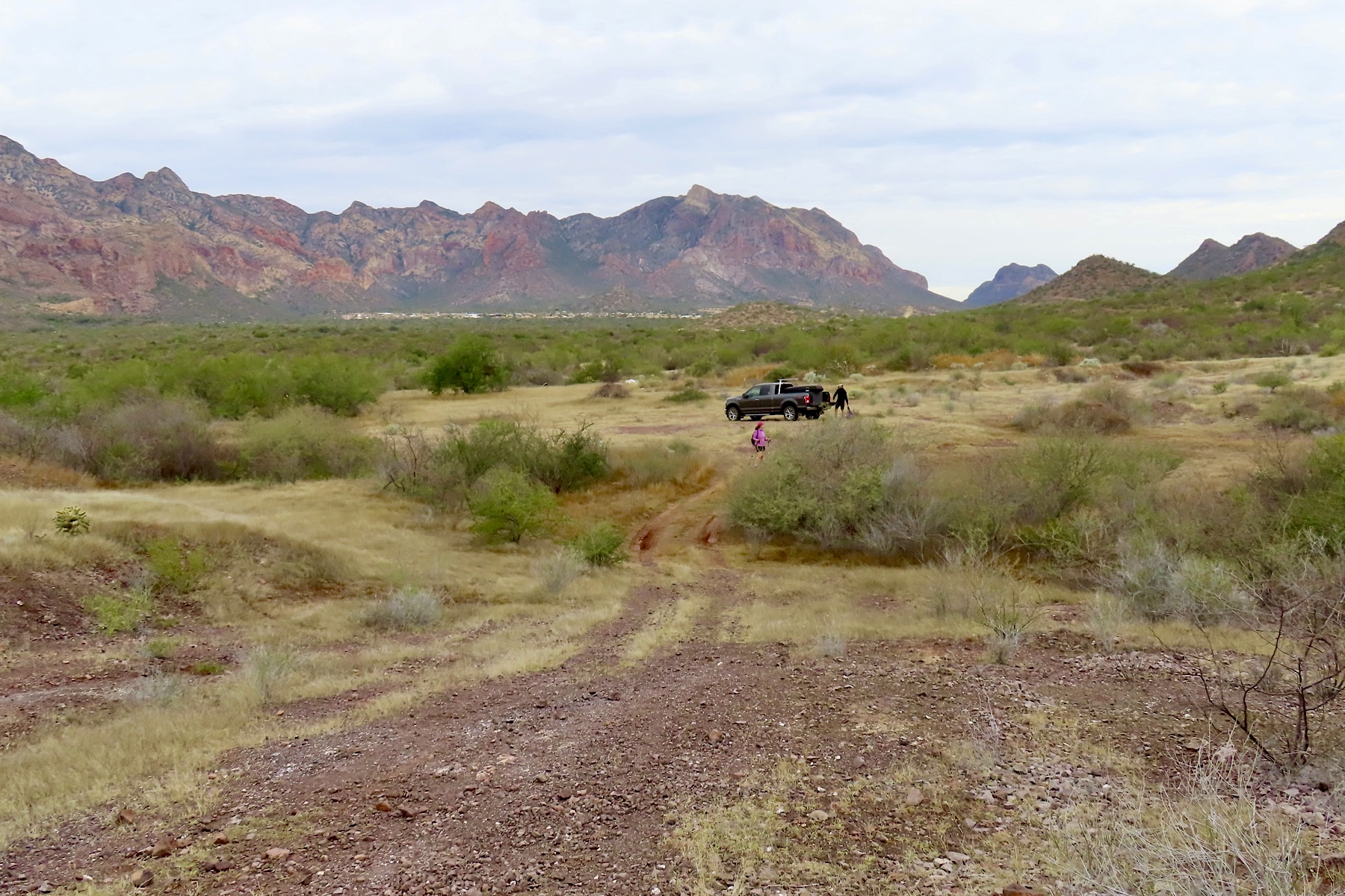
Take the next right, then an immediate right again, and drive less than 100 metres to a small dry grassy meadow.
This informal clearing is the easiest place to park.
Tip: If you’re staying at Totonaka RV Park, it would be an easy e-bike ride to the trailhead. Just remember to bring a good bike lock.
Finding the Start of the Trail
From the parking area, walk up the short hill back toward the “control tower.”
Take the first left.
The path drops downhill briefly before reaching a bike trail heading off to the right.
Follow this trail up and over a low pass. On the popular mountain biking app Trailforks, the route is labeled Yaqui Trail (sometimes called Dan’s Trail). On the other side of the pass heading downhill, don’t be distracted by the faint path heading off to the right. Watch for the cairn (rockpile) on the left that leads down through a small dip before starting the climb up the mountain.
Once on the trail up, the route is distinct and easy to follow – just take care near drop-offs.
What the Trail Is Like?
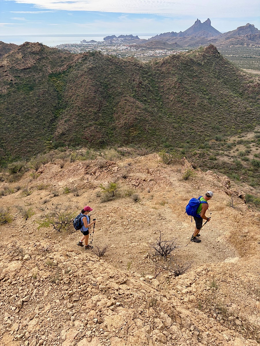
The hike starts gently, winding through desert hills dotted with cacti and low shrubs.
Before long, the trail begins climbing in earnest.
The path zigzags up the slopes with expanding views over the surrounding desert landscape. With each switchback, the panorama grows wider.
Soon the Sea of Cortez begins to appear beyond the hills.
The higher you climb, the better the perspective becomes.
Who Is This Hike Best For?
Tom’s Peak is ideal for:
- Active travellers who enjoy short summit hikes
- Hikers looking for the best panoramic views in San Carlos
- Photographers chasing sunrise or sunset light
- Anyone wanting a quick but rewarding outdoor adventure
It’s less ideal for those uncomfortable with steep climbs or loose rock on descents.
Who was Tom?
Once you reach the summit, you’ll find the small memorial plaque behind the trail register.
In Loving Memory of Thomas Folkers
Tom’s Peak
The memory of a good person is a blessing!
Devoted husband, father and steward of the earth.
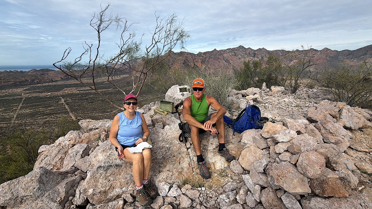
… steward of the earth.
Sounds like Tom was our kind of guy!
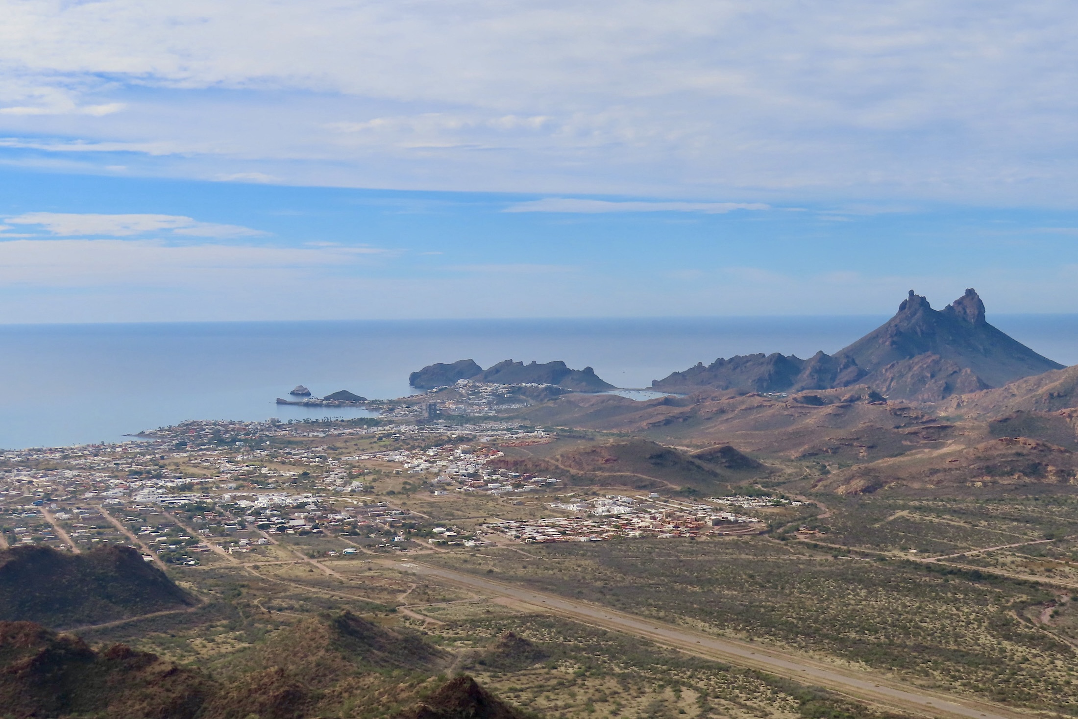
The Views from Tom’s Peak
The summit delivers exactly what you hoped for when you started the climb.
A true 360-degree perspective of the San Carlos region.
To the west, the deep blue waters of the Sea of Cortez stretch toward the horizon.
Below, the wetlands of the Estero El Soldado form a green ribbon along the coastline.
Across the bay rises the unmistakable twin peaks of Cerro Tetakawi, one of the region’s most iconic landmarks.
From this vantage point, you can also trace many of the adventures that make San Carlos such a great outdoor destination.
The coastline and islands where we kayaked.
The desert trails where we biked.
The rugged hills in canyons and near the water’s edge where we hiked.
The beaches we walked and where we launched our kayaks.
Tom’s Peak ties it all together.
Is Hiking Tom’s Peak Worth It?
Absolutely.
The hike is short enough to fit into a relaxed morning or afternoon. But the payoff feels much bigger than the effort required.
If you enjoy viewpoints, photography, or simply understanding the geography of a place, Tom’s Peak is one of the best vantage points in the San Carlos area.
Whether you hike it on your first day or your last, it’s a great way to appreciate just how much adventure is packed into this corner of the Sea of Cortez.
Pick up a copy of our printable Hiking Journal in our Etsy shop
and add this hike to your list of more trails to explore!
When You Go: A Few Trail Tips for Tom’s Peak
Start early
This hike has very little shade. Morning hikes are far more comfortable, especially in warmer months.
Bring more water than you think you need
The climb gains over 300 metres in just over 2 km. Even though it’s short, the steady elevation gain can feel hot and exposed.
Wear shoes with good grip and support
Sections of the trail have loose, roll-y rock. Sturdy hiking shoes or boots make the descent much safer.
Watch for mountain bikers
Part of the route follows Yaqui (Dan’s) Trail, which is also used by mountain bikers. Stay alert and step aside when riders approach.
Use the views as an excuse to pause
The higher you climb, the better the views get. Frequent photo stops make the ascent more enjoyable and help break up the climb.
Bring a camera or binoculars
From the summit you can spot the coastline, estuary wetlands, and the striking outline of Cerro Tetakawi across the bay.
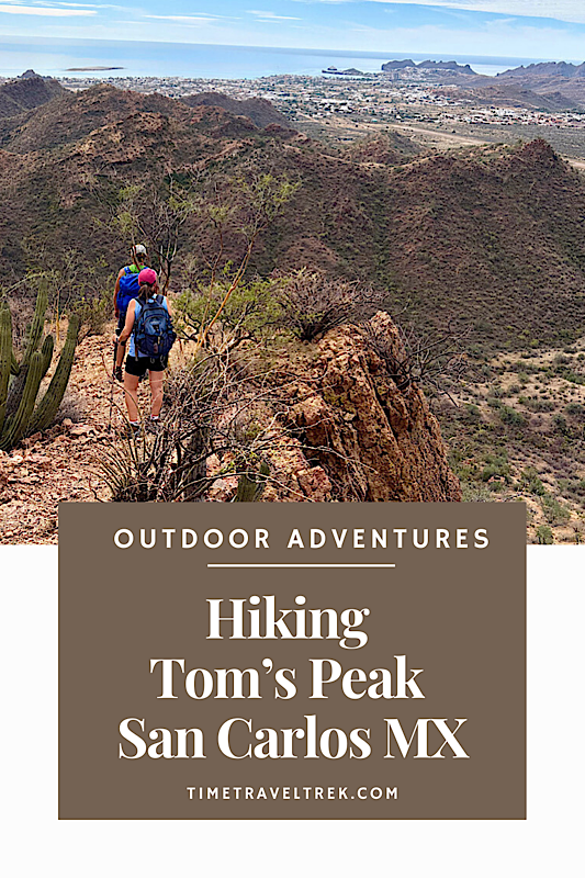
PIN THIS POST FOR FUTURE REFERENCE!
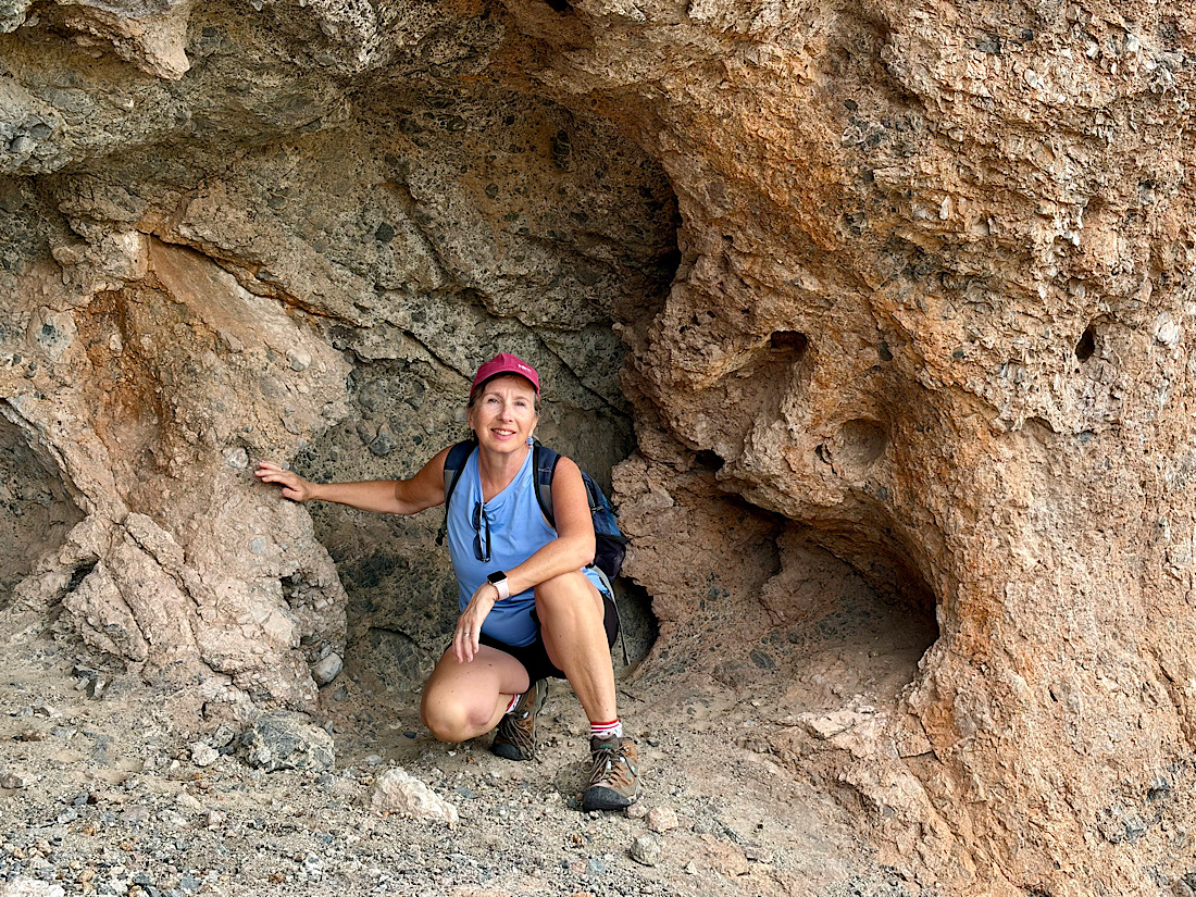
Faaaantastic as always! Who is that funny looking woman who is always in your photos?
She’s one of our favourite adventure partners!