It is the highest peak in the Tucson Mountains with 360-degree views that span from Kitt Peak to Mount Wrightson to Mount Lemmon and on to Picacho Peak, plus trails that wander through cactus gardens, past prehistoric petroglyphs, and alongside historic mines. What’s not to love about hiking Arizona’s Wasson Peak?
Disclosure: This post contains Affiliate links.
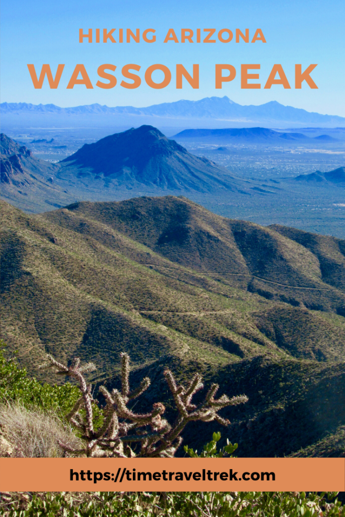
Table of Contents
Hiking Wasson Peak
We stopped in at the Tucson Mountain Park Visitor Centre at Gilbert Ray Campground to ask about hiking Golden Gate mountain – and were immediately distracted when the woman behind the desk asked if we had already hiked Wasson Peak. It wasn’t even on our radar, but quickly jumped to the front of the queue when we learned it was the highest peak in the Tucson Mountains.
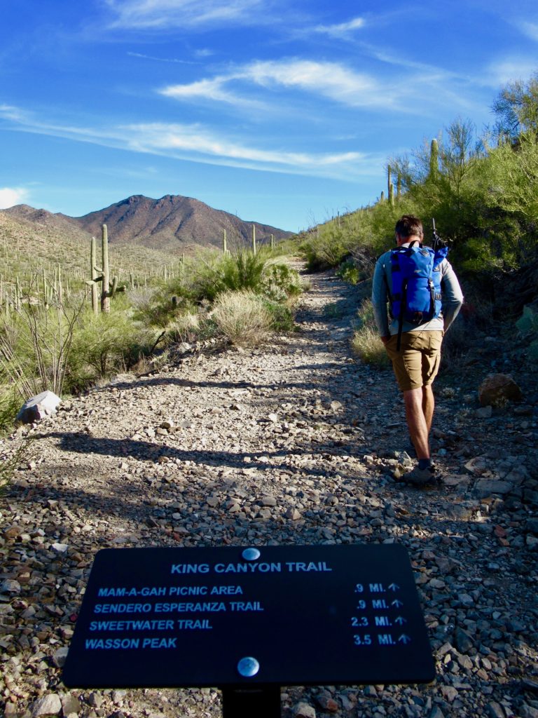
The next day we parked the motorbike at the almost full, gravel trailhead parking lot and sauntered up the old road leading into Saguaro National Park (park permit is required). The road was built by the Civilian Conservation Corps (CCC) in the 1930s. Watch for the rock retaining walls – signature CCC craft – along the way.
(Photo: Megan Kopp)
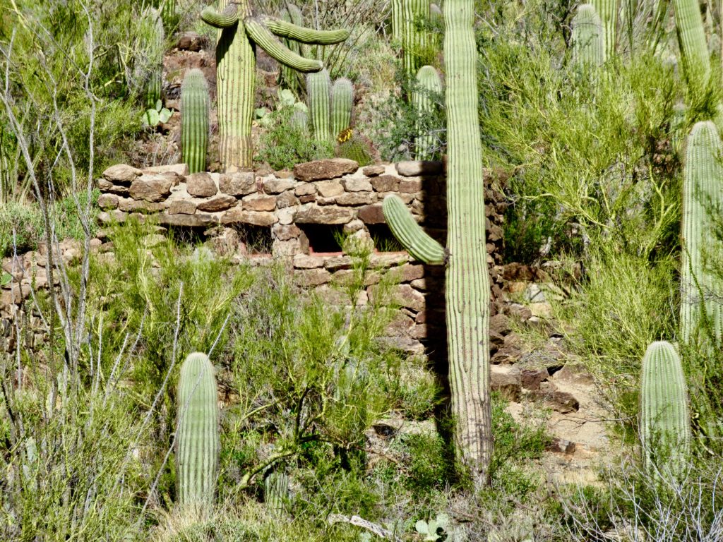
Descending a short hill, be sure head across the wash for a quick view of the historic rock building. The onetime washroom is classic CCC construction, but is slowly being overtaken by saguaro, prickly pear and palo verde. The trail continues a short distance up to the Mam-A-Gah picnic area, named after a Tohono O’odham chief.
A Better Route to Mam-A-Gah
We didn’t read about the King Canyon rock art until several days after completing our first Wasson Peak summit – so of course we had to go back and find the petroglyphs (and do the summit again). After walking both the old roadway and the wash to get to Mam-A-Gah, we suggest taking the creaked.
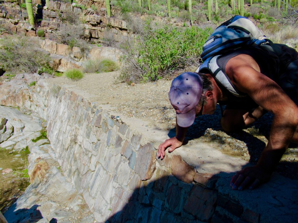
From the top of the King Canyon parking area, head down into the wash. Walk up the dry, gravelly creekbed, past several dry falls, watching carefully as low walls close in just below an old rock dam. Best in early morning light, the rock comes to life with hundreds of petroglyphs covering almost every surface.

(Photo: Megan Kopp
I couldn’t find exact dates as to when the rock art was created, but general consensus seems to be between A.D. 300 and 1450. In the neighbourhood 600-plus years old, the panels show the wear and tear of age and thoughtless acts of vandalism, but somehow still rise above it all to offer a unique glimpse of the past.

Climbing up over the dam, look carefully for what we think might be the builder’s names etched in concrete on the right side (looking upstream). The inscription reads: Smith and Molina on Sept 10 45. Continue up the wash less than a couple hundred feet to the Mam-A-Gah picnic site junction.
From Mam-A-Gah to the Pass
From the picnic area, return to the wash and head up it, passing a major side tributary coming in from the right. A short distance ahead, stone steps lead out of the dry creekbed and onto the well-travelled trail climbing up to a low pass and the junction with the Sweetwater Trail.

It had rained a few days before we were on the trail, and wildflowers had begun popping out the hillside among the saguaro cactus forest. Along the gradual climb that wanders through a small section of State Trust land before re-entering the park, views of another abandoned road to the east hark to the early mining era of the region.
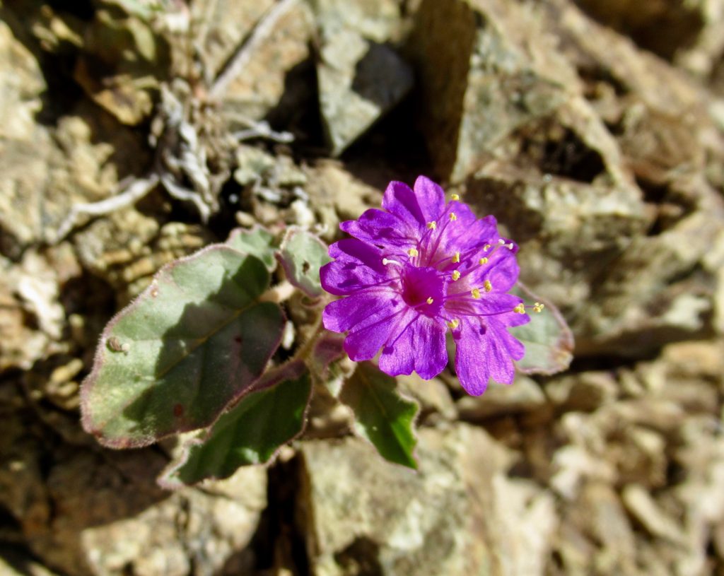
The pass is a good place to enjoy a cooling breeze before continuing with the steepest part of the ascent in the just over one mile of remaining trail up to Wasson Peak. Two fenced mine shafts – one vertical and one horizontal – are tangible reminders of the area’s mining history and good distractions from the uphill climb.

Summit Views
The cooling breeze turns into “time to put another layer on” wind as you near the summit. Endless views still make it the perfect lunch spot. We scanned the horizon in a clockwise rotation, picking out sites we’ve visited.
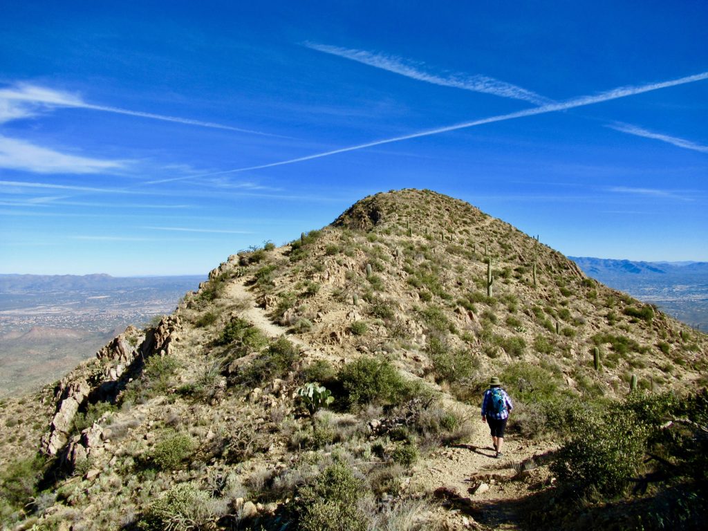
There’s Picachu Peak looking like a small island in the deceptive flatness of the valley almost 50 miles (80 km) away; the faint white dot of the infamous Biosphere 2; the rugged backdrop of Catalina State Park; Sweetwater Lagoons and its excellent birding habitat; Sweetwater Preserve’s sweet mountain biking trails; Golden Gate Mountain and snippets of the Sarasota/Starr Pass trail system in behind; our “home away from home” at Desert Trails RV Park; Mt. Wrightson still sporting traces of snow; Kitt Peak observatories; and the gravel drive through Saguaro National Park West.
Heading Down Hugh Norris
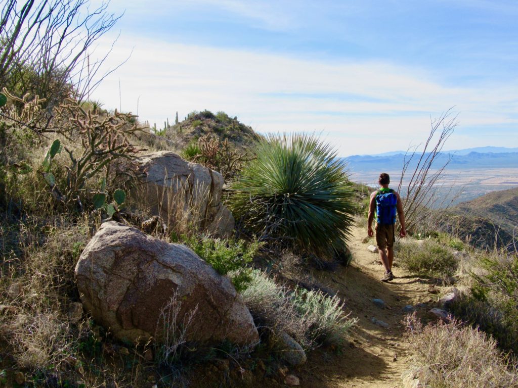
Less than half a mile down from the summit, the trail splits and we chose to make a loop by taking a section the Hugh Norris trail. It zigs and zags down, down, countless switchbacks down to the junction with Sendero Esperanza. The sandy Hugh Norris section of trail turns rocky again on Esperanza, but the pathway widens on what was once an old mining road leading directly to the Gould Mine.
(Photo: Megan Kopp)
Copper at the Gould Mine
S.H. Gould established the Gould Copper Mining Company in 1906. A year later, this shaft was 165 feet (50 m) deep. Gould had bigger plans. Mortgaging his interests, the mine reportedly reached a depth of 375 feet (114 m). Gould believed that large amounts of ore were deeper still, up to 1200 feet (365 m). He would never find out. Mining operations stopped in 1908, stockpiles were shipped until 1911 and by 1915 Gould was in bankruptcy.

Flash forward 42 years and another mining company is requesting the right to start open pit mining over the Gould Mine area. Pressure from the public stopped potential development. In 1963, the area became part of Saguaro National Monument and all mining rights expired in 1975.
As we hike by today, an open shaft is grated over and fenced. Reddish tailings flow down the hillside. Concrete slabs that once supported machinery, a stone cabin, scattered bits of wood and metal and a rock wall are all that remains as the desert slowly heals the scars.

Coming Full Circle
A junction sign points the route 1.1 mile (1.8 km) back to the King Canyon trailhead. The trail is rubbly as we head down the overgrown road. One last dip down into the wash and we pop back up in the parking lot. Total distance for our loop is just under 8 miles (13 km).
On our 2nd jaunt up the peak, we didn’t take this loop. Instead, we came back down Sweetwater to the pass and then walked down the old road to the southeast instead of the main trail. It ends up in the wash that splits off to the right just above Mam-A-Gah. It’s a popular alternative by the look of the beaten trails around prickly pear cactus trying to overtake the route.
Where is Wasson Peak?
Wasson Peak is located in Saguaro National Park, although the King Canyon trailhead starts in Tucson Mountain Park before dipping into Saguaro National Park. To access this trailhead from Interstate 10 in Tucson, head west on Speedway Blvd for 12 miles (19 km) to Kinney Road. Turn right on Kinney and follow it for approximately 2.5 miles (4 km) to the trailhead on the right, just past the entrance to the Arizona-Sonora Desert Museum on the right.
Read about Other Arizona Adventures!
White Tank Regional Park (near Phoenix)
Sedona and the Sinagua


We spent time in Gilbert Ray ;last year and headed back that way this year.
The area has so much to offer – love the biking trails outside of Gilbert Ray!