Looking for relatively easy half day hikes in Cairngorms National Park, Scotland? Lucky for you, we decided to do a circumnavigation of the Cairngorms and discover three peaks that could readily be summited without too much effort. And the bonus is that Geal-charn and Cairn Gorm are “Munros” and Morrone is a “Corbett” – if you’re looking for peak-bagging rights! Read on for all the details.
Disclosure: This post contains affiliate links. If you buy something from one of our affiliates, we receive a small commission at no extra charge to you. We appreciate your support!
Table of Contents
What and Where is Cairngorms National Park?
Scotland has two National Parks: Loch Lomond and the Trossachs National Park and Cairngorms National Park. Cairngorms – established in 2003 – is the largest National Park in Scotland. In fact, it is twice the size of Loch Lomond and the Trossachs. It is also 40% larger than the National Park in the Lake District, making Cairngorms the largest National Park in all the United Kingdom (UK).
Cairngorms National Park is in the eastern Highlands of Scotland, between the cities of Perth and Inverness. The major tourist hub within the park is the town of Aviemore. Cairngorms is almost equal distances between Scotland’s two major cities: 206 km (128 mi) from Edinburgh and 225 km (140 mi) to Glasgow.
Interested in RV adventures that get you close to hikes?
Check out our top tips for camper van rental in Scotland and exploring the Orkney Islands!
The park is home to five of Scotland’s six highest mountains (the highest peak in the country, Ben Nevis, is off to the west). But don’t worry, we’re not going for the highest mountains in our quest for “easy” half day hikes! We chose our top 3 day hikes in Cairngorms based on ease of access due to our chosen travel route, weather on the day of the hike and length of trail and approximate time to complete. Still, two of our choices still classify as Munros and the third is a Corbett!

What are Munros and Corbetts?
Munros are Scotland’s highest mountains. Now, before you get too excited, many of these are more like high hills than the rugged peaks you might find in North America’s Rocky Mountains. Munros were named after Sir Hugh Munro. He was the first to catalogue the 282 mountain summits in the country with an elevation over 3000 feet (914 m).
Corbetts – of which there are 222 in Scotland – are peaks ranging in elevation from 2500 to 3000 feet (762 to 914 m). Corbetts were named after the first person to list all of them, one John Rooke Corbett.
There are also an equivalent number of Grahams (2000 to 2500 ft / 610 to 762 m) as there are Corbetts, but we’ll save that discussion for another post!
3 Easy Day Half Day Hikes in Cairngorms
Today, we’re going to focus on two specific Munros and one Corbett in Cairngorms National Park: Gael-charn in the west off A9, Cairn Gorm in the north near Aviemore, and Morrone in the south in the castle country near Balmoral.
On a good day, these summits can be reached in about 1 to 1 ½ hours – depending how many stops for photos you take! Hiking distance is no longer than 3.5 km (2.2 mi) or so one-way. Maximum elevation climb is about 600 m (1968 ft). After all, these are easy Munros and Corbetts.
Love hiking? Take the AllTrails along on your next Scottish hiking adventure!
Hiking in Cairngorms: Geal-charn
This hike starts at a pass, 425 m (1394 ft) above sea level. When you start high, you know that the summit is going to be within easy reach in Scotland! In this case, we only had about 500 m (1640 ft) of elevation in 3.5 km (2.2 mi) to gain the summit of this laidback Munro.
Geal-charn means the “white hill.” Looking out from the trailhead the cairn on top does stand out brightly. We started off with blue skies, clip-clopping across the wooden bridge over the tiny but pretty River Truim. Heading past the B&B and across the level railway crossing, keeping left at the first major fork in the gravel road ahead.
After crossing another small stream on a bridge, we veered off right at the next fork in the road. From here, the path gains some serious elevation, braiding up through heather moorland.

Layering up piece by piece as the wind picked up and rain spat for a few minutes. Little storms blew in and out and rainbows blazed across the skies over distant mountains.
After reaching the first large cairn – which makes a good lunch spot if the timing is right as it’s a little more out of the wind – we layered up against the wind and continued across the flatter ridge for a short way before reaching the summit of Geal-charn, about a kilometre (0.8 mi) from the first cairn.
The views of Loch Ericht and distant mountains were drool-worthy! We eyed up A’Mharconaich – the next peak over. There is a circular route that takes hikers over to this second Munro by adding only another 200 metres of elevation, but we had to scurry back down. Flushing grouse along the way, we headed back to campervan in a hurry as the Highland Folk Museum was on the schedule for the afternoon.

Geal-charn Trailhead Access
Park in the small parking lot off A9 at the Pass of Dromochter near Balsporran Cottages B&B.
Another Half Day Hike in CairnGorms: The Namesake
It took two tries for the weather to cooperate – but Cairngorm National Park’s namesake summit was almost as high on my list as getting up Ben Nevis.
High cloud overhead as we drove back from Grantown-on-Spey for one last shot at hiking up Cairn Gorm. Packs on, we head up past the UK’s highest telephone booth. We can almost see the summit – roughly a 3 km (1.9 mi) or so hike with just over 600 m (1968 ft) elevation gain on stone steps up Windy Ridge trail.
“Gee, I wonder who thought up that name?”, I mutter as I’m almost blown over for the third time. I can’t see the trail because my eyes are watering so much. My nose is running like a faucet. I’m grouchy, but I’m the one who was determined to check off this “easy” summit, so I keep plodding.
My guy – on the other hand – is skipping up the trail like he’s a boy playing hooky from school and on his way to a favourite fishing pond. He’s just happy to be hiking.
The wind lets up and I look up beyond the ski lifts and funicular railway. Yes, it is beautiful. By the time we reach the Ptarmigan Station lodge at the end of the funicular, I’m getting into the spirit of the adventure.
The final little stretch to the summit has been fitted with flat stones driven in on edge to create a bumpy path that keeps hikers from slipping on the way down during wet weather. Ropes on either side keep people on the route when mist and fog rolls in. Sometimes hikes in Cairngorms – like this one – can be on well-constructed paths.
And there it is – the summit cairn. We soak up the views before tucking into the shelter of the weather station.
I can’t stop smiling – these views…

Alternate Route Down for this hike in Cairngorms National Park
We read in our guidebook that it was possible to do a loop walk but heading down to another minor bump called Cnap Coire na Spreidhe before descending a long ridge to an overnight campground on the hairpin corner of the road that winds up to the ski base. The loop is just over 12 km (7 mi) in length.
Perfect, we thought as we headed downhill. Pockets of cloud danced in and out, shrouding then clearing. We pulled on extra layers for warmth. Heading off the beaten path onto a wilder side of the mountain, we caught sight of movement below. Pulling out the binoculars, we watched five reindeer run gracefully across the heather and disappear out of sight. Wild!
We climbed up a small rise and started down the ridge, but the wind became even more insistent. Time to call it. Angling back across the slope towards the ski lifts, we scrambled around and under wooden snow fences before ending up back on the Windy Ridge trail.

And that’s when the rain hits, sideways.
So why recommend this hike? Because I still can’t stop smiling thinking of those views.
Cairn Gorm Trailhead Access
From the main car park below the Cairngorm ski area base, head uphill on the path between the day lodge and the funicular building. Watch for sign for Windy Ridge and follow the well-marked path.
Easy Half Day Summit up Morrone
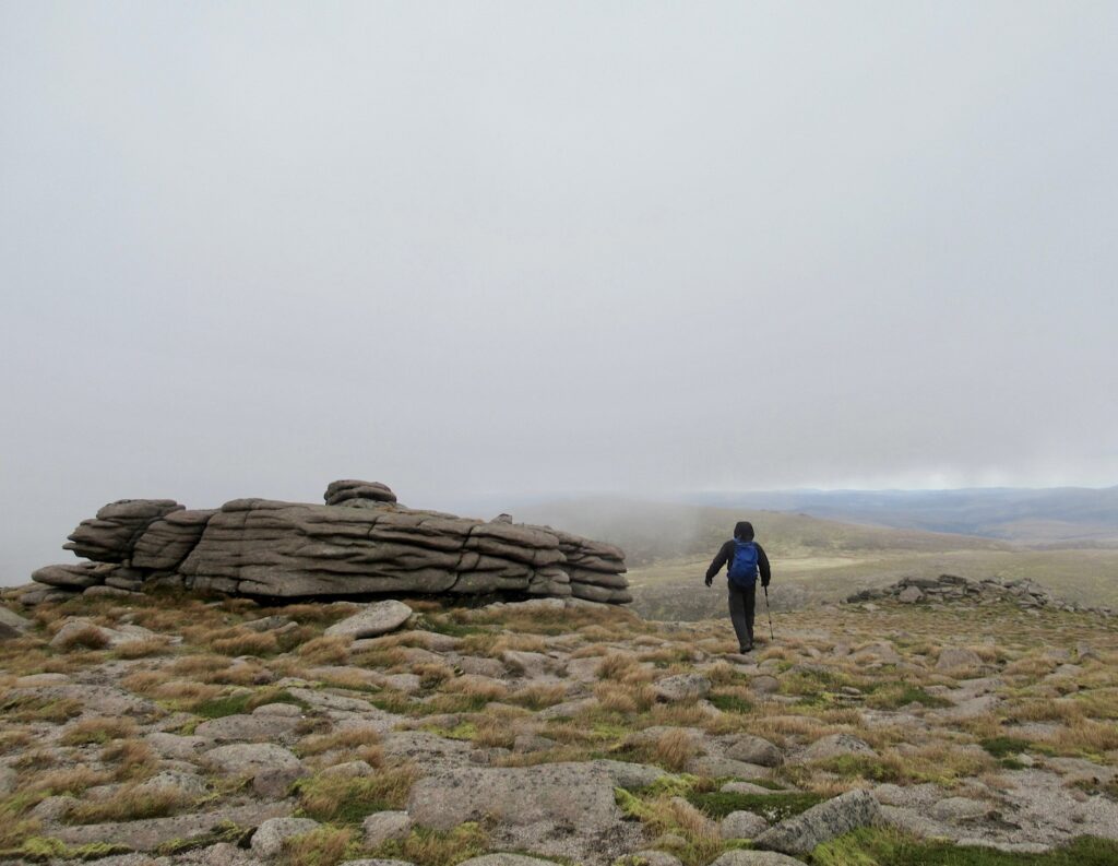
Like Cairn Gorm, the Morrone hillwalk can be done as a 12 km (7.5 mi) circular loop. And just like Cairn Gorm, weather and timing had other plans. We did the roughly 3 km (1.9 mi) with 500 m (1640 ft) elevation gain walk up to the summit and back down the same way.
As far as hikes in the Cairngorms go, this pretty, little Corbett is a straightforward climb, even with clouds racing in and out, wind and a brief rain shower. Rainbows pointed to the treasure that is the main mass of Cairngorms National Park.
Our route started from the duck pond, followed the path up to the gravel road, took the road passing by a stone house at the edge of the woods and headed right back onto the trail at the signpost for “Morrone.”
The trail climbs more steeply here through vast patches of heather and wide open moorland. Braemar, its namesake castle and our campsite pop in and out of view as the clouds toy with our view.

The sun comes out, spotlighting distant peaks before skies become moody once more. Nearing the top, a row of cairns helps guide the way. As the mist clears, the radio antennae and buildings at the summit come into view.
We read the sobering brass plaque on the wall of the old stone relay station erected by the Braemar Mountain Rescue Association. It was funded by donations in memory of Brian M. Goring, who died of exposure in the Cairngorms in April of 1967. Hiking in the moorlands, even easy half day hikes in Cairngorms, requires vigilance.
We zip our coats a little higher, take one last look at the map on our phone and head down with a nod to the past. As much as we love hikes in the Cairngorms, we respect the sometimes unpredictable outdoor element.
Morrone Trailhead Access
The Morrone trail can be accessed starting at the carpark in the centre of Braemar or from the duck pond parking area just on the edge of town. Note that the duck pond parking area in not accessible for high vehicles due to a low height entrance gate.
Safety Considerations for Half Day Hikes in Cairngorms National Park
As you’ve probably already garnered from reading this post, mountain weather is fickle and can change in the blink of an eye. Even half day hiking adventures require good planning and gear.
- Be prepared for cold, windy, and wet weather.
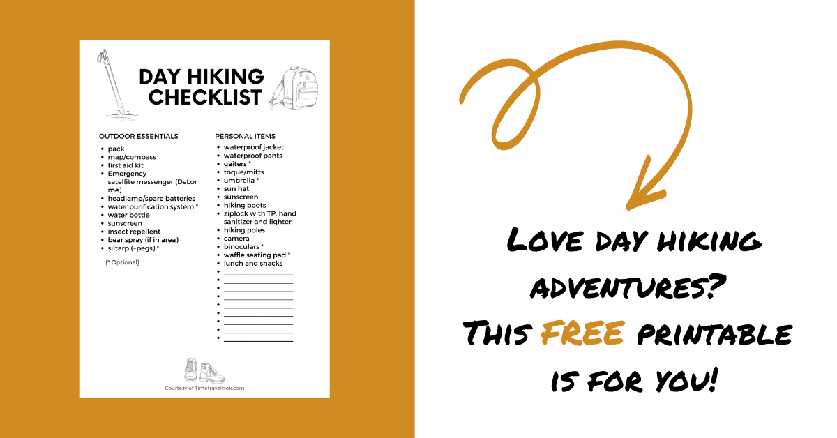
- Use a checklist (like the one below) to ensure that you have all the gear you need.
- Know how navigate in low fog, cloud and whiteout conditions.
- Don’t hesitate to change plans and turn back if necessary.


[…] Half-day Hikes in Cairngorms, Scotland […]