At the northern end of Lake Mead Recreation Area lies the ghostly remains of St. Thomas, Nevada. It was once a prosperous Mormon community built of sweat, drowned in sorrow, and now covered in desert dust. It’s a ghost town you need to wander to fully appreciate.
Disclosure: This post contains affiliate links. If you buy something from one of our affiliates, we receive a small commission at no extra charge to you. Thanks for helping to keep our blog up and running!
Table of Contents
Exploring the Ghostly Remains of St. Thomas, Nevada
A ghost town?
One shrouded by the rising waters of Lake Mead in the 1930s and brought back to ruined life several times over in periods of low water?
Where is it and when can we go? There’s nothing I love more than walking around exploring remains of the past – especially ghost towns!
Turns out we are surprisingly close to the ghostly remains of St. Thomas, Nevada while camping in Valley of Fire State Park. Taking a day off hiking, we drove the Valley of Fire Road towards Hwy 169, heading right back towards Lake Mead National Recreation.
Let the ghost town adventure begin!
Before St. Thomas was a Ghost Town
It all starts with the Muddy River Valley – a fertile stretch of land in what is now southern Nevada not far from Las Vegas. Native Americans planted crops of corn, bean, squash and cotton along the river as early as 900 AD.
In 1865, Thomas Smith travelled through the area. Mormon leader Brigham Young wanted to create a settlement along the freight route from the Colorado River to Salt Lake City. Smith and a small group of Mormon men and women settled near the confluence of the Virgin and Muddy Rivers. The community was located about 23 miles (37 km) north of the Colorado River.
Growing the Little Town of St. Thomas
Life in the remote Mojave Desert was a struggle but by 1866, close to 45 families had settled in St. Thomas. Together they built an irrigation system to bring water from the Muddy River to their crops. They harvested cotton and grain. Vegetables grew and fruit trees blossomed. By 1869, the irrigation system was extended with concrete-lined canals and ditches to the town. Filled cisterns became hubs where residents came daily for buckets of water. Life became a little bit easier.
Taxed… But Life Goes On!
At the time, the St. Thomas settlers were under the impression that they were in either Utah or Arizona. In 1870, a boundary survey determined that the community was in Nevada. They owed back taxes. The residents did not have the appropriate payment. The townspeople voted whether to stay or go. Sixty-three chose to abandon St. Thomas. Two people – Daniel and Ana Bonelli – voted to stay.
The Bonellis operated the Bonelli Ferry on the Colorado River. They raised livestock, grew crops, investing time and energy in the irrigation systems that were already in place in St. Thomas. Over time, people began to move back and Bonelli profited from his work on the water supply system.
St. Thomas was a major stop along the Arrowhead Trail. The Arrowhead Trail – which ran through Valley of Fire and portions of which can be hiked or biked today – was the first designated all-weather automobile route between Salt Lake City and Los Angeles.
The hard work of maintaining the road often fell to the residents. They agreed to rake more than 100 miles of this dirt road to keep it in good condition throughout the year. The Arrowhead Trail was an all-weather road as its route stayed at a lower elevation. It could remain open all winter. This allowed the local economy to prosper. St. Thomas was an oasis in the desert in the burgeoning era of automobile travel.
A Prosperous Period for St. Thomas
In 1911, a railway spur line was constructed between Moapa and St. Thomas. Upon completion, trains arrived with cars full of commercial goods and even blocks of ice hauled in refrigerated cars. Train cars left filled with copper, silver and gold ore as well as salt, sand, fruits and grains. Homes were built with lumbered wood finishes and surrounded with neat hedges on tree-lined streets.
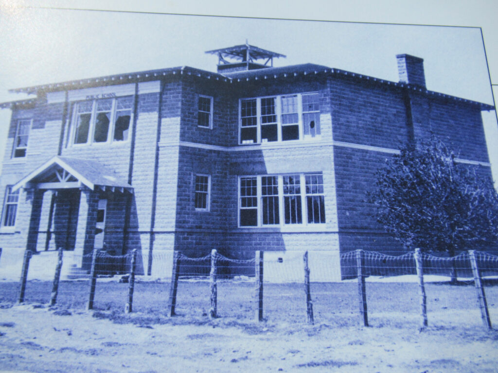
A two-story school – for grades 1 to 8 – was built in 1915. It had four classrooms, a large auditorium and room upstairs for dances and plays. High school students took the long bus ride to Overton.
Although farming and ranching were mainstays, businesses flourished along the Arrowhead Trail. Several garages popped up around town. Reinhold and Solinda Hannig built a grocery store and soda fountain also known as the Hannig ice cream parlor. William Sellers opened a café. The Gentry’s operated the 14-room hotel. At its peak, St. Thomas was home to almost 500 people. In 1926, the Arrowhead Highway was officially replaced by the U.S. numbered highway system.
Dam It – There Goes the Town!
In 1928, President Calvin Coolidge signed a bill authorizing the building of what would become the Hoover Dam. Lake Mead would inundate the landscape. As a result, St. Thomas residents had no choice but to leave.
Residents were paid out – sparingly – for their land. Houses were dismantled and moved. By 1932, the once-prosperous town was pretty much gone. Only a few hardy souls remained. By 1935, filling of the lake commenced. It took three years to fill. At its high-water mark, St. Thomas was 60 feet (18.3 m) below the surface.
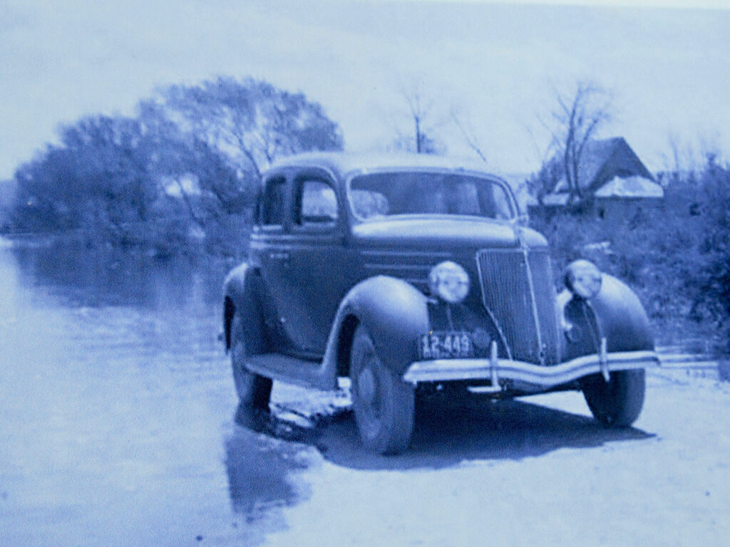
Ghostly Remains of St. Thomas Rise from the Depths
Lake levels never remained consistent. What was left of St. Thomas rose from the depths of the water in 1945, 1963 and 2012. I loved reading the interpretive signage – especially the story of a U.S. senator who came back for a resident’s reunion in 1965. He had buried a keepsake beside his family’s home before they left in the 1930s. The morning of the reunion, he dug up his old hat and proudly wore it on his head as he addressed the crowd.
Water levels continued to ebb and flow. Today, we walk a 2.5-mile (4 km) loop among the eerie remains of the townsite along a dry, dusty path. Not surprisingly, considering the drought that plagues the west, the shoreline of Lake Mead has retreated far beyond sight.
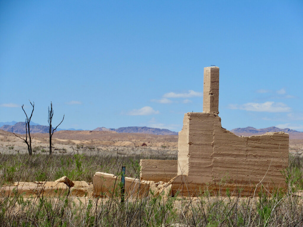
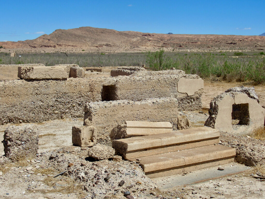
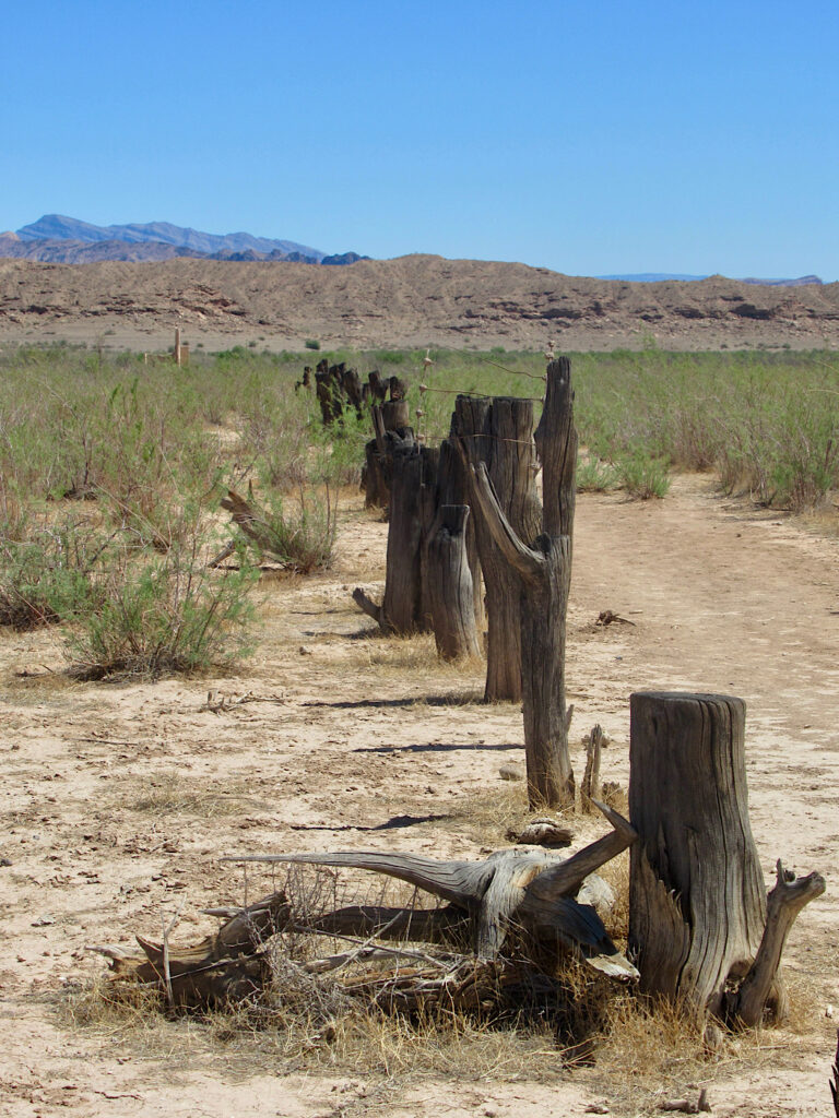
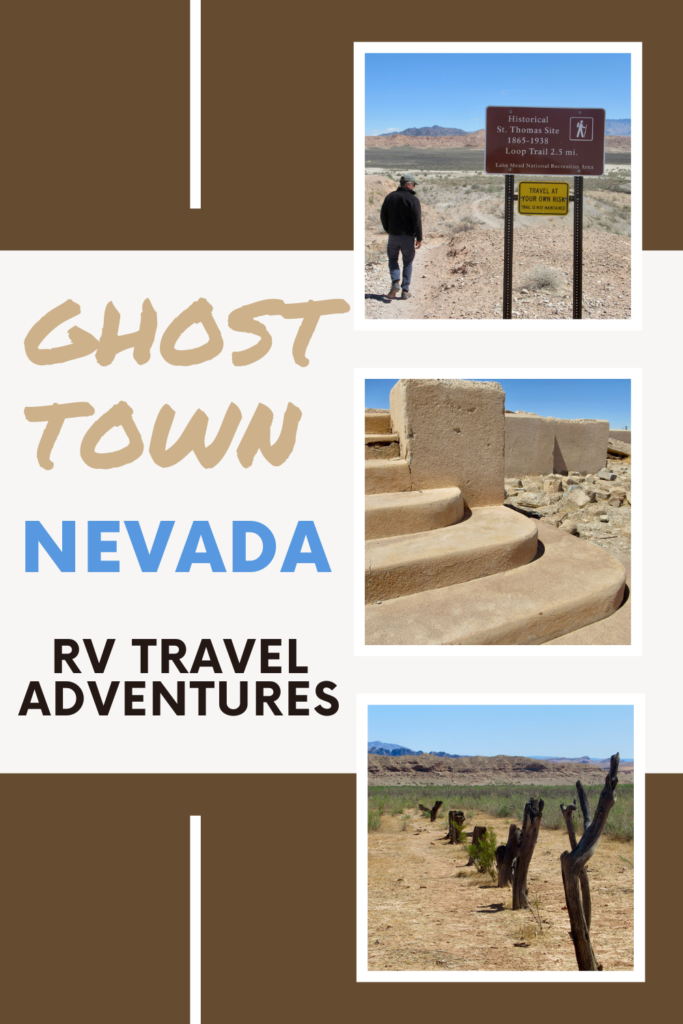
We walked among tree stumps lining abandoned streets; up adobe steps leading to nowhere; and peered into grated cisterns where locals used to come for their daily water needs. The bits and pieces of a once-vibrant community were almost tragic to see.
It was almost enough to bring tears to my eyes as I read the story of Hugh Lord. In June of 1938, with water lapping at the door of his home, he lit the place on fire and roared away by boat.
Water. It seems to be inescapably tied to the success and downfall of this tiny community turned ghost town. Built of sweat and drowned in sorrow, it’s now a dry and dusty reminder of a once vibrant past. It’s a ghost town you need to wander to fully appreciate.
Where is St. Thomas, Nevada?
The ghost town of St. Thomas lies at the northern end of Lake Mead National Recreation Area.
In order to access the historic site from the Valley of Fire Road, head right at the junction of Hwy 169 (Northshore Road). Just past the closed entrance station on Northshore Road, turn left onto the St Thomas Road.
It’s a 3.3-mi (5.3 km) bumpy drive down the gravel road cut through the Mojave Desert to the old reservoir edge and the start of the signed historic St. Thomas loop trail.
Looking for more things to do in Lake Mead National Recreation Area?
Check out this list of camping and active travel adventures near Boulder City!
Explore the nearby Lost City Museum in Overton!



Leave a Reply