For active RV travellers and history buffs based at Chiricahua National Monument, Fort Bowie National Historic Site is the kind of day trip that is a perfect mix of hiking and history. Follow along as we walk through to Arizona’s Apache Pass exploring landscape, ruins and numerous cultural layers along the way.
Disclosure: This post contains affiliate links. If you buy something from one of our affiliates, we receive a small commission at no extra charge to you. Thanks for helping to keep our blog up and running!

Table of Contents
Quick Facts: Fort Bowie National Historic Site
Most historic sites let you drive straight to a visitor centre, hop out and wander around a few signs. Fort Bowie isn’t one of them. Hidden deep in Apache Pass and reachable on foot (or accessible-access only road), this National Historic Site asks you to slow down, step into the landscape and experience the story the same way soldiers, scouts and Apache families did more than a century ago — one dusty mile at a time.
Location: Southeast Arizona in Apache Pass between Willcox and Bowie
Access: By foot via the 1.5 mile (2.4 km) Fort Bowie Trail (see special note below for accessibility)
Total hiking distance: 3 miles/4.8 km return (longer if you use the old military road return route)
Elevation gain: Approximately 200 ft (60 m)
Trail difficulty: Easy to moderate with full sun exposure
RV access: RVs can drive the rough, gravel Apache Pass Road but trailhead parking is best suited to passenger vehicles and camper vans
Fees: None (no entrance fee)
Best season: Late autumn through early spring
Visitor centre: Located beside the second fort ruins (seasonal hours)
Pet friendly: Yes, on leash
Closest camping: Bonita Canyon Campground inside Chiricahua National Monument
Tip: Hike with friends who enjoy hiking & history and you’ll double the fun!
Plan and record your active travel adventures with our digital RV travel planner!

Special note about access
For those unable to walk this distance, drive 2.5 miles (4 km) to South Old Fort Bowie Road and follow it for 3 miles (4.8 km) until you enter the park. There is a 500 m (152 m) trail to Visitor Center. Park staff can arrange for vehicle access to the Visitor Center from parking lot. Because this option traverses fragile park resources, this option is only for those that otherwise can’t access the facility.

Getting There From Chiricahua: A Scenic Gravel-Road Warm-Up
Leaving Chiricahua National Monument, the route feels straightforward at first: paved roads, wide ranch views and a glimpse of the Willcox Basin. But once you turn south toward Apache Pass Road, pavement gives way to graded gravel. The adventure starts to take shape.
Apache Pass is a low divide separating the massive Chiricahua Mountains from the Dos Cabezas Mountains. This landscape formed a rugged corridor through which people and goods were moved. With wood, water and grass, the low pass was an essential part of a direct east-west transportation corridor in an era of horseback and horse-drawn wagon travel. And it was especially important during the Apache Wars from 1862 to 1886 – more about that in a moment.
Today’s drive is suitable for most vehicles, but RV travellers may prefer leaving the bigger rigs at the campground and taking a tow vehicle instead. Washboard conditions are common and the road narrows in places. The trade-off is worth it, though. Every mile brings a shift in geology, vegetation and perspective.

The Bascom Affair
On February 4, 1861, Lt. George Bascom and Chiricahua Apache chief Cochise collided nearby over the kidnapping of a rancher’s son – 12-year-old Felix. The kidnapping was blamed—incorrectly—on Cochise and the Chiricahua Apaches living near Apache Pass.
A few nights later a wagon train camped in this meadow was attacked by Apaches. Eight teamsters were killed and three more taken hostage. Six Apaches were hung in retaliation in nearby oak trees. The “Bascom Affair” led to an ongoing battle and became the reason for the establishment of Fort Bowie.
A little further along the road is the Overlook pullout. We took the short walk to a weathered tree stripped of bark. Looking close, we saw viewing tubes inserted at different heights. They point directly to the fort ruins on Apache Pass. Fort Bowie served as the military hub during the 24-year war against the Chiricahua Apaches.

The Fort Bowie Trail: A Hike Through History
Before long, a brown sign beside the road marks the unassuming trailhead for Fort Bowie — no big gate or entrance booth, just a small gravel lot, a small picnic area with ramadas, a couple of interpretive signs and a path heading down into a desert wash. It feels like you’re being invited into a story rather than visiting a site – like we’re about to the enter the drama of a western novel.
Instead of dropping you directly into a cluster of ruins, this 1.5-mile (2.4 km) approach trail guides you chronologically through events that shaped Apache Pass long before the fort existed.

1. Mining
The trail passes the foundation of an old mining cabin. Of course we stopped to read the sign. Apache Pass became a mining region when gold was discovered in 1864. The”Harris Lode” as it came to be known, was later developed by the Apache Pass Mining Company led by John F. Stone. Mining was prohibited in the late 1870s as military activity took over but it picked up again after Fort Bowie was abandoned.

2. Stage Station Ruin
The Apache Pass Stage Station – one of 19 stations in Arizona – was built of stone in July 1858. The stage stopped here for a change of mules, rest and a meal. When tensions grew and cultures clashed in 1861, the southern Butterfield Overland Mail route was discontinued.

3. The Post Cemetery
Predating Fort Bowie, the cemetery was the final resting place for emigrants, mail carriers, military and family members… and three Apache children. After the fort’s closure 72 soldiers, dependents and “unknowns” were removed and reinterred at the San Francisco National Cemetery. Walking through, we silently acknowledged all the stories that remain (as we do at all historic cemeteries).


4. Chiricahua Apache Indian Agency
There’s not much left of the Chiricahua Apache Indian Agency except an outline of stone walls. In 1875-76, U.S. Indian Agent Thomas Jeffords governed close to 900 Chiricahua Apaches with the help of the U.S. Army at Fort Bowie. A nearby display showcases an Apache camp. Their lifestyle was irrevocably changing and nothing was nearly as romantic as the old western movies led us to believe.

5. Apache Spring
Early on, the path descends toward a cottonwood-lined oasis where Apache Spring still flows. Water has always determined movement in this landscape. Control of this spring shaped alliances, trade and conflict. The cool shade here make a perfect pause point before climbing gently toward the first ruins.

Ruins of the First Fort
The first Fort Bowie, constructed in 1862, sits just beyond the spring. Its footprint is still easy to walk through, with low stone outlines showing where soldiers slept, ate and stored supplies. This version of the fort was small and hastily built during the early Apache Wars. Imagining its rougher edges and improvisation helps set the stage for what comes next.
We took time here to wander the short spur paths and read the interpretive displays. The setting is open, peaceful and — like so many military sites in the West — surprisingly vulnerable. The soldiers who lived here were isolated, relying heavily on wagon roads that wound through contested territory.

Exploring the Second Fort: What to See
The trail climbs gradually toward the main attraction: the larger, more permanent second Fort Bowie. Built in the 1870s – and abandoned in 1894 when it had served its purpose – this fort is the footprint most visitors picture when they think of the site.

Fort Bowie Headquarters, Hospital and Bakery
The headquarters complex anchors the core of the fort, with clear outlines of rooms and support structures. The hospital building is particularly interesting given its size and the remote logistics required to run it. The bakery ruins still show the footprint of ovens where daily rations were prepared.
Officers and Enlisted Quarters
On opposite sides of the parade ground, the remains of officer’s quarters and soldier’s barracks reveal stark differences in living conditions. Officers enjoyed more space and privacy, while enlisted men shared tighter quarters with fewer comforts. The Commanding Officer’s Quarters cost $4500 to build in 1885.


Interpretive Signage and Spur Trails
Scattered throughout are signs that tie together timelines, daily routines and major events. Several short side trails lead to viewpoints and outbuildings. If you’re up for a little extra wandering, these add dimension to the site without adding significant distance.
Fort Bowie National Historic Site Visitor Centre and Museum
The small but excellent visitor centre sits at the far end of the fort ruins. Inside, you’ll find artifacts, maps and a short overview of the conflicts that shaped the area. Rangers often provide hiking tips and additional context about what’s visible from the ridge trails.
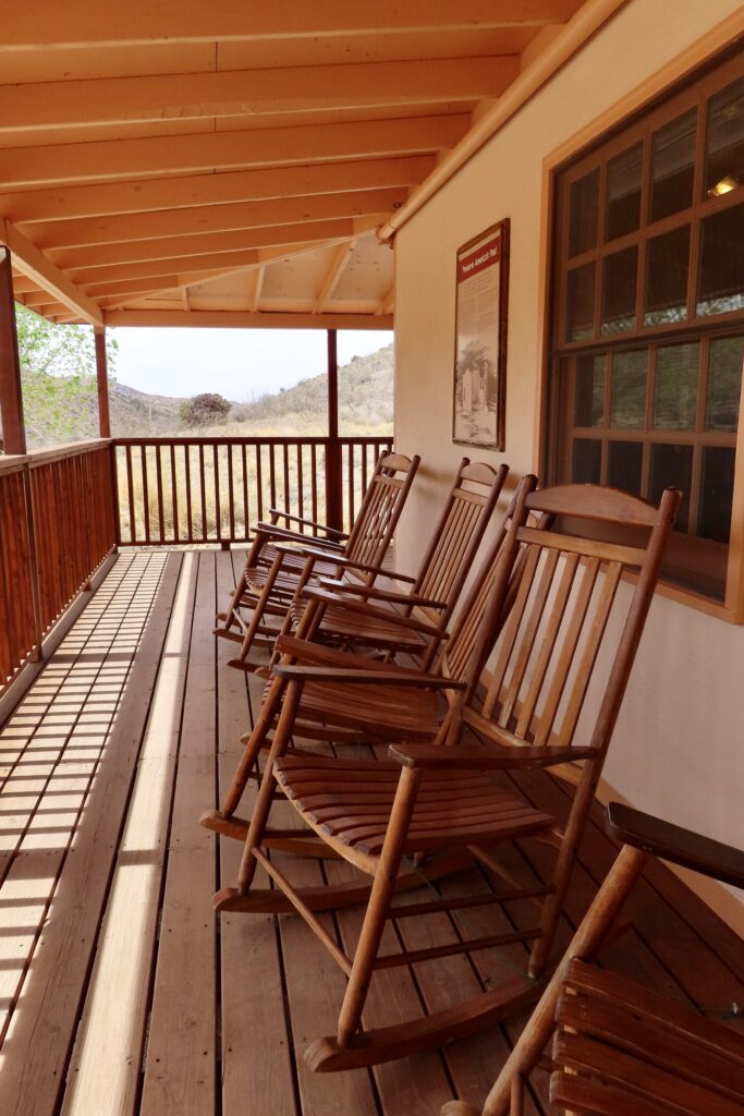
Out front are picnic tables, a water fountain and a handful of rocking chairs on the porch that look out over the site ruins. Flush toilets are around the back of the building making this a useful rest stop before you begin the return hike.
A thoughtful display inside explains how many artifacts were removed from the site during the decades when the fort sat untended. Some of these items have since been returned by people who inherited them or found them among family possessions — a small but meaningful gesture toward restoring the site’s history.
Return Route Options
You have two good choices for the way back:
1. Return the Same Way
Most hikers choose the in-and-out route to revisit Apache Spring and the Bascom Affair site. This direction also gives you front-facing views of the basin as you walk out.
2. Ridge Trail Loop
A short climbing trail leads up the ridge above the fort and connects with the main approach trail from a higher vantage point. It adds broader views and a sense of the fort’s strategic placement without extending your total mileage dramatically.
Even though we returned the same way to the parking lot, our total wander came to about 7.9 km (4.9 miles) including all spur trails, the first and second forts.

Final Thoughts
Fort Bowie is ruins. It isn’t architecturally dramatic in the same way Tombstone’s Historic District or San Xavier del Bac Mission are. Its power come through with a little time and reflection. The trail, the spring, the ruins and the empty basin weave together to tell a story that can’t be fully captured from a window or a quick overlook.
For active RV travellers seeking meaningful experiences between hikes and scenic drives, this site delivers something deeper — a sense of connection to the land and to the people who endured, survived and shaped the history of Arizona’s southeast corner.
P.S. If you love off-the-beaten-path adventures, check out these posts:
New Water Mountains Wilderness: Another Arizona Adventure
RV Adventure: Homolovi State Park | AZ
Besh-Ba-Gowah in Historic Globe, Arizona
Exploring Ironwood Forest National Monument
PIN THIS POST FOR FUTURE REFERENCE!

Leave a Reply