After our introductory visit to ‘Ksan Historical Village, we were hooked on discovering more about the Gitxsan culture. Kispiox, Kitwanga and Kitwancool – the names capture our imaginations and our quest continues in Northern BC.
Disclosure: This post contains Affiliate links.

Table of Contents
In Search of the Kispiox, Kitwanga and Kitwancool Totems
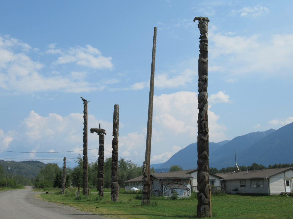
We followed the Skeena upstream by road before cutting across to the Kispiox River to the village bearing the same name. Blue and white signs direct us right to over a dozen, uniquely carved totems. Abalone shells highlight one carved face. Wooden tears drip down the face of another. Carved owls and hawks perch impossibly high on totem tops.

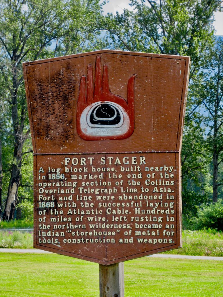
Aside: In 1865, the Collins Overland Telegraph Company started construction of an international communications link with Europe by way of the Bering Sea. A trail was hacked through the northwest wilderness. In 1866, crews from the Collins Telegraph arrived in Hazelton and Fort Stager was built in Kispiox. The Fort and the telegraph line were both abandoned when a competitor succeeded in laying a cable across the Atlantic Ocean in 1868. The Telegraph Trail remained in use for many years.
Place of the Rabbits
Gitwangak, formerly known as Kitwanga, means “place of the rabbits”. It is the starting point for the Stewart Cassiar Highway at the junction of Highway 16 and 37. The Kitwanga River joins the Skeena here.
Driving just off the highway, the century-old St. Paul’s Anglican church catches the eye first. Built in 1893, the church is typical of the time period, but the separate wooden bell tower standing in front is unusual. It stands aloof, demanding to be walked around and photographed. Still, we weren’t on the hunt for historic buildings, no matter how unique. We were looking for Gitwangak’s totem poles.

Down the gravel road, just off the river, twelve aging totems stand in various degrees of upright posture. Some of these cedar totems are more than a century old. The poles are carved with a variety of animal and human-like figures.
Gitwangak Battle Hill National Historic Site
Up the road from Gitwangak’s totems lies Gitwangak Battle Hill National Historic Site. From the parking lot, it looks like a small, odd-shaped grassy knoll. The clear Kitwanga River meanders around one flank of the hill. It’s a short 10 to 15-minute walk down 110 metal steps, across a small meadow filled with flowering dogbane and up another 65 steps to the summit. Interpretive signs tell the site’s story along the way.

A Fortified Village
Daa’ootsip, as it is known in Gitwangak language, was a fortified village. It was occupied by the Gitwangak First Nation in the late 1700s and early 1800s. Gitwangak warrior chief ‘Nket built his home here along with the homes of the Eagle and Wolf clans. In total there were five longhouses and a palisade. From its vantage point, it was possible to see anyone approaching from the valley or the river.
‘Nket and his warriors built the wooden palisade with releasable logs. When the village was attacked, the logs were set loose to down the hill and crush any opponents. The hilltop structures were eventually overtaken and burned to the ground around 1835 during another tribal war over fishing sites and trade routes.
Gitanyow and Emily Carr
Gitanyow, formerly called Kitwancool, is 15 kilometres (9 miles) north of Kitwanga. Possibly the most famous totem site in the area, it was designated a National Historic Site in 1972. At one point, Gitanyow had one of the largest number or original totem poles of any Coastal First Nationas village. Canadian artist Emily Carr visited Kitwancool in 1928 to paint the village’s poles. Her work can be found in numerous exhibitions around the country.

Today a mixture of 22 old and new poles grace the site. Some date back to the mid 19th century. The village is cluttered with abandoned cars and bits of metal, the old graveyard near the creek below the totems is overgrown. Fireweed blooms in profusion. It is one of the totems mentioned in the Battle Hill interepretive signs.

Gitanyow has a museum, but sadly it was closed during our visit. We still wanted to learn a little more. Excuse us while we bury our noses in a few books as we continue the quest to learn a little more!
Want to learn even more about First Nations in Northern B.C.? Check out our post on Kitselas National Historic Site.


I come from the Kispiox Valley, just up the road from Kispiox. Our old house, built in the 1860s, burned down some time after we left.
The first time I went to Gitwangak was a school field trip in the 1960s. The road went from the Kispiox road, just past the first bridge out of Hazelton, and travelled along the other side of the Skeena.
At that time, the “road” from Gitwangak to Gitanyow was two ruts through the bush. It entered Gitanyow beside the graveyard and totem poles. The new highway is on the opposite side of the village, which is why the poles appear to be at the back. They are facing what was the original approach.
Love reading about your adventures!
Again, great details that help begin to fill in a faded picture of the past!