Chiricahua National Monument in southeastern Arizona may be one of the less-visited geological wonders in the Grand Canyon State, but it is a “wonderland of rocks.” Join us for a little hiking laced with history in this monumental adventure!
Disclosure: This post contains affiliate links. If you buy something from one of our affiliates, we receive a small commission at no extra charge to you. Thanks for helping to keep our blog up and running!

Table of Contents
What and Where is Chiricahua National Monument?
Over 27 million years ago, a volcano erupted. It covered the land with layers of pumice and ash two thousand feet thick. This mass bonded together to form a rock called rhyolite tuff. Time and the elements began eroding the rhyolite into an amazing labyrinth of rock formations. Early settlers dubbed it the “Wonderland of Rocks.” In 1924, President Calvin Coolidge signed legislation to create Chiricahua National Monument.
Located about 120 miles (193 km) southeast of Tucson, Arizona, the monument attracts hikers, photographers and birders alike.

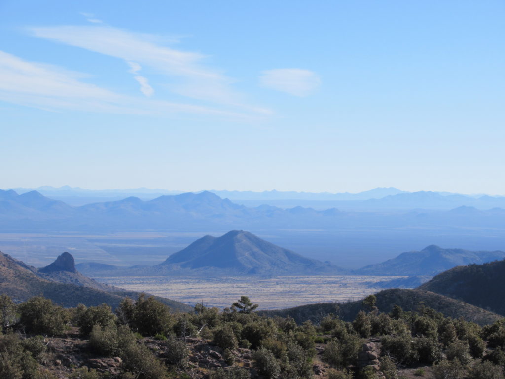
The Chiricahuas lie in an area of the southwestern United States and northwestern Mexico that has an extremely high degree of biodiversity. Mountain peaks rise above desert valleys and grasslands creating a wide variety of habitats for bird, animal and plant life. These areas are called “sky islands.”
Camping in Chiricahua
We set up our tiny trailer in our reserved site in Bonita Campground. It’s important to note that the maximum vehicle length allowed beyond Chiricahua National Monument Visitor Centre is 29 feet (8.8 m). They are serious. The road narrows, twists, and winds beyond this point. In the campground, a concrete dip has countless deep gouges. It make me wonder what the trailers or RVs look like. Campsites are on the small side, but it’s still perfect for our little rolling home.
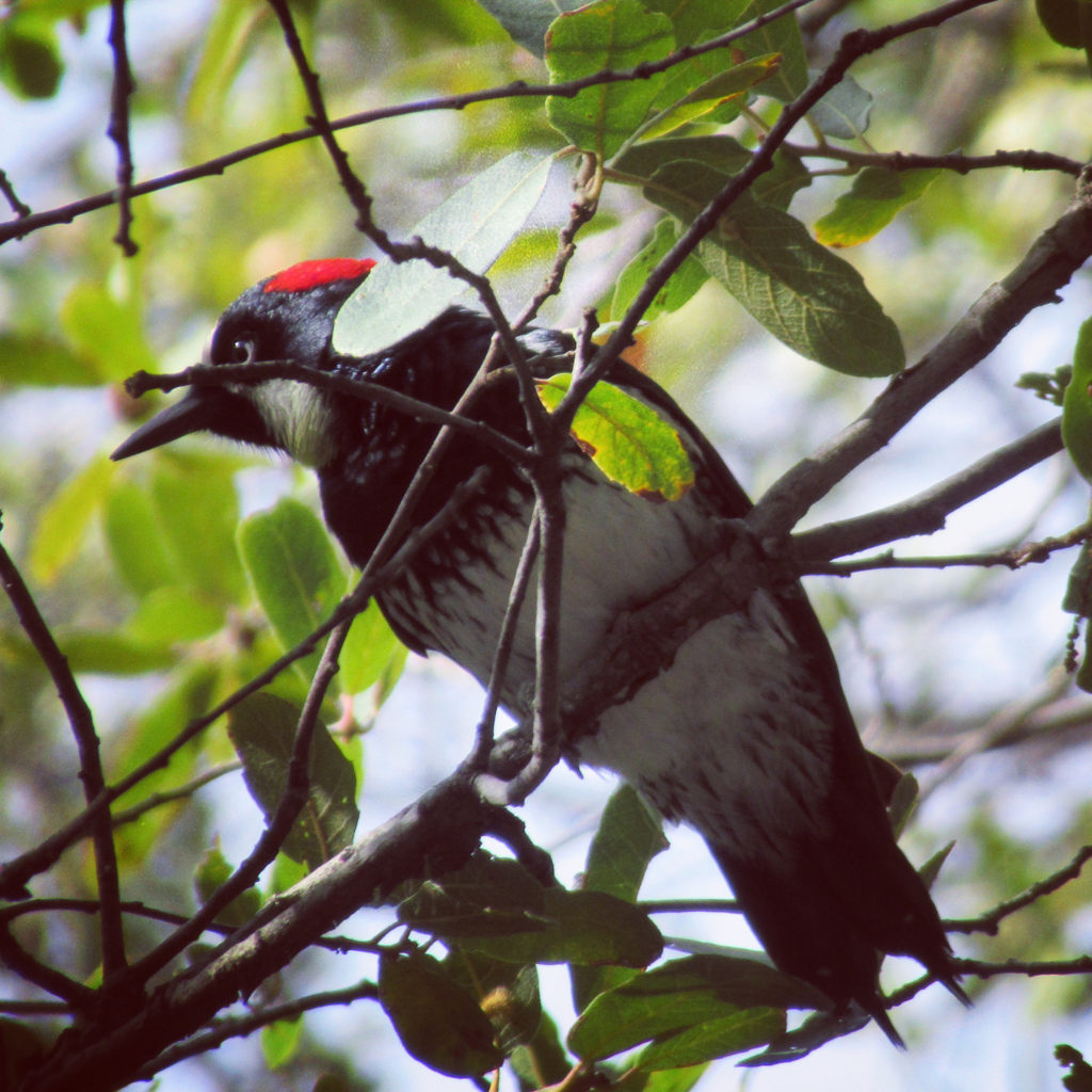
Stretching legs, we walked back down the creek along the 0.4 mile (0.6 km) stretch of forested trail to the Visitor Centre. Woodpeckers and Mexican jays flitted noisily from tree to tree. We wanted to check out the displays about the park’s geology, natural history, archaeology and cultural history – and book a couple of seats on the hiker shuttle for the next day.

Visiting the Monument
From September to May a free shuttle leaves the Visitor Centre at 9:00 a.m. The shuttle doesn’t run in the hotter and quieter summer months. Registered shuttle users are picked up from the campground if requested. Hikers can get off at either Echo Canyon or Massai Point trailheads for the one-way walk back down to the Visitor Centre.
Shuttle seats reserved, we spent time reading about the CCC legacy in Chiricahua National Monument. It’s an impressive list, ranging from the Visitor Centre building itself to miles of trails to the remnants of Civilian Conservation Corps camp life from the 1930s.
Leaving the Visitor Centre, we walked a little farther down the creek, pausing to appreciate the late afternoon sun as it struck the twin fireplaces off to one side of Silver Spur Meadow.

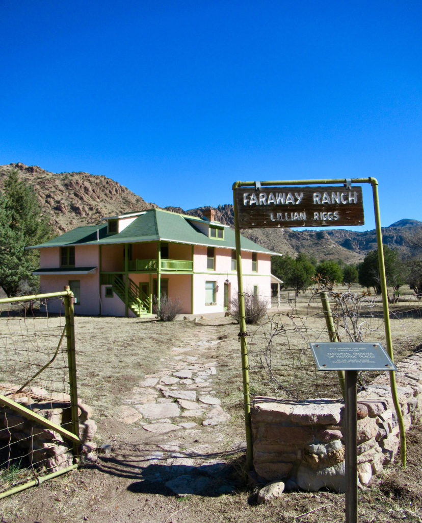
Long Ago & Faraway Ranch
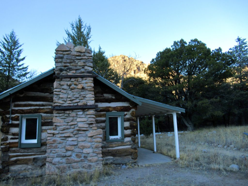
Continuing along the 1.2-mile (1.9 km) long Silver Spur Meadow Trail, we passed the historic Stafford Cabin and entered Faraway Ranch. Every weekend (Saturday & Sunday), park staff offer free tours of the main ranch house at 11:00 a.m. and 2:00 p.m.
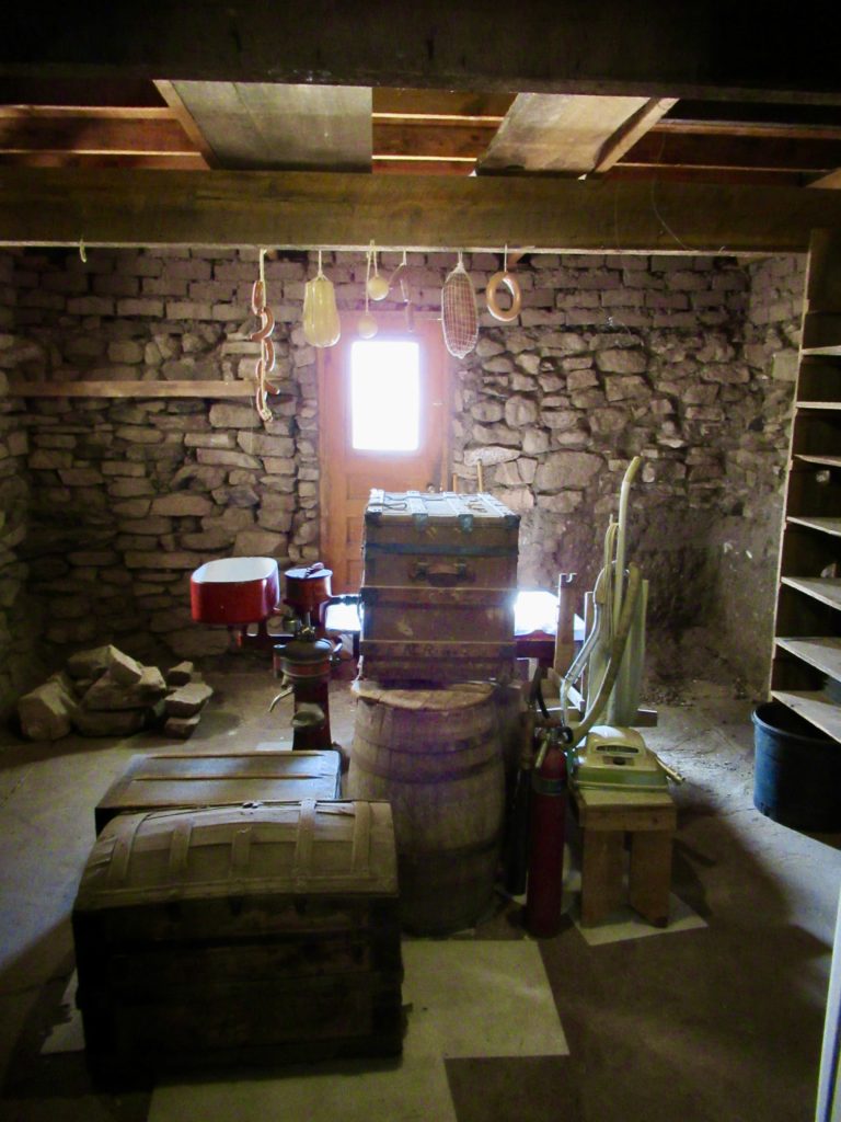
I am a sucker for back story. The next day and early the next day, we are sitting on the benches outside the two-story, peachy-pink, stuccoed home waiting for the tales to begin.
Human History in the Chiricahuas
Southeastern Arizona has been home to the Chiricahua Apaches for hundreds of years. As white settlers began moving into the area, tensions began to rise (read more about nearby Fort Bowie). The US government began a campaign to capture Chiricahua Chief Naiche and the renowned Geronimo. Soldiers were stationed all around the border area.

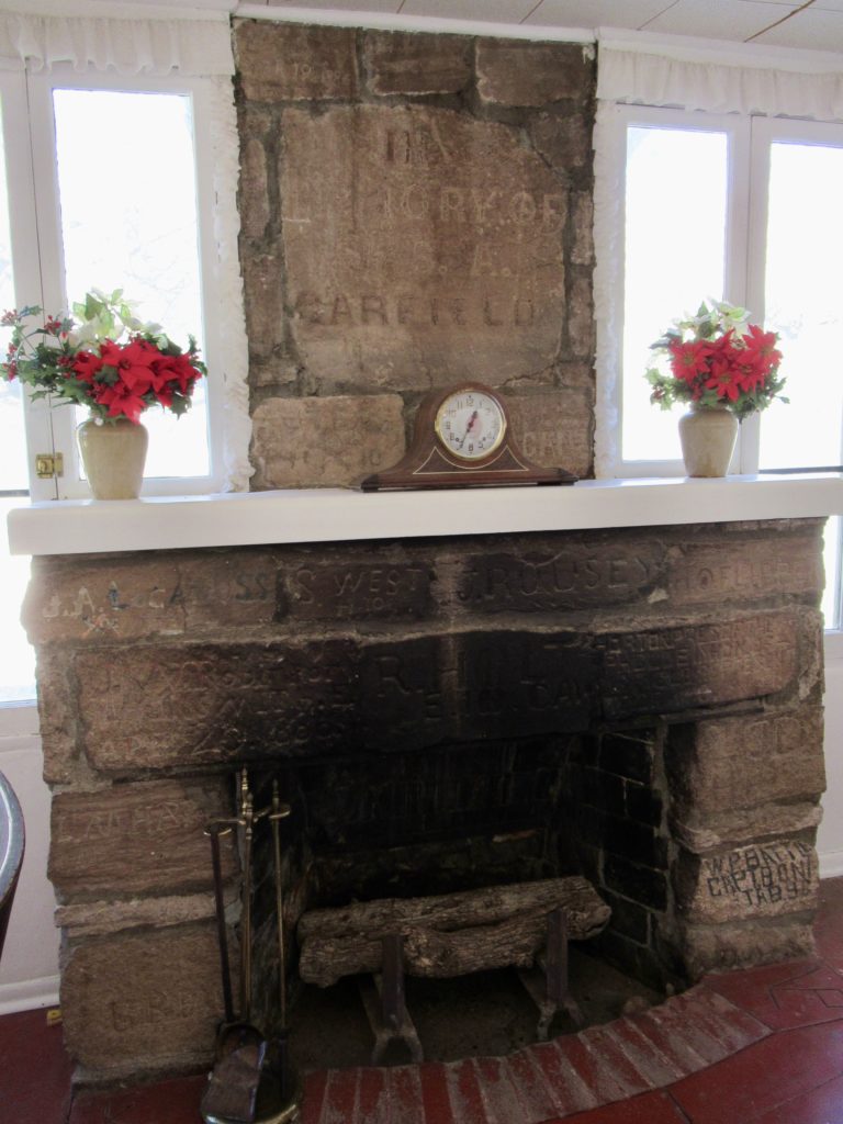
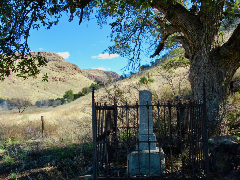
In Bonita Canyon, Buffalo soldiers set up a temporary camp where Faraway Ranch is now. Unfortunately, there are no photos of Camp Bonita. It was a quiet post and the Buffalo soldiers never saw any action. Their stories were never immortalized in history books. The soldiers did create a one-of-a-kind, three-tiered monument to President James A. Garfield. Their names were carved into the stones – proof of their time in the canyon.
After the Chiricahua Apache threat was contained, Bonita Canyon became even more appealing for white settlers. Louis Prue had a ranch at the mouth of the canyon. Ja Hu Stafford and his young wife, Pauline arrived in Bonita Canyon in 1880. In 1886, Swedish immigrant Emma Peterson bought a two-room cabin near the Staffords.
When Emma married Neil Erikson after purchasing her home, she let Neil apply for the 160-acre homestead grant surrounding the cabin. The cabin changed and grew in size over the years. The Erikson family grew to include children Lillian, Ben and Hildegard.
From Guest Ranch to CCC Camp to National Monument
Neil became the first ranger for the Chiricahua Forest Reserve in 1903. Lillian began teaching at nearby schools in 1906. In 1917, Neil and Emma moved to Flagstaff for work. The now adult children took over the responsibility of running the ranch. Hildegard started boarding guests. Life was busy, so busy that Lillian quit teaching and came back to help. Sisterly “discussions” were loud. Guest often heard them arguing in the kitchen!
As luck would have it, Hildegard met a man, got married and moved away. Lillian took over running the guest ranch. Ed Riggs, an old friend, started helping out. By 1923, Lillian and Ed married. Ed added bathrooms, oil heat and electricity to the ranch. They closed the north porch and made a large guest dining room. The highlight was a large stone fireplace – made of sixty salvaged stones taken from the crumbling Buffalo soldiers’ monument.
Guests rode horses out into the rocks of the newly minted National Monument, picnicked, watched birds, swam in the guest ranch pool, and joining in on Lillian’s sing-alongs in the evenings. Because Faraway was a working ranch, guests also had the option of participating in cattle roundups.
Time and the Ranch
In the late ‘30s, the CCC Camp was built on property leased from the Riggs. Ed had an active role in trail building with the CCC enrollees. After the CCC left in 1940, life on the ranch slowed. Ed passed in 1950. Lillian – partially deaf and blind – continued to manage the property. Resilient to the core, she kept the ranch running with the help of a manager, until 1970. Lillian turned 82 that year.
Sadly, Lillian passed on two years before the National Park Service bought out Faraway Ranch in 1979. I hope that somehow, somewhere, she knows that her legacy is being preserved for future generations. The ranch house is currently undergoing renovations by the Parks Service. It looks like it will be a showpiece for the monument’s 100th anniversary celebration in 2024.
Hiking in Chiricahua National Monument
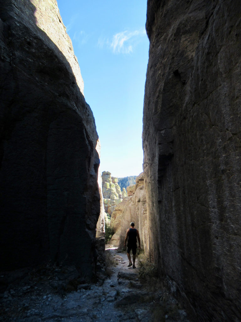
Ed Rigg’s gravestone reads: “He engineered the construction of Echo Trail. He wishes this to be his monument.” You’ll see why when you hike down the wild switchbacks clinging to the edge of the rugged canyon. We made it a 3.3-mile (5.5 km) loop by going down Echo to Hailstone and back up by Ed Riggs’ namesake trail.
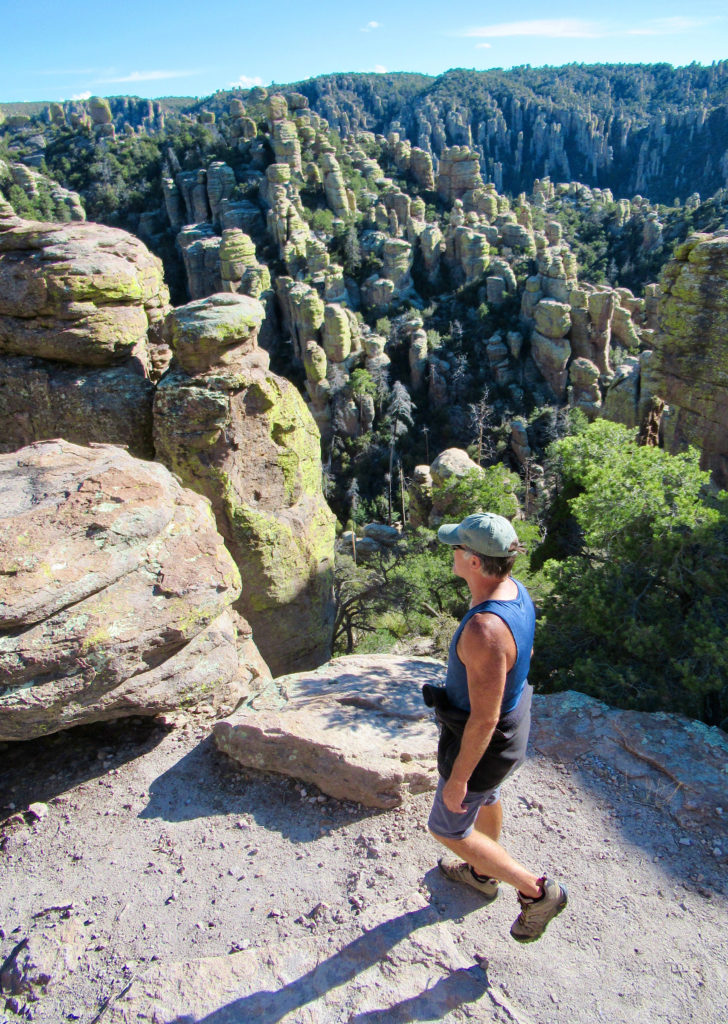
Our second day started at Massai Point. Just after 9 a.m., the pre-booked shuttle van pulled into the campground. We joined eight other hikers for the 20-minute lift up to the summit. Some were hiking Echo Canyon, but the majority were, like us, planning to head down Ed Riggs trail to Mushroom Rock, Big Balanced Rock, Heart of the Rocks loop, Sarah Deming and Lower Rhyolite Canyon trails back to the Visitor Centre. It’s about 7.3 miles (11.8 km).
The trail off to Inspiration Point is an easy side trip that will you make you laugh when you look across the canyon to see Massai Point so close – and yet you’ve been hiking down and back up again for well over an hour! Heart of the Rocks loop brings home the “wonderland” feeling as you stroll past kissing rocks, an old maiden, and so much more.

A few hours later, we were out of the towering pines and walking beneath the Arizona sycamores along the creek by the Visitor Centre. What a day, what a monument.
Hiking, history and a huge celebration coming up in 2024 – is it too early to start planning another visit?
When You Go
Access Chiricahua National Monument off I-10, through the town of Willcox. Take AZ State Hwy 186 for 32 miles (51.5 km) from Willcox to the junction of AZ State Hwy 181. Turn left and follow this highway for another 4 miles (6.5 km) to the Chiricahua National Monument entrance. For further details, visit the park website.

Because it’s a small campground, we highly recommend making reservations through the National Reservation Recreation System or by phone at1-877-444-6777 before arriving. Site are $20 per night ($10 for America the Beautiful – The National Parks and Federal Recreation Lands Senior and Access pass holders).
Leave a Reply