Choosing Davis Camp in Bullhead City, Arizona as an adventure base is a fantastic idea! Setting up camp – directly below Mojave Lake – we explored bits and pieces of the past. We biked and hiked. And we did it all while camping cheaply with the Colorado River on our doorstep. Join us as we dish on this surprisingly good location for RV travellers and adventure seekers alike.
Disclosure: This post contains affiliate links. If you buy something from one of our affiliates, we receive a small commission at no extra charge to you. Thanks for helping to keep our blog up and running!
Table of Contents
An Outdoor Adventure Base at Davis Camp in Bullhead City?
We pulled into Davis Camp at the north end of Bullhead City after an amazing week in Death Valley. It was supposed to be a stopover for one night. Just like Boulder Beach on Lake Mead near Las Vegas, it became a surprisingly perfect base camp for multiple days of adventure!
Don’t get me wrong, but cities are normally not our thing. Although we love museums and cultural events, we do best when we’re away from the hustle and bustle. Things are better when we’re more immersed in natural settings. Bullhead City sits directly across the Colorado River from the bright lights of the casinos in Laughlin, Nevada. Truth be told, Bullhead City is not an overly attractive city. But a base camp for adventures … well now, that’s another story.

What and where is Davis Camp?
Davis Camp is a Mojave County Park located in northern Arizona near the base of the Davis Dam. Construction on the Davis Dam – named in honor of Arthur Powell Davis, Director of Reclamation from 1914-1923 – began in 1942 and halted less than a year later when World War II took precedence.
In 1946, the project geared up again. The Bureau of Reclamation built a small town – called Davis Camp – for the workers and their families. There were homes, a grocery store, gas station, post office, recreation center with a swimming pool, and not just one, but two churches.
A lot of effort went into creating a community that would start to dwindle away after completion of the dam in 1953. Many of the Davis Dam employees moved downstream to newer neighbourhoods in Bullhead City. Empty homes were rented out. By 1982, the Federal Government declared Davis surplus property. Most of the houses were moved. The Catholic Church building remained, although its congregation moved to a new church in Bullhead City.
Various agencies – including Mohave County, Bureau of Reclamation, National Park Service, and the AZ State Parks board – began turning Davis Camp into a regional park. An RV Park was created in the mid-1980s. A few of the remaining homes were renovated to be tourist rentals. Ramadas and picnic areas and additional dry camping at North Beach were added.
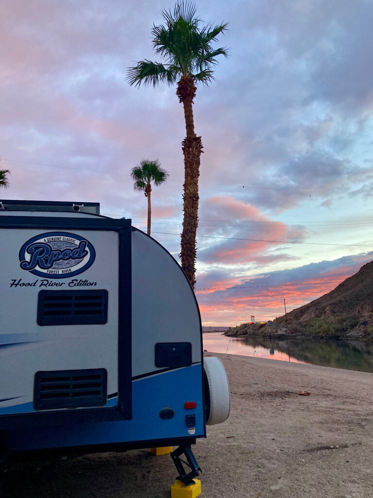
For $20 a night – with access to relatively inexpensive laundry facilities and hot showers in the main RV Park – North Beach became our adventure base.
What to Do Around Davis Camp and Bullhead City?
The first time we stayed here, we hiked Nevada’s Grapevine Canyon and Spirit Mountain Wilderness area. We biked the old railway line across the water – a popular hiking, cycling and jogging path alongside the Colorado River.
Explore Katherine Landing
On this trip we started with an exploration of Katherine Landing on Mojave Lake. It’s just above the dam – a hop, skip and a jump uphill from Davis Camp. Wandering down to the marina, we stopped to read the interpretive panel at the top of the landing. Turns out this area was a mine and mill site from the early 1900s until 1942.
“Everyone worked seven days per week in eight-hour shifts…
Graveyard shift slept in tunnels with the rattlesnakes…when it was 128 degrees outside.”

Today the clean green waters of Mojave Lake and the tranquil marina beckon visitors to relax and explore. We need to come back on a less windy day and get the kayak out on the water!
Heading out along the Lake View Trail – and quickly headed off on a side burro trail to an overlook of both Nevada and Arizona Telephone Cove camping areas. Hmmm… looks like we need to investigate closer!
Bike to Nevada’s Telephone Cove
We could have driven the roughly 4.7 miles (7.5 km) down on the narrow but good gravel road to Nevada’s Telephone Cove. However, it was a little more active to park just off Highway 163 (about 4.3 miles/7 km uphill from Casino Road in Laughlin), unload the bikes and cycle down to the lakeside camping area. The road has a bit of washboard and a few remnant mud puddles from the last storm but is overall in great condition.
Situated on BLM land, the camping area includes less than a dozen sites with a pit toilet and a large blue garbage bin. Lake Mojave water levels were up at the time of our visit, almost reaching the four large cottonwood trees that grace the shoreline. Pretty sweet camping… for free!
Bike to Hike
Our main goal for the afternoon though was to explore the lower end of Grapevine Canyon. We’d hiked the upper section of Grapevine with its incredible petroglyphs on our last visit.
It was just under a 2.5-mile (4 km) stroll on bits and pieces of an old 4×4 road up the canyon between red and gold-coloured cliffs. We scanned for petroglyphs but there were only natural markings on the weathered rocks.
After passing a dry fall on the left, the canyon closed in, pinching off our walk at massive boulder hung up between walls. A series of ropes, each one a little more faded and worn than the other, were tied together as a safety for the scramble up the slick rock on one side. The top piece was not much thicker than a bootlace. We passed and headed back down to our bikes.
With more time we’d have explored the large side canyon about halfway down, but we still had a 4.7-mile (7.5 km) bike ride uphill to the truck. We arrived in time for the sunset glow.
Bike Secret Pass Loop past Thumb Mountain
It looks like a thumbs up when you drive downhill on Hwy 68 from Kingman; coming up from Bullhead City the finger looks a less friendly… haha! Nonetheless we pulled off Hwy 68, bounced over the cattleguard and parked in the small clearing at the bottom of the hill littered with an old couch, construction material waste and miscellaneous other bits and pieces of humanity. Some people!
Things improved exponentially as we climbed the hill on the 4×4 road. It was loose and rocky in a few places but overall, a pretty ride in a counter clockwise direction. We stopped at a road junction, finding a warm nook in the shelter of a large boulder to get out of the wind for lunch. And that’s when I spotted it…
I thought it was a native prayer flag tree like we come across some times while hiking in Alberta. Walking closer, I started to notice they weren’t strips of fabric hanging on the branches. It was the “panty tree” and stripper pole. Only in Arizona!

Continuing our loop, we rode through the remain of an old mining area. Only bits and pieces of concrete foundation remain. The beautiful, sculpted rock of the thumb kept us stopping for yet another photo.
Take a Drive on Route 66
On our last day we opted for an historic adventure and headed up to Oatman. After lunch at the Oatman Hotel, we wandered main street and found one lone burro behind a split log fence at the top of the hill. It was a perfect vantage point out of the busyness of the town hub to reflect on the town as it was – and as it is today.

Oatman grew out of the gold mining boom that began about 1906 in the area. Twenty-five years later, mines in the area had produced over 1.8 million ounces of gold. By 1942, the last of the remaining mines were closed.
Burros came to Oatman with early prospectors. They hauled rock and ore from inside the mine and water and supplies outside. When the mines closed, the animals were set free. Today, their descendants frequent the town where tourists come and buy “burro food” to feed them and take photos.
Exploring a National Scenic Byway
The road up to Oatman and over Sitgreaves Pass in the Black Mountains is part of a National Scenic Byway. In 1926, Route 66 linked the nation from east to west. The Black Mountains section – 42 miles (67 km) from McConnico to Golden Shores – was part of the route until 1953, when a flatter route was built through Yucca, Arizona.

Driving the scenic backroad – now called the “Historic Route 66 National Back Country Byway” – I had no trouble imagining a Model T Ford navigating the mountain pass in the dustbowl ‘30s. I could almost visualize post-war adventurers seeking the open road as they got their kicks, on Route 66.
We stopped in at Kingman’s Visitor Centre – home to the Route 66 Museum – to pick up a new copy of the Arizona Gazetteer for future adventures in the state with call of the open road and adventure ringing in our ears before we headed back to Davis Camp for one last night.
Adventures by car, by bike, and foot – this historic area has so much to offer and Davis Camp makes the perfect base.
When You Go to Bullhead City & Davis Camp
Davis Camp is a Mohave County Park at 2251 Highway 68, Bullhead City, Arizona. You can make reservation by phone at (877) 757-0915 or through their website.


Leave a Reply