We launched with the wind at our backs, sun warm overhead. Buffalo bean bloomed golden in young green grass. Cliff swallows flew an aerial salute. It was a picture-perfect day for canoeing the Oldman River from Monarch to Lethbridge.
We had two half and two full paddle days set aside for this 52-kilometre stretch. I read another post where one group did triple our distance on the Oldman in four and a half days, but as you might guess, we’re into slow travel. It’s all about taking time to discover the natural and cultural history of this prairie river – and enjoying appys and cocktails riverside at the end of the day!
Disclosure: This post contains Affiliate links.
Table of Contents
Easy Adventure On!
Right out of the chute, there was a small riffle with midstream rocks. Instream assessments are part and parcel of paddling in lower flow levels. The Oldman was just starting to rise. We chose to go right down the middle. Turns out we were right, this time.
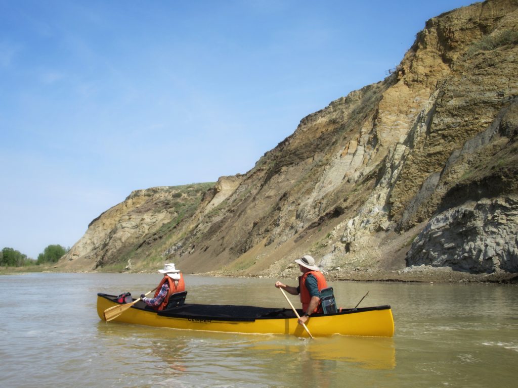
At the first sharp left corner, towering sandstone cliffs with a multitude of layers had us thinking this trip was going to be more photo opp than anticipated. On the left bank downstream, a coyote trotted quickly up a grass-covered slope. Hawks soared above and mergansers and geese quickly became the most common bird sightings.
Be sure to check out our recent trip paddling the Oldman River: Nolan’s Bridge to Taber.
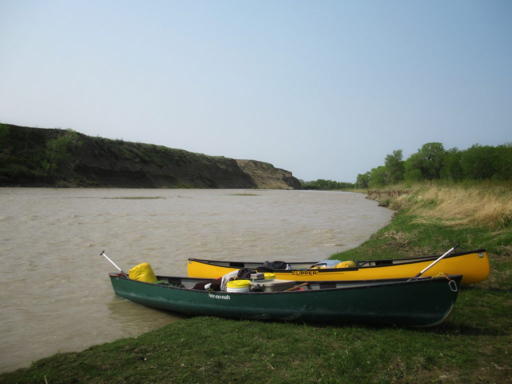
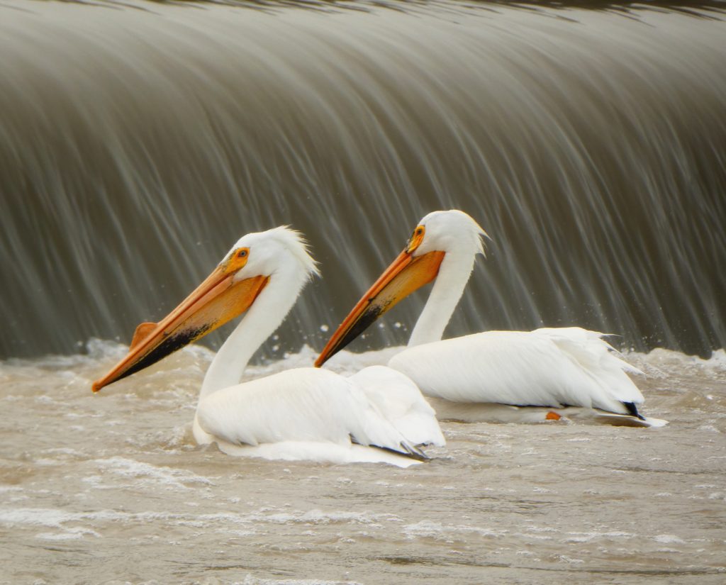
Eight kilometres downstream, the turbid Belly River meets the lighter green brown of the Oldman. Pulling out upstream of the confluence on river right, we eyed the fine collection of tumbled river rock with excitement. Of course, the goal was to find a campsite and as pretty as these cobbles appeared, they weren’t going to make for a comfortable night. Lucky for us, a finger of sand was hidden slightly inland. Home sweet campsite. Fishing pelicans provided evening entertainment while we munched happily on sundried tomato bruschetta and freshly smoked salmon and toasted the day.
Naturally A Great Trip!
River life is always diverse and canoeing the Oldman River is no exception. Coyotes howl and beavers slap their tails at dusk. Mule deer hide in the shade of ancient cottonwood groves during the day, while white-tailed deer bound away across grassy hills. Birds buzz, chirp, sing and sit silent as we drift on by. Here’s a little list of the avian life we found along the way:
- American crow
- American robin
- American white pelican
- Bald eagle
- Bank swallow
- Belted kingfisher
- Black-billed magpie
- Canada goose (with goslings)
- Cliff swallow
- Common goldeneye
- Common grackle
- Common merganser (with chicks)
- Downy woodpecker
- Eastern kingbird
- Great blue heron
- Gray catbird
- Gull (species unknown)
- House wren
- Killdeer
- Mallard
- Mourning dove
- Red-eyed vireo
- Red-tailed hawk
- Ring-necked pheasant (heard, not seen)
- Rock pigeon
- Spotted sandpiper
- Swainson’s hawk
- Western grebe
- Western meadowlark
Canoeing the Oldman – Day Two
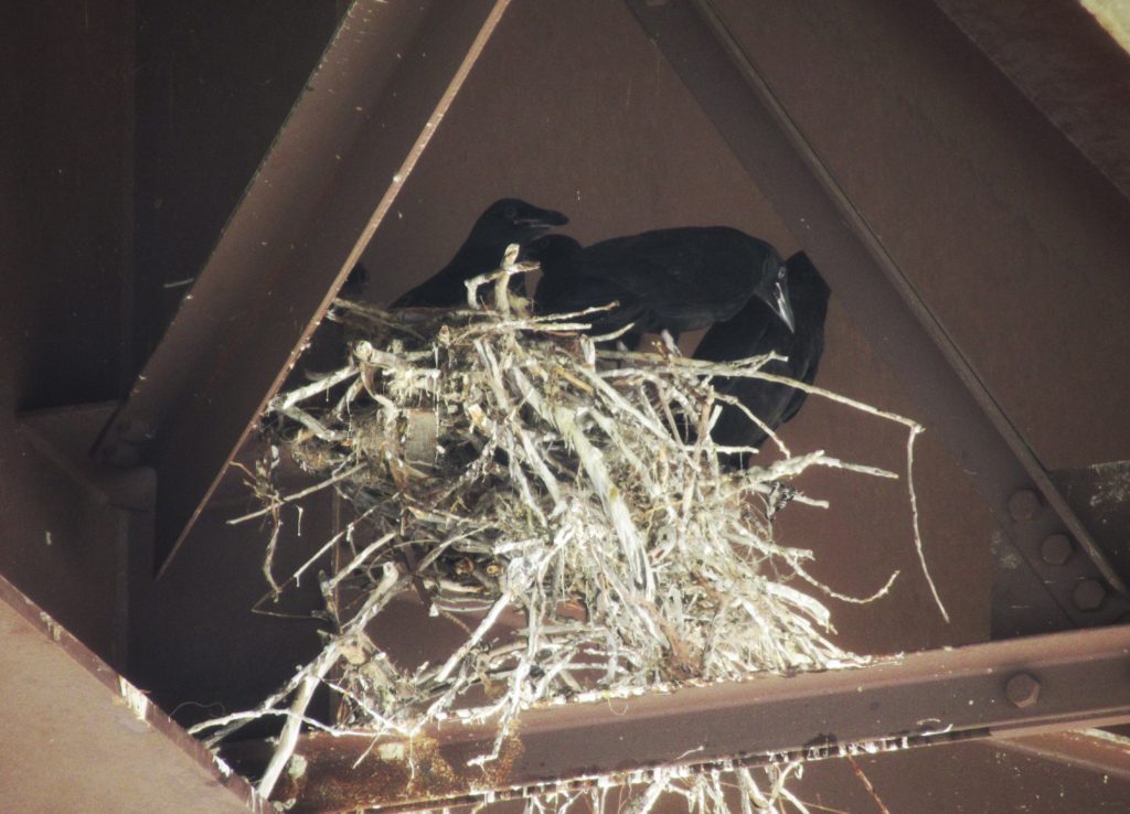
It was more of a float, punctuated with moments of actual paddling as the current picked up in the twists and turns of the river. Most of this section of the Oldman was wide and slow-moving, perfect for “what’s that bird on the left shore?” and “who’s that in the tall cottonwood on the right?” Another highway bridge was cluttered with swallow condos and a messy crow’s nest – complete with four curious young.
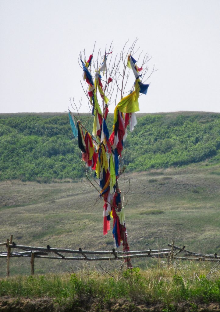
A barren cottonwood pole draped in colourful strips downstream on river right, had us backpaddling and questioning “Sundance site?” The entire river right side, from the Belly River to St. Mary River was off-limits for us as it is the northern terminus of the Blood (Kainai) Reserve. We didn’t have permission to access but canoeing the Oldman River by we were reminded of the close connection of the people to the river we were paddling.
Napi – The Old Man
According to Kevin Van Tighem’s book “Coming West: A Natural History of Home”, Blackfoot origin myths say that the first people to make their homes in southern Alberta were put there by Napi, the Old Man. The Blood are one of three nations comprising the Blackfoot Confederacy. Napi made their world and everything in it. He taught the people how to survive. He taught them how to hunt. When he was done, Napi retreated to the mountains near the source of the river that bears his name, the Oldman.
Did You Know?
Buffalo bean (Thermopsis rombifolia) blooms in May and June. It was an important traditional indicator for the commencement of the spring hunt, when the bulls were in prime shape. Buffalo bean is also known as golden bean.
Change is Coming
The first residents of European origin in the Oldman River basin were American whiskey traders. In the early 1870s, they began trading with the Blood and Peigan tribes. Whiskey forts became legitimate trading posts after the arrival of the Northwest Mounted Police (NWMP) in 1874. European settlers followed in the footsteps and hoofprints of the NWMP.
In 1877, the chiefs of the Blackfoot tribes and representatives of the government of Canada signed Treaty 7. Under the terms of this treaty, the Blackfoot surrendered all of their land, including the entire Oldman River watershed, to the Crown. In return, the government agreed to allow the Blackfoot to hunt throughout the area and to reserve a block of land for occupation by each tribe. The Blood reserve is approximately 1,424 square kilometres (549.7 sq mi). It is bordered by the Oldman, St. Mary and Belly rivers. The Blood Reserve is the largest Indian reserve in Canada.
The Sun Dance is a sacred ceremony practiced by the Blackfoot. It was filmed for the first time in Colin Low’s “Circle of the Sun.” Although seriously dated, the 1960s film provides a little insight into the Sun Dance. Today all we saw was the remains of the ceremony, a cottonwood pole draped with multi-coloured strips of fabric. Still, it was enough to make us reflect on the connection of the people to the land to the river.
From Sun to Storm
Our third day had us paddling past eroding cliffs of black shale – source of ammonite fossils. Ammonites are extinct mollusks that had flat, spiral shells. Ammolite is cut from the shells of ammonites. This gemstone reflects a rainbow of colours. It is Alberta’s provincial gemstone. Traditionally, ammonite fossils were healing stones and stones that bring good luck. They are called “Iniskim” or Buffalo stone. We saw signs of collecting along the shore and fragments of fossils left behind.
Paddling downstream, we lunched on a gravel bar, watching the antics of a pair of herons on the opposite shore and listening to the call of cattle from a nearby ranch. The sky was clear, the sun was warm, but less than an hour later we watched the first puffy cumulus clouds pop up. Within two hours, the cauliflower-shaped clouds were overpowering the sun. Pulling in downstream of St. Mary River, we set up camp.
Nature Rules
This time, our shelter was built for wind and rain instead of relief from the sun. By 5:00 p.m. the wind hit, quickly followed by rain and the first few flashes of lightening. At 7:30 p.m., we were still huddled around the camp stove, appreciating the last few drops of Mediterranean stew that warmed our bellies. When the lightening flashed and there was no time to count “one thousand one…”, we accepted that we were in the heart of the storm. Not fun.
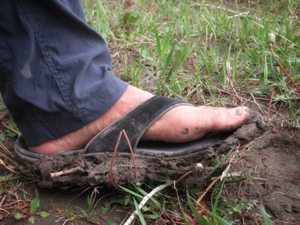
But storms pass and day four shone bright. We were at the takeout by lunchtime, a little bedraggled, but thinking wouldn’t it be great if we could just keep canoeing the Oldman River downstream, learning more about the cultural and natural wonders of this amazing prairie river.
When You Go
The Oldman is an easy Class I river suited for novice and intermediate paddlers, depending on the flow. We drove from our home to the launch point at the Monarch bridge on Highway 3A, unloaded gear, shuttled a vehicle to the takeout point just below the weir in Lethbridge and were canoeing the Oldman River by mid-afternoon.
(Photo: Megan Kopp)
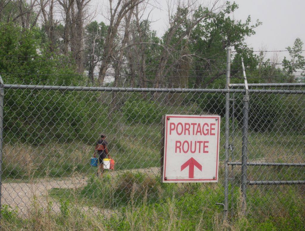
We took out at the river access just above the weir. Our advice: don’t do this! The portage route around the weir is 700 metres each way and the pullout off the river is only a couple hundred metres below the weir. It took us multiple trips to pack the gear and boats. Plan to take out upstream at Popson Park. It does cut eight kilometres off the paddle, but vehicles can drive to within 50 metres or so of the river. If you really want to follow our route, remember to pack canoe wheels!

We used Mark’s Guide to Alberta Rivers as a source for maps and detailed river information.
More Alberta Paddling Adventures!
Canoeing the South Saskatchewan River: Medicine Hat to Sandy Point
Paddling the South Saskatchewan River: Old Bindloss Ferry to Estuary


I don’t blame you for wanting to take your time canoeing the Oldman, with all that beautiful wildlife. Thanks for sharing your incredible adventure. Pinning this.
Appreciate your comment, Christina (and thx for the social share!).
Woops, sorry. Sharing to FB, instead.
Thank you for sharing this well written post. I don’t blame you that you wanted to take it slow. to enjoy nature learning more and more about what god has given us.
Thx Laura!
My wrists won’t put up with a canoe paddle anymore, but it’s nice to take the trip with you from the comfort of my couch.
We’re honoured to have you along for the adventure Ellen!
What a wonderful trip! I’ve only done one multi-day canoe trip, and that was back in middle school days. But I’ve always wanted to do more! I actually spent a full month on the Blackfeet reservation one summer, so I loved the section on the history of the river and the tribe.
Cool connections, Maggie. I hope you get back on a river one day soon!
Wow what an amazing trip you had! I’ve never even been in a canoe, but would have loved to see all the wildlife you did!
Thx for your comment, Shannah. River paddling and wildlife sightings are a magical combination, for sure!
This is beautifully written and really helped me imagine the place. It sounds like even someone non-athletic like me could manage it, since you were going with the current of the river.
Short sections would work for almost anyone, definitely! The overnight aspect require hauling gear up slippery banks and rocky shores – which can be a bit more of a challenge.
Wow. Two full days and two half days do not sound a little to someone who never embarked on such canoe adventure! I hope one day I’m gonna do something similar. Well, after I find a partner I can rely on when I get tired of rowing 🙂
Nice thing about river trips is that they generally flow in the direction of travel! If you’ve lots of time, you don’t have to paddle the entire distance!
I was very excited to stumble across this post! I have kayaked along the Oldman before, but further up steam. Would you say you could have done that run (Fort Macleod to Monarch) in two days? Or would that be a hard two days paddle?
I’d love to hear what your suggestions for 2 or 3 day paddles in the area are.
You know I just see that you did Monarch to Lethbridge, not Macleod to Lethbridge. Silly me!
No worries; hope you are out enjoying the rivers!
We had originally planned to do the Fort Macleod to Monarch stretch, but changed last minute for Monarch to Lethbridge. Macleod to Monarch would be easily done in 2-3 days. Happy paddling!
Great post, thanks this is a wealth of information. I have always wanted to do this in my kayak but was stunned to find out how long it took. I had thought it would only take a day.
I stumbled across this when trying to find information on kayaking from Lethbridge to the 845 bridge between Coaldale and Picture Butte.
Have you or anyone you know completed that route? If so how long would it take.
Thanks Rob! You could probably complete our route much faster in a kayak – we also tend to do a lot of floating, back paddling and stopping to investigate interesting sites. We haven’t done section from Lethbridge down to the 845 bridge yet – nor do I know anyone personally who’s done it. Wish I could be of more help. Will post more if I find any details. Cheers, M.
Thank you for the post. I was looking at kayaking the oldman from Monarch to Taber and was wondering at what flow level would be best? Or what level is to high?
Good question! I’m not sure of the answer myself, but there’s a good source for recreational paddling flows that suggests minimal flow is 30 cubic m/s with preferred flow being 55 cubic m/s. The higher the flow, the more difficult it is to find campsites and there’s more debris to worry about.