Canyonlands National Park is a bucket-list destination in southern Utah. Canoeing the Green River through the park bumps it up a notch. The river cuts a swath through gold and red sandstone in Canyonlands as it lazily meanders through Stillwater Canyon on its way to the Confluence with the mighty Colorado River. Join us to learn how to prepare for a canoe trip of a lifetime from the put-in at Mineral Bottom to the take-out at the Confluence.
Disclosure: This post contains affiliate links. If you buy something from one of our affiliates, we receive a small commission at no extra charge to you. Thanks for helping to keep our blog up and running!

Table of Contents
Canoeing the Green River
Travel downtime due to the pandemic has been a mixed blessing. While we can’t make any firm plans for future trips, it has given us time to look back on past travel. After reading a few of these trip journals, I’m realising that there are so many outdoor adventures I’ve never written about – like canoeing the Green River in Utah from Mineral Bottom to the Confluence. Which is surprising, because we love it.
What’s not to love about a 52-mile, four-plus day, flatwater float through ever-deepening canyons painted in shades of gold and red and brown and white? What history buff wouldn’t love to follow in the paddle strokes of Major John Weseley Powell’s group exploring and mapping the river in the late 1800’s? Who can’t appreciate the ruins and rock art left behind by the Ancestral Puebloans (formerly known as the Anasazi)? And who wouldn’t love to see desert bighorn sheep high on the cliffs and listen to coyotes sing a song at night?

A Word of Warning
Before I go any further, I have to say that this self-guided trip may not be for everyone. It is remote. You need to be prepared for the unexpected. One of the chapters of my upcoming e-book of some of our travel misadventures – I’ll Never Pee in the Woods Again – is taken from a newspaper article I wrote years ago all about canoeing the Green River from the namesake town down to Mineral Bottom. It’s an epic tale of a wind misadventure on this same river.
Wind, weather and water levels can all take this float from easy to “what the heck?” in no time! Knowing this and being prepared is key. If you’re still keen, this post will give you the details and resources to help make canoeing the Green River a trip worth remembering.
Get the Guides
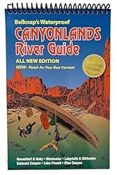
No, this isn’t a guided trip. By guides, I mean books and maps. You’ll want to spend time reading through them and familiarizing yourself with the trip before you put a paddle in the water. Two essentials are Belknap’s Waterproof Canyonlands River Guide and the River Guide to Canyonlands National Park and Vicinity.
Why two guidebooks? Because Belknap’s is more of a mapbook, showing each bend in the river. It has a bit of information – usually historical tidbits – scattered throughout the pages, but its strength are the maps.
On the other hand, Michael Kelsey’s River Guide is packed with details on what to see along the way and when you explore side canyons off the river. It maps out countless historic sites and prehistoric ruins and petroglyphs (or rock art) worth stopping to see. This pair of books work well together. Our copies are well-marked with our own notes – including best campsite locations!

Bottoms Up to Mesa Top!
You might find the terminology used in these books and maps a little different. Wide, flat spots along the river’s edge are called bottoms. They are usually given a descriptive name like Mineral Bottom or Hardscrabble Bottom. Sometimes they are named after historic residents, such as Tidwell Bottom or Anderson Bottom. Canyons are also named. Horsethief Canyon is just downstream of Saddlehorse Bottom.
Occasionally trails will climb out of the side canyons to the mesa – or table top. Bighorn Mesa rises above Fort Bottom. Although you can hike out of Fort Bottom up to the White Rim Road, you can’t actually access the mesa itself at this point.
Choose Your Dates
The best time to float the Green River from Mineral Bottom to the Confluence is in spring or fall. Temperatures are too hot during summer to spend much time exploring side canyons off of the river. We chose the middle of May for this canoe trip down the Green – and it was on the verge of being too hot. Winters are too cold.

Water levels can be too high in early spring to find good campsites. Of course, conditions change from year to year, so you’ll need to do some research. Check resources for water flow and weather forecast (when it’s closer to your date of trip).
You’ll need a minimum of three days just to paddle this section of the river. It is always advisable to add an extra day in case you run into weather – which is likely! Also, factor in the number of extras days you’ll need for off-river adventures. You’ve had time to read the guidebooks. What sites do you want to see along the way? Do you want to spend more than one night at a campsite? We took a week for this trip from Mineral Bottom to the Confluence because we love hiking and exploring prehistoric sites.

Get the Permit
The canoe trip from Mineral Bottom to the Confluence travels through Canyonlands National Park. A permit is required. Now that you know your dates, you can get your permit online, in-person at the Backcountry Permit Office in Moab or from any Canyonlands National Park visitor center – when they are open.
Note: If you are out for a longer adventure and choose to extend this trip to include Labyrinth Canyon – for a roughly 120-mile trip starting upstream at Green River State Park, Crystal Geyser or Ruby Ranch – you will also need to have a valid BLM permit.
Book a Shuttle Service
It’s a one-way trip down the Green River to the Confluence. Unless you have arms of steel and want to attempt paddling back up the Colorado to Moab, you’ll need to arrange a shuttle. Companies will take you and your boats and gear from their compounds in Moab (where you can leave your personal vehicle) to the put-in point at Mineral Bottom.
It is about an hour and a half drive from Moab to Mineral Bottom. This includes the last mile and a half, 900-foot descent on a one-lane, switchback, dirt road to the put-in. It is impassable when raining. Adventure on!

Pickup via jetboat is set for a specific time, location and date – although my journal notes our jetboat was an hour early! You can choose to be picked up at the Confluence or downstream at the Spanish Bottom campsite. Your gear must be ready to load as soon as the boat arrives.
For more information on a jeboat shuttle out of Moab and to confirm prices and details, visit Tex’s Riverways.
Get the Gear
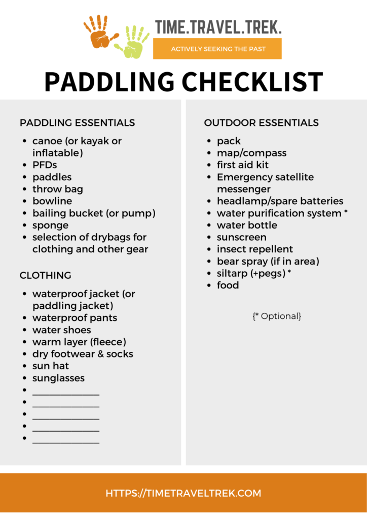
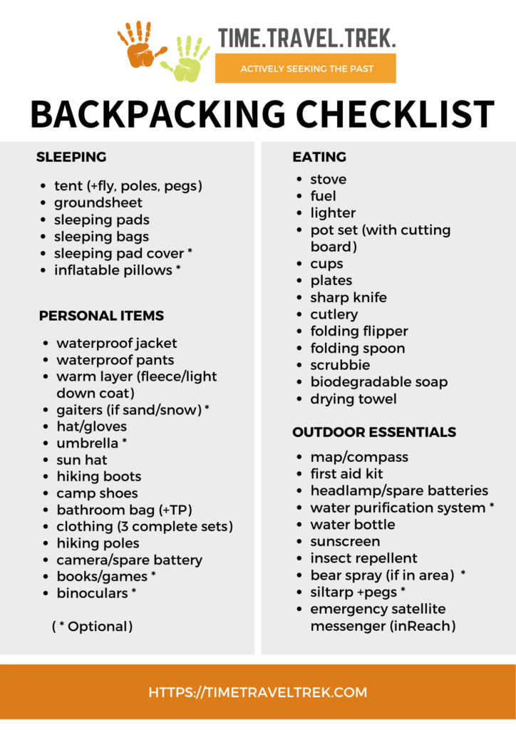
Feel free to use our backpacking and paddling checklists to help you get started organizing the gear you’ll need for this trip. We recommend good water sandals that can be worn with socks to double as lightweight hiking shoes.
Buy, borrow or rent?
We do a lot of backpacking and have garnered all of the camping gear – from tent and sleeping bags to stove and cooking gear – we need to travel off-the-beaten path in comfort. Because we also love river-tripping we have a bought more than a few waterproof bags to keep our gear dry while on the water. If you don’t have camping gear or drybags, you can rent them from river outfitters in Moab.

We rented rafts for the San Juan River trip and rented canoes for this section of the Green River because we were on an extended trip and this week was the only canoe portion of our travels. Friends borrowed a few of our extra drybags to save them having to buy or rent. If you can borrow gear, it’ll save you a few dollars on gear that you may use only once or twice.

A Few Dirty Facts
Spoiler alert – you need to pack out all human waste on overnight trips on the Green River. We highly recommend renting a toilet system from an outfitter (one that includes disposal and cleaning after the trip).
Fire pans are also mandatory in Canyonlands National Park and surrounding BLM lands regardless of whether or not you plan on having a fire while camping on the river. I guess it’s because you might end up changing your mind partway down the river. The point is to Leave No Trace. Fire pans must be at least 12” in diameter with a 2” lip. We used a metal garbage can lid, but you can rent fire pans as well.

Important Note about Water
You will need containers for fresh drinking and cooking water. Even if you have a water filter, the river is always silty and cannot be filtered easily. Be prepared to pack at least 1 gallon per person per day with extra for cooking meals.
Cool tip: freeze fresh water in empty juice jugs and use in your cooler as ice. When they thaw, the water can be used for drinking or cooking.
Enjoy the Adventure!
We’ve done a total of four different canoe trips on the Green River over the years – two trips through Labyrinth Canyon from Green River State Park to Mineral Bottom and two trips through Stillwater Canyon from Mineral Bottom to the Confluence. Each one was unique. Each one had its own sense of adventure.
I’m not going to describe this trip bend by bend and stop by stop, but I will share a few snippets from my journal to inform and – hopefully – inspire.
Journal Entries
May 15
Meet park ranger at the river. Checks permits and gear and gives us the river rules talk. One other group of 8 from BC, 1 group of 2 in a raft, 1 group with 3 boats just arriving as we leave. Busy time of the year.
Floated – seriously floated – down to Horseshoe Canyon, 7 miles. Arrive 2 pm. Hot. Water level high enough to paddle up wash to second campsite. Walk to petroglyphs.
May 16
Paddle 14 miles to Bonita Bend. Water level high enough to paddle up wash short distance and pack up to flat spot (lots of red ants) under cottonwoods. Bit of an awkward unload, person in boat handing up to those on shore. Rest in shade until cloud cover thickens.
Walk over soda flats, up pink sandstone to cliff – frog-shaped buttress – and around to flats where old spring (can see building) and another group of campers set up. Continue hugging cliff following windswept path up pink sand and there is a fantastic petroglyph panel. One figure holding shield – which is unusual. Ubiquitous deer and desert bighorn sheep images.

Book said cowboy glyphs at entrance to side canyon – not. Glyphs right on wall opposite fence for stock trail. Guys did a little skinny-dipping a short 15 feet or so to dry fall. Managed rash-worthy climb unscathed.
Back to camp as dark settles in – dinner by headlamp.
May 17
On river 9:48 a.m. Short 9-mile to Turk’s Head, but stops along the way to scout for ruins.
Passed group of three boats camped on bench upstream of Boulder glyphs. No trail to petroglyphs, carried on. Group of two boats with full head-to-toe covered (sunhats with back shade flap, long-sleeved shirts and pants) pull up on rocks where we think we started the hike to Boulder Glyphs the last time we were here. Older man said best access was downstream where trees (read: tamarisk) ends.
We pulled into corner – narrow ledge to pull out on – sketchy path, but there was a path – even cairned after it opened up away from the cliff edge. Panel still impressive. Petroglyphs on 3 sides on the boulder.

Cactus blooming – yellow, pink and red. Great blue herons, night herons, vultures, ravens, songbirds tucked in riverside scrub. Round corner to Turk’s Head for our two-night stay.
Need lunch ideas for your next paddle trip? Check out 10 Best Sandwiches for Outdoor Adventures!
May 18
Up early with sun, but lazy day approach. Coffee on rock patio watching river flow by, breakfast 10 am, hike 11 am to Anasazi ruins and chert knapping sites. Sprinkle of rain!
Back for late lunch (1:30 pm) on patio. A little reading, a little writing, a little dozing naptime. Clouds moved off to northeast. No more sprinkles. Chatted with Keith and Sandra – fellow canoeists from northwest Oregon who pulled in for lunch at our camp…
Need some meal planning inspiration? Check out our canoe trip meals post!
May 19
Paddle from Turk’s Head to campsite at Spanish Bottom. Small rapids below Confluence were first sign of how this river is about to change downstream. No one else here at Spanish Bottom! Walk to larger downstream rapids – beyond mandatory canoe pullout – and watched a few rafts go by. Glad we’re pulled up snug in camp above this!

May 20
Hike Doll House. Hot. It’s very hot. View from top is worth the effort. Back at camp, two women from Colorado pull in. Helped unload their gear. Looks like we’re in same jetboat tomorrow.

May 21
Pickup scheduled for 1 pm. Boat arrived at noon. Sticks floating in high water a problem. Two stops to clear jets. All to the front to raise the back of the boat so that it can be cleared!
Still smiling.

Five Simple Steps
That’s it! There are five (somewhat) simple steps for an unforgettable paddle on the Green River from Mineral Bottom to the Confluence:
1. Get the guides
2. Choose your dates
3. Book a shuttle
4. Get the gear
5. Enjoy the adventure!
PIN THIS POST FOR FUTURE REFERENCE!


Well that brings back good memories.
Thinking of you guys the whole time I was writing 🙂
Woooah what an amaaazing way to see the Canyons!
I wouldn’t be keen on meeting scorpions but everything else about this sounds fantastic! I love the mix of hiking, seeing the views and paddling. The scenery and the boulder glyphs are simply amazing.
I don’t have much experience paddling though, so I would be a bit tempted to do this as part of a mini tour…
Or start slow and build up to this trip (it’s worth the extra effort!).
This looks like an awesome adventure. I would love to try it out myself.
🙂
Canyonlands is one of the places still on my bucket list, as the rest of the mighty five. This canoeing trip looks great.
Hope you get the opportunity to visit Canyonlands soon!
What an amazing adventure! The landscapes at Canyonlands look unreal! I’d love to visit one day! I’m not sure we’re quite experienced enough for 4 days of canoeing but it definitely looks like a lot of fun! Although I’m not sure I’d like to encounter a scorpion…yikes! Thanks for the great guide!
It is a beautiful place – and you can always start with shorter canoe trips to build up to a multi-day one!
I’ve never actually been in a canoe but I would love to try it. This looks like such a pretty spot to visit.
Yes, it is a beautiful place to visit – but if you’ve never been a canoe, you will want to start with something easier and work your way up to it. As I mentioned in the post, this is a remote paddle that can be unpredictable with wind, weather and water levels. A worthy goal – after you get a few trips under your PFD!
Have done this trip many times, sometimes upper sometimes lower section. We take our time. Enjoy the scenery. Each trip is alittle different. You didn’t mention the mud one sometimes run into, especially in an end of summer trip. May be because the water is higher in spring, there is no mud!🙂
Haha! We have seen our fair share of mud – even with spring high water – but as you noted, each trip is a little different!
Definitely looks like a unique perspective on seeing the local scenery. I’m not sure I’d be ready for a canoeing on the river trip but it looks like a fun activity to work towards (minus seeing the scorpions). The petroglyphs are really cool though.
The prehistory in this part of the world keeps us coming back time and time again – it’s amazing!
This is really great – I’ve been exploring more domestically with international travel shut down. Definitely a good location to keep in mind.
Domestic travel works, too – especially with this kind of scenery 😉
looks very doable-in higher water times-spring=could I use my Northstar Magic (Kevlar) canoe? I E- no unavoidable rocks . Its definitely not a ‘rock boat, but great for the lake trips its been on
The Green is not terribly rocky – it’s a flat water float (unless the wind is blowing!). So yes, I think you’d do just fine in a Kevlar canoe. Enjoy the adventure when you go!
Thank you- went down lower canyons of rio in March (with guides- Smoking Rivers- )looking ahead will be reading rest of your posts
You’re more than welcome! I’ll do my best to keep posts interesting and relevant 😉
If you were going to do just one of the two trips, upper (GR to Mineral Bottom) or lower ( Mineral Bottom to Confluence), which one would you choose? Which would be the most impressive?
That’s a hard decision as both of these sections for canoeing the Green River are incredible in their own rights. I love the twists and turns and beauty of Labyrinth Canyon but I also love the prehistoric sites along the lower section. If I had to choose, I’d probably pick Mineral Bottom to the Confluence.