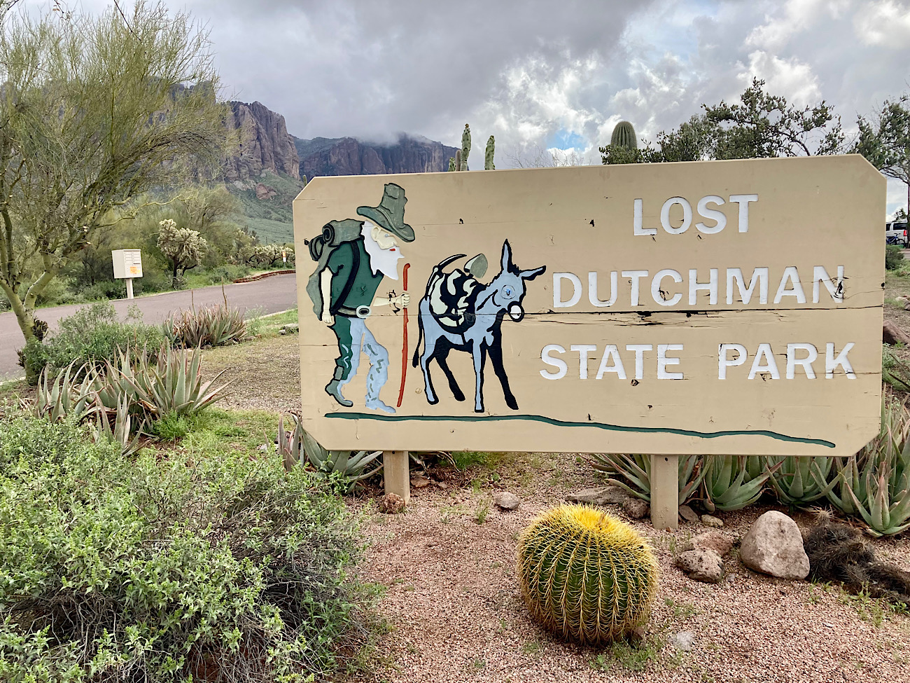
Thinking about camping at Lost Dutchman State Park? If you like outdoor adventures – from hiking to biking to paddling – you’re going to want to stay here! Not convinced? Check out our top 7 reasons for choosing Lost Dutchman State Park campground as your adventure base.
Disclosure: This post contains affiliate links. If you buy something from one of our affiliates, we receive a small commission at no extra charge to you. Thanks for helping to keep our blog up and running!
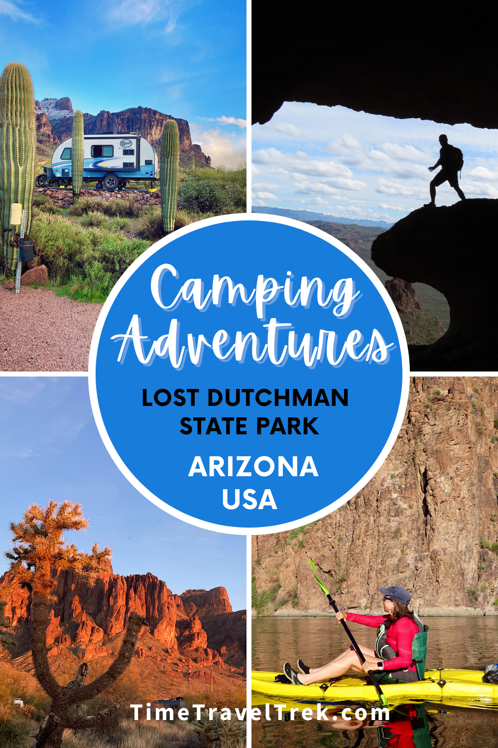
Table of Contents
7 reasons for camping at Lost Dutchman State Park
There are 33 state parks in Arizona and we are slowly checking them off, one by one. Camping at Lost Dutchman State Park near Metro Phoenix is one of our favourites – for many reasons. Here are our top 7!
Reason #1: Location
When choosing a campsite, think location, location, location. Lost Dutchman is relatively close to Metro Phoenix – with the conveniences of nearby grocery stores and a Multi-Generational Center with indoor walking/running track, weights, stationary bikes, ellipticals, yoga classes, pickleball, etc., near the Apache Junction Library for occasional rainy days – but the park is a world away from the hustle and bustle of the city.
The park is situated at 2,000 feet (610 m) elevation in Sonoran desert at the base of the volcanic-formed Superstition Mountains. Many species of cacti thrive in the arid climate with an average rainfall of about 14 inches (35 cm). Winter daytime temps usually climb to 60° F (15.5 ° C) – perfect for active outdoor adventures – and one reason the park’s busy season is from October to April.
Evening brings a nightly light show across the face of eastern peaks as alpenglow paints a rosy blush over the rocks. Camping slightly above the valley also allows for spectacular sunset-gazing to the west.

Reason #2: Intriguing history
Although the park was only officially dedicated in 1977, the area has long history. During the 1840s, the Peralta family of northern Mexico came north. According to legend, they developed gold mines in the Superstitions. Ambushed by Apaches, all were killed except for a couple who managed to flee back to Mexico.
Thirty years later, Jacob Waltz (aka “the Dutchman” although he was from Germany) is said to have located the mine. Waltz and his partner, Jacob Weiser, worked the mine, and hid some of the gold in the Superstitions. The location of the riches was apparently lost… and the Lost Dutchman became legend.

If history is your thing, consider taking a drive from your camp at Lost Dutchman
towards historic Globe and visit Besh-Ba-Gowah Museum & Archaeological Park!
Reason #3: Hiking Beyond Flat Iron
Flatiron is a bucket list hike for many people – even though almost every time we stay at Lost Dutchman, we witness at least one helicopter rescue off the difficult route. The first time we tried it, we got off route – a common problem with no official trail – and ended up under the cliffs below the summit before descending unscathed.
Gear guru has since summited twice. Not being a fan of potential rock fall from hikers scrambling above, I opted for other adventures.
Lost Dutchman State Park has a variety of easy trails – from the Native Plant Interpretive Trail to the Discovery Trail (connecting the campground and day use areas).

Plus these little gems:
- 2.4-mile (3.9 km) Treasure Loop Trail
- 0.7-mile (1.1 km) Prospector’s View Trail – connector between Siphon Draw & Treasure Loop
- 0.8-mile (1.3 km) Jacob’s Crosscut Trail – connects Treasure Loop with Prospector’s view and continues out the park along the base of the Superstitions to Broadway Cave
- 4-mile (6.4 km) round-trip Siphon Draw Trail – leads up into a scenic canyon before disintegrating into the non-designated Flatiron Trail.
All of these trails are easily accessed from your RV site.
Reason #4: Nearby hiking adventures
There are dozens of hiking options nearby Lost Dutchman. Another hike from the park is the Broadway Cave Trail. We used AllTrails to help us pick the best route. It’s 2 miles (3.1 km) up to the cave. The section is a little rubbly and rocky with a gentle climb; the last part is steep up. Broadway Cave is actually the remains of a short mining tunnel – sorry, no gold!

Silly Mountain loop is a short drive from the park (turn left on Mountainview Road off SR 88 from the park and follow it to just before junction with Highway 60. Turn left on 32nd Ave and right on Silly Mountain Road to the parking area with washroom and picnic table).
We did a 2.5-mile (4 km) loop to a little bump by the highway via Brittlebush, Crest, and Old Baldy – but there are lots of options for linking trails (next time we’ll try “Huff and Puff”!).
Though not an official hiking trail, and requiring a little navigational skill to follow, Canyon of the Waterfalls is an interesting hike. We parked on Second Water Road, hiked across the slopes to the rock fins and down into the next canyon.

Climbing above the little waterfall trickle, we accessed the steeper, rougher path leading to the split in the canyon. From here is was a short climb on the right for a view of the falls. A little challenging, but spectacular! In total we did 6.2 miles (10 km) return.
Also down Second Water Road, the Second Water/Hackberry Loop is a 5.3-mile (8.5 km) circuit. We took it in a counterclockwise direction. Passed a group of horseback riders, a few trail runners, and countless day hikers on this super scenic saunter.

Reason #5: More hiking adventures in the Superstition Mountains
Venturing further from the park, we set off one day to explore Wave Cave. It was an 18-mile (29 km) drive from the Lost Dutchman campsite to the trailhead. The Peralta Road turns to dirt about a mile (1.7 km) off Hwy 60, crossing several flowing washes. Go early, this is a popular trail and parking is limited.

Heading back down, we branched off and over to check out Carnie Springs Falls, passing Shaka Cave on the way up. Sitting and soaking up the atmosphere at the base of Carnie Springs falls, we were startled when something long and thin and coiled landed with a thwap at the base of the waterfall.
What the heck?

We hiked a total of 5 miles (8 km).
Another trail – and there are many – off the Peralta Road is Lone Tree Trail to Weaver’s Needle viewpoint. It was a 6.8-mile (11 km) jaunt with friends. Met up with another group of hikers who suggested making it a loop by heading over to Geronimo’s Cave and down.

Getting up to Weaver’s Needle viewpoint was straightforward. Doing the loop as suggested… a bit more interesting. The route was difficult to find even with the AllTrails app. Our location kept bouncing. We spent time side hilling, navigating rocky sections and picking our way carefully down steep descents – scenic but challenging.
Reason #6: Mountain biking from your campsite at Lost Dutchman
There’s a 2.5-mi (4 km) mountain biking loop trail around the park. It’s a fun little trail with a few short challenging sections – hills, cacti to avoid, and washes to cross. We like adding in Vista and Quail Loops to make it a little longer. You can check out the trail before you go on Google Earth.
We took an exploratory bike ride one day to check out nearby green (easy) trails we’d seen on Trailforks. Biking down McKellips Blvd (upper section dirt/lower section paved) to Nodak Road (paved), we crossed over the low black rubber padded entry step and into trail system.

Green – it would seem – is subjective. These are not groomed bike trails. They are horse trails. In places, very muddy, and/or rocky horse trails! It didn’t stop us from checking out Mommas Mustang, Lost Waltz, Mustang Roundup and Quarterhorse.
We tried to loop back to the park without going on the highway. It might improve once the Goldfields Recreation area is open again, but it was a struggle to piece a route together. In all we did a 9.3-mile (15 km) ride, but I’d suggest doing a couple loops around the campground or driving about 45 minutes over to McDowell Mountain Regional Park for more biking fun!
Reason #7: Paddling Canyon Lake
We drove about 10 miles (16 km) from Lost Dutchman State Park, down through a jagged corner of the Superstition Mountain range on Route 88 (Apache Trail) to Canyon Lake. The lake is part of the Salt River – which includes Saguaro Lake and Apache Lake both nearby and within Tonto National Forest.

There are several good put-in points at Canyon Lake. We settled on Laguna Boat Ramp Recreation Site. Paddling across to Tortilla Creek, we explored the scenic little canyon, watching nature’s show all the way. Turtles pulled up on rocks for the sun. A pair of bald eagles played on the cliffs. Coots and grebes paddled alongside. Marsh wrens chattered in bullrushes.
Love birding? Check out Gilbert Water Ranch only 1/2 hour away from Lost Dutchman!

Heading out of the canyon, we paddled across toward the marina and up La Barge Canyon, stopping at the Boulder Canyon recreation site for a bite of lunch. We toured up the canyon as far as water levels allowed us before heading back to the boat launch put-in point.
Although we didn’t have time this trip, you might want to consider stopping at the always-entertaining Tortilla Flats for a stroll and some snacks and a beverage before heading back to camp.
So much to do, so little time – you won’t have trouble filling your days when you are camping at Lost Dutchman State Park!

When you go
Lost Dutchman is located just east of Apache Junction, AZ. Take State Route 88 north for approximately 7 miles (11 km) from the US 60. Park entrance is on the right.
Campsites can be reserved online or by calling the AZ State Parks reservation desk at 1-877-MY PARKS. For more details about camping at Lost Dutchman State Park, visit the Arizona State Parks website.

Plan your adventures with our 2026 RV Trip Planner available in our Etsy Printables Shop!
Leave a Reply