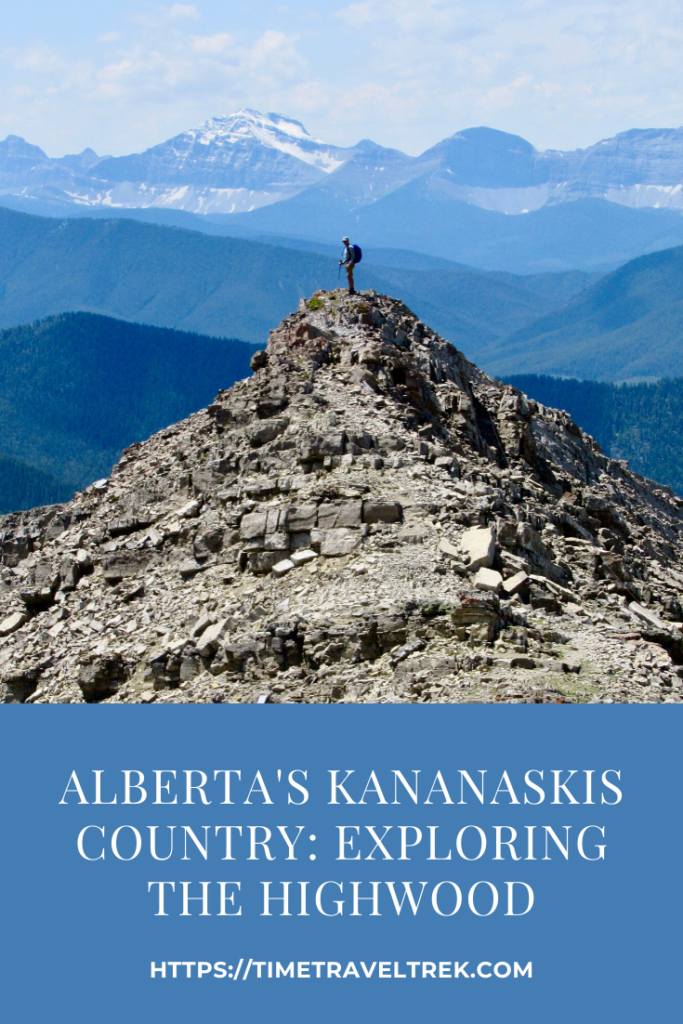
For this week’s adventure, we opted to go off-grid. Yup, we even ditched paved roads to drive a short section of the gravel Forestry Trunk Road south of Highwood House in Kananaskis County, Alberta, to set up for a three-day stay away from the fray. To find out more about off-the-beaten-path hiking and camping in the Highwood, read on!
Disclosure: This post contains Affiliate links.

Table of Contents
Highwood Who’s Who
The Highwood is an area within Kananaskis Country. Situated west of Calgary, Alberta in the foothills and front ranges of the Canadian Rockies, it’s a conglomeration of parks and recreation areas and multi-use lands. Kananaskis Country’s western border runs along the Continental Divide south of Canmore. The Highwood area begins on Hwy 40, south of Peter Lougheed Provincial Park at the highest paved pass in Canada – Highwood Pass, naturally! From here the road dips and winds down to Highwood House. The paved road continues out towards Longview; our gravel path splits south.

Hiking and Camping in the Highwood
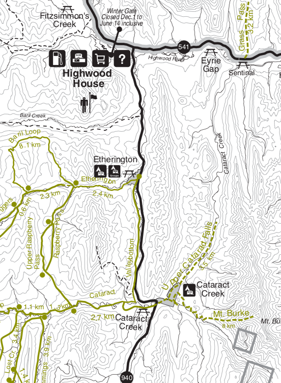
There are two campgrounds immediately south of Highwood House along the Forestry Trunk Road: Etherington and Cataract. Etherington offers reservations (check link for camping in Alberta Parks); Cataract is first-come, first-serve. With summer season upon us, Etherington was full when we checked for a last-minute reservation. Cataract still had at least a dozen sites available mid-week.
The great thing about camping at Cataract is that two of the three hikes we wanted to check out were based right out of camp. While our friends chose to bike and hike up Baril Creek to Fording Pass (along part of the Great Divide Trail), we opted for a climb up Mt. Burke.

Note: You can find a great list of Highwood South trails online at Kananaskis Trails but be sure to pack the guidebook (below) for detailed descriptions. Another fairly good Cataract-Highwood map from Alberta Parks online here.
Hiking Mount Burke
The long-ago abandoned Cameron Lookout perched on the summit of Mount Burke has 360-degree views across the foothills and front ranges of the Canadian Rockies. It’s a steep (890 m elevation gain) but relatively short (11.2 km return) hike with spectacular scenic rewards.
Starting at the parking lot at the entrance to Cataract Creek campground, the original pack trail followed Salter Creek upstream a little way before ascending the ridge. Washed out years ago, the newer route climbs through a pine forest and beside a logged off area before climbing steeply up a long cutline to rejoin the gentler grade of the switchbacking pack trail. Soft earth gives way to rocky footholds as the trail breaks free of the trees. A short rock ridge is crossed before the final climb to the creaking shell of the Cameron Fire Lookout on the summit.

Cameron Lookout was built in 1929 and was supplied by pack horses. In operated for 25 years but was shut down in 1954 when the nearby Raspberry Ridge Fire Lookout (another great hike!) took over. Mount Burke was named after local rancher Denis Burke and the lookout itself was named for another rancher in the area, Duncan Cameron. It took us just over two hours to reach the summit where we were entertained by a sunning marmot!

It Shall Remain Nameless
The options are endless and we tossed around a few possibilities for our next little adventure before settling on Nameless Ridge. Heading north to Highwood Pass on Hwy 40, we drove past Picklejar Lakes to a little pullout near Mist Mountain. Being another unofficial trail, there are no trail signs. The route is marked by flagging slightly uphill of the pullout. Clouds blew in and out and we opted for coats before breaking out of the trees into the lush, green subalpine meadow.

The narrow trail was inexplicably busy, until we reached the pass (approximately 4 km one way and 500 metres elevation gain) and saw the reason – Mist Mountain hot springs. No one else was headed up Nameless Ridge! At the pass, we soaked up the views for a moment, watching the masses slip and slide across snow patches to the teeny tiny – and packed – pool.

Zipping up coats a little further against the increasing wind we started ascending the ridge. And that’s when the storm front decided to have a little fun with us. Wham – knocked flat on my butt! To add insult to injury, icy pellets of graupel started coming in sideways to slap us in the face. The wind even whipped our friend’s sunglasses off his face and the lenses popped out and flew away in the blink of an eye. We kept plugging, but when the wind had us sitting down yet again to avoid the gusts, we knew it was time to bail. Summiting the ridge and heading down the other side would have to wait for another day.

Checking Out Cataract Falls
Heading out early the last day, we followed the trail down past site 27 in Cataract Campground towards the river. The two-kilometre long meadow offered spectacular views up to Mount Burke and the North Peak of Burke.

The trail braids and is difficult to follow at times but keep heading downstream and they all come together at a pinch point where you have the option of crossing the creek or staying on the right hand side and walking the wooded path to the falls.

With water levels still unseasonably high, we opted for the woods. A large rock cairn marks the route. Keeping left at the next junction, we meandered through a forest filled with heart-leaved arnica, columbine and one lone Calypso orchid!

Washouts took a little more route-finding, but we reached the cliff above the falls – watch your footing here! – in just over an hour. Even with high water levels, it’s easy to see why trout love this creek and why anglers are willing to hike the distance to find the right hole. On our way back, we took another side trail that pops back up into the campground at site 72.

Three days, three hikes and so much more left to explore. Hiking and camping in the Highwood merely whetted our appetite! What about you, where have you been hiking and/or camping close to home lately? Leave a comment below.
And don’t forget – pack the right gear for your hikes – including a reusable water bottle! Check out Epic Water Filters for E.Coli and Giardia filtration options.
When You Go Camping and Hiking in the Highwood
We accessed on this trip Cataract Creek by turning west off Hwy 22 at Longview and following it to the Forestry Trunk Road heading south from Highwood House. You can also head south on Hwy 40 (west of Calgary on Hwy 1), drive up over Highwood Pass and follow it along to the same junction.


This looks like an amazing area! Thanks for bringing it to my attention.
You are very welcome Darla!
I definitely hope to walk here one day. I think you can easily spend a lifetime hiking in Canada without getting bored…
Couldn’t agree more!
Such a great trail! Hiking in Canada is on my bucket list, so I am definitely saving this post. Thank you for sharing this!
You are welcome – and thanks for putting this post in your pocket for future reference!
Great info! Photos are so beautiful!! Would love to visit here.
Thanks for your comments! I hope you get a chance to make it up here one day!